
Covenant College is a private, liberal arts, Christian college in Lookout Mountain, Georgia, United States, located near Chattanooga, Tennessee. As the college of the Presbyterian Church in America, Covenant teaches subjects from a Reformed theological worldview. Approximately 1,000 students attend Covenant each year.

A fire lookout is a person assigned the duty to look for fire from atop a building known as a fire lookout tower. These towers are used in remote areas, normally on mountain tops with high elevation and a good view of the surrounding terrain, to spot smoke caused by a wildfire.

The Angeles National Forest (ANF) of the U.S. Forest Service is located in the San Gabriel Mountains and Sierra Pelona Mountains, primarily within Los Angeles County in southern California. The ANF manages a majority of the San Gabriel Mountains National Monument.

Palomar Mountain is a mountain ridge in the Peninsular Ranges in northern San Diego County. It is famous as the location of the Palomar Observatory and Hale Telescope, and known for the Palomar Mountain State Park.

The Cleveland National Forest encompasses 460,000 acres/720 sq mi (1,900 km2) of inland montane regions—approx. 60 miles from the Pacific Ocean—within the counties of San Diego, Riverside, and Orange, California. The landscape varies somewhat, with mostly chaparral canyons, arroyos and high desert, but dotted with meadows and oak and conifer forests. Near water sources, riparian environments and perennial aquatic plants attract native and migratory wildlife, such as at San Diego’s man-made Lake Cuyamaca. A generally warm and dry, inland-Mediterranean climate prevails over the forest, with the cooler months producing morning frost and snowfall. It is the southernmost U.S. National Forest of California. The area is administered by the U.S. Forest Service, a government agency within the United States Department of Agriculture, and is locally overseen by the Descanso, Palomar and Trabuco Ranger Districts.

Whiteface Mountain is the fifth-highest mountain in the U.S. state of New York, and one of the High Peaks of the Adirondack Mountains. Set apart from most of the other High Peaks, the summit offers a 360-degree view of the Adirondacks and clear-day glimpses of Vermont and even Canada, where the skyscrapers of Montreal, 80 miles (130 km) away, can be seen on a very clear day. Located about halfway between the town of Wilmington and Lake Placid, the mountain's east slope is home to a major ski area which boasts the greatest vertical drop east of the Rockies, and which hosted the alpine skiing competitions of the 1980 Winter Olympics. Unique among the High Peaks, Whiteface features a developed summit and seasonal accessibility by motor vehicle. Whiteface Memorial Highway reaches a parking area at an elevation of 4,600 feet (1,400 m), with the remaining 267 feet (81 m) being obtained by tunnel and elevator.
Bear Mountain is one of the best-known peaks of New York's Hudson Highlands. Located partially in Orange County in the town of Highlands and partially in Rockland County in the town of Stony Point, it lends its name to the nearby Bear Mountain Bridge and Bear Mountain State Park that contains it.

A fire lookout tower, fire tower, or lookout tower is a tower that provides housing and protection for a person known as a "fire lookout", whose duty it is to search for wildfires in the wilderness. It is a small building, usually on the summit of a mountain or other high vantage point to maximize viewing distance and range, known as view shed. From this vantage point the fire lookout can see smoke that may develop, determine the location by using a device known as an Osborne Fire Finder, and call for wildfire suppression crews. Lookouts also report weather changes and plot the location of lightning strikes during storms. The location of the strike is monitored for a period of days afterwards, in case of ignition.
Gore Mountain is a mountain located near the village of North Creek in Warren County, New York, of which its peak is the highest point. Gore is flanked to the north by South Mountain, and to the southwest by Height of Land Mountain. The mountain is the site of the popular Gore Mountain ski resort. The mountain is the site of the Gore Mountain Fire Observation Station which was built in 1918.
Ingraham Hill is a mountain in the Southern Tier of New York. It is located south-southwest of Binghamton in Broome County. The mountain contains the television and radio broadcast towers for the surrounding metropolitan area. The summit rises to an elevation of 1,824 feet (556 m). These towers include TV stations WBNG, WICZ, WIVT, WSKG-TV and radio stations WNBF, WAAL, WWYL and many more. The towers are visible throughout the region.
WUSY is a commercial radio station licensed to Cleveland, Tennessee, and serving the Chattanooga metropolitan area. The station airs a country music radio format. Local DJs staff the station by day, with the syndicated Cody Alan Show heard overnight.
Alma Hill is a 2,543-foot-tall (775 m) mountain in the Southern Tier of New York. It is located southwest of Wellsville in Allegany County. In 1950, an 80-foot-tall (24 m) steel fire lookout tower was built on the mountain. Due to the increased use of aerial detection, the tower ceased fire lookout operations at the end of the 1971 fire lookout season. In 1973, the tower was sold to the landowner where the tower stood. It is the highest hill in western New York, or the highest in New York outside the Adirondacks and Catskills.
Stillwater Mountain is a 2,244-foot-tall (684 m) mountain in Adirondack Mountains of New York. It is located south of Stillwater in the town of Webb in Herkimer County. In 1919, a 47-foot-tall (14 m) steel fire lookout tower was built on the mountain. At the end of the 1988 fire lookout season, the tower ceased fire lookout operation. The tower was restored and is open to the public except from the second Tuesday in October through December 20.
McCarty Hill is a mountain in the Southern Tier of New York. It is located in Cattaraugus County, mostly in Little Valley and Great Valley, with portions in Ellicottville and Mansfield. In 1940, an 82-foot-6-inch-tall (25.15 m) steel fire lookout tower was built on the mountain. The tower ceased fire lookout operations and then officially closed in early 1989. In 1993, the tower was dismantled and removed and replaced with a free-standing communications tower.
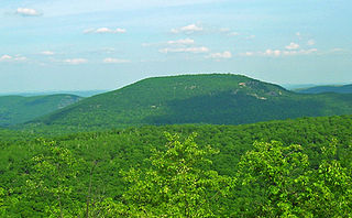
Fingerboard Mountain is a mountain located southeast of the hamlet of Central Valley in Orange County, New York.
Jackie Jones Mountain is a 1,253-foot-tall (382 m) mountain in the state of New York. It is located west of Stony Point in Rockland County. In 1928, a 60-foot-tall (18 m) steel fire lookout tower was built on the mountain. The tower ceased fire lookout operations at the end of the 1988 fire lookout season, and was officially closed in early 1989. The tower is listed on the National Historic Lookout Register, and is open to the public.
Ohmer Mountain is a 2,572-foot-tall (784 m) mountain in the Adirondack Mountains of New York. It is located northeast of Northville in Saratoga County.
Hartzfelt Mountain is a 2,405-foot-tall (733 m) mountain in the Southern Tier of New York. It is located south-southwest of Olean in Cattaraugus County. In 1924, a 60-foot-tall (18 m) steel fire lookout tower was built on the mountain. Due to increased use of aerial detection, the tower ended fire lookout operations at the end of the 1970 fire lookout season, and was later dismantled and removed.
Mount Tuscarora is a mountain in the Southern Tier of New York. It is located within Allegany State Park in Coldspring, Cattaraugus County. In 1928, a 60-foot-tall (18 m) steel fire lookout tower was built on the mountain. The tower remains on the mountain but needs to be restored. The peak is the tallest in the Allegany State Park among those that have a trail to the summit, at 2,144 ft above sea level.


