
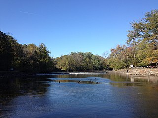
Tohickon Creek is a 29.5-mile-long (47.5 km) tributary of the Delaware River. Located entirely in Bucks County, in southeastern Pennsylvania, it rises in Springfield Township and has its confluence with the Delaware at Point Pleasant. It is dammed to form Lake Nockamixon.
Neshaminy Creek is a 40.7-mile-long (65.5 km) stream that runs entirely through Bucks County, Pennsylvania, rising south of the borough of Chalfont, where its north and west branches join. Neshaminy Creek flows southeast toward Bristol Township and Bensalem Township to its confluence with the Delaware River. The name "Neshaminy" originates with the Lenni Lenape and is thought to mean "place where we drink twice". This phenomenon refers to a section of the creek known as the Neshaminy Palisades, where the course of the water slows and changes direction at almost a right angle, nearly forcing the water back upon itself. These palisades are located in Dark Hollow Park, operated by the county, and are flanked by Warwick Township to the south and Buckingham Township to the north.
Robin Run is a dammed headwater major tributary of the Delaware River with a drainage area of 22.69 square miles that is 1.69 miles north 1.69 miles north of Mill Creek's Confluence with the Neshaminy Creek on the border of Buckingham and Wrightstown Townships), The headwaters originate in Buckingham Township, Bucks County, Pennsylvania and the stream flows generally southeast to its confluence with Mill Creek in Wrightstown Township.
Hickory Creek is a tributary of the Delaware River in Plumstead Township, Bucks County, Pennsylvania, in the United States.
Deep Run is a tributary of Tohickon Creek which is located in Bedminster Township, Bucks County, Pennsylvania, in the United States.
Deep Run is a tributary of the Tohickon Creek in Bedminster Township, Bucks County, Pennsylvania in the United States.
Deer Run is a tributary of the Tohickon Creek in Bedminster Township, Bucks County, Pennsylvania in the United States.
Mink Run is a tributary of the Tohickon Creek in Bedminster Township, Bucks County, Pennsylvania in the United States.
Haycock Creek is a tributary of the Tohickon Creek in Bucks County, Pennsylvania in the United States and is part of the Delaware River watershed.
Threemile Run is a tributary of the Tohickon Creek in Bucks County, Pennsylvania in the United States and is part of the Delaware River watershed.
Dimple Creek is a tributary of the Tohickon Creek in Haycock Township, Bucks County, Pennsylvania in the United States. It is part of the Delaware River watershed.
Morgan Creek is a tributary of the Tohickon Creek in Bucks County, Pennsylvania in the United States, rising in Milford Township and empties into the Tohickon in Richland Township east of Quakertown.
Beaver Run is a tributary of the Tohickon Creek in Milford Township and Richland Township, Bucks County, Pennsylvania in the United States and is part of the Delaware River watershed.
Smithtown Creek is a tributary of the Delaware River in Tinicum Township, Bucks County, Pennsylvania in the United States.
Tinicum Creek is a tributary of the Delaware River in Tinicum Township, Bucks County, Pennsylvania. It flows for 6.40 miles (10.30 km) from the confluence of its branches, Beaver Creek and Rapp Creek, before entering the river across from Marshall Island. Tinicum Creek and its two branches are part of the federally-designated Lower Delaware National Wild and Scenic River.
Rapp Creek is a tributary of Tinicum Creek in Nockamixon Township, Bucks County, Pennsylvania in the United States. Rapp Creek is part of the Delaware River watershed.
Swamp Creek is a tributary of the Delaware River in Tinicum Township, Bucks County, Pennsylvania in the United States.
Falls Creek is a tributary of the Delaware River wholly contained in Bridgeton Township, Bucks County, Pennsylvania in the United States. The creek boasts the highest falls in Bucks County.
Gallows Run is a tributary of the Delaware River in Springfield and Nockamixon Townships, in Bucks County, Pennsylvania in the United States.

Cooks Creek is a tributary of the Delaware River in Bucks County, Pennsylvania, in the United States, rising in Springfield Township and passing through Durham Township before emptying into the Pennsylvania Canal and the Delaware.
