Related Research Articles

Reynolds is an unincorporated community in western Reynolds County, Missouri, United States. It is located on Route 72, approximately six miles southwest of Centerville.
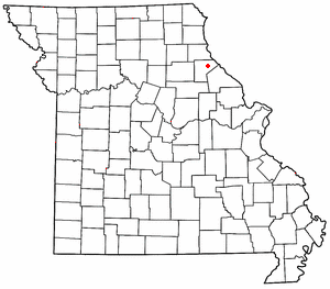
Corridon is an unincorporated community in western Reynolds County, Missouri, United States. It is located approximately one mile south of Reynolds and seven miles southwest of Centerville.
Saverton is an unincorporated community in eastern Ralls County, Missouri, United States. It is located on the Mississippi River, approximately ten miles southeast of Hannibal. Saverton is part of the Hannibal Micropolitan Statistical Area.
Bee Fork is an unincorporated community in Reynolds County, in the U.S. state of Missouri.
Bills Creek is a stream in Iron and Reynolds counties in the U.S. state of Missouri. It is a tributary of the West Fork of the Black River and is located in the Mark Twain National Forest.
Dagonia is an unincorporated community in Reynolds County, in the U.S. state of Missouri.
Dairyville is an extinct town in Reynolds County, in the U.S. state of Missouri.
Exchange is an unincorporated community in southwest Reynolds County, in the Ozarks of southeast Missouri. The community is located along Missouri Route 106, approximately 3.5 miles west of Ellington. The community sits on the floodplain of Logan Creek.
Fruit City is an unincorporated community in Reynolds County, in the U.S. state of Missouri.
Marcoot is an extinct town in Reynolds County, in the U.S. state of Missouri. The GNIS classifies it as a populated place.
McMurtrey Creek is a stream in northwest Reynolds County in the U.S. state of Missouri. It is a tributary of the West Fork Black River.
Melton is an unincorporated community in Reynolds County, in the U.S. state of Missouri.
Oates is an unincorporated community in northern Reynolds County, in the U.S. state of Missouri. The community is located on Brushy Creek st the intersection of Missouri Route J and county road 836. Nearby communities include Black, approximately seven miles to the east-southeast on the Middle Fork of the Black River and Buick, about six miles to the northwest in Iron County.
Ohlman is an unincorporated community in Reynolds County, in the U.S. state of Missouri.
West Fork is an unincorporated community in Reynolds County, in the U.S. state of Missouri. The community lies on south bank of the West Fork of the Black River adjacent to the confluence of Toms Creek with the Black. The community lies approximately six miles east-northeast of Bunker on Missouri Route KK.
Carroll Township is an inactive township in Reynolds County, in the U.S. state of Missouri.
Jackson Township is an inactive township in Reynolds County, in the U.S. state of Missouri.
Wintersville is an unincorporated community in Sullivan County, in the U.S. state of Missouri.
Burch is an unincorporated community in Wayne County, in the U.S. state of Missouri.
Conklin is an unincorporated community in western Webster County, in the U.S. state of Missouri. Conklin is located on Missouri Route 38, approximately six miles northwest of Marshfield. Elkland lies about four miles north on Route 38.
References
- ↑ U.S. Geological Survey Geographic Names Information System: Bedwell, Missouri
- ↑ "Reynolds County Place Names, 1928–1945". The State Historical Society of Missouri. Archived from the original on June 24, 2016. Retrieved December 13, 2016.CS1 maint: discouraged parameter (link)
Municipalities and communities of Reynolds County, Missouri, United States | ||
|---|---|---|
| Cities |  | |
| Townships | ||
| Unincorporated communities | ||
| Ghost towns | ||
| Footnotes | ‡This populated place also has portions in an adjacent county or counties | |
Coordinates: 37°16′06″N91°01′09″W / 37.26833°N 91.01917°W
| | This Reynolds County, Missouri state location article is a stub. You can help Wikipedia by expanding it. |