Beech, Iowa

Last updated

Beech, Iowa
BeechIowaPark.jpg
Beech community park
USA Iowa location map.svg
Red pog.svg
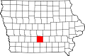
Beech, Iowa
Location of Beech, Iowa
Coordinates: 41°22′29″N93°21′12″W / 41.37472°N 93.35333°W / 41.37472; -93.35333 [1]
Country USA
State Iowa
County Warren County
Founded1911
Elevation
[1]
277 m (909 ft)
Time zone UTC-6 (Central (CST))
  Summer (DST) UTC-5 (CDT)
GNIS feature ID454480 [1]

Beech is an unincorporated community in Warren County, Iowa, United States. It is located just north of the intersection of County Road S31 and Highway 92. It is 1 mile east of Sandyville and five miles west of Pleasantville, at 41.3745865N -93.3573103W. [2]

Contents

History

Founded in 1911 [3] as a railroad town, Beech was originally known as New Sandyville, but the residents of nearby Sandyville objected to the name. [4] The town was renamed Beech in honor of a railroad employee. [3]

The population was 133 in 1940. [5]

Education

The Pleasantville Community School District operates local public schools. [6]

Humility of Mary Catholic Church in Beech BeechIowaChurch.jpg
Humility of Mary Catholic Church in Beech

References

  1. 1 2 3 U.S. Geological Survey Geographic Names Information System: Beech, Iowa
  2. "US Gazetteer files: 2010, 2000, and 1990". United States Census Bureau. February 12, 2011. Retrieved April 23, 2011.
  3. 1 2 Savage, Tom (2007). A Dictionary of Iowa Place-Names, p. 36. University Of Iowa Press. ISBN   1-58729-531-8.
  4. Warren County, Iowa. Iowa GenWeb Project. Accessed 2011-05-15
  5. The Attorneys List. United States Fidelity and Guaranty Company, Attorney List Department. 1940. p. 293.
  6. "PLEASANTVILLE" (PDF). Iowa Department of Education . Retrieved August 30, 2020.