
Beerburrum Soldier Settlement was a soldier settlement in Beerburrum, Queensland, Australia, established to provide opportunities for Australian soldiers returning from World War I. It is generally regarded as a failure.
Beerburrum Soldier Settlement was a soldier settlement in Beerburrum, Queensland, Australia, established to provide opportunities for Australian soldiers returning from World War I. It is generally regarded as a failure.
As early as 1915 the Queensland Government was looking for vacant land suitable for settlement by returned soldiers. The Department of Lands stated that Queensland's vast areas of crown land and varying climates provided more opportunities than any other state of Australia for the settling of returned soldiers, both Australian and British. It was envisaged that the land would be suitable for lighter farming activities such as fruit and vegetable growing, poultry-raising and bee-keeping. [1]

The first land chosen for soldier settlement in Queensland was 53,000 acres (21,448.34 hectares) near the Beerburrum railway siding on the North Coast railway line. This mostly dry sclerophyll forest and wallum heathland had been leased to the Australian Government in 1910 as a military reserve for 30 years at a peppercorn rent. From 1913 the Australian government paid an annual rent of £1 subject to the right of resumption by the State of Queensland if required for State purposes. In 1916 the area was returned to the Queensland Government for soldier settlement. The area eventually opened for this purpose stretched from Beerburrum to Glass House Mountains in the north, southwards to Elimbah and eastwards to Pumicestone Passage. Beerburrum Soldier Settlement was first and largest of the approximately two dozen soldier settlements established in Queensland. Over the course of the scheme (1916–1929) approximately 2,500 returned soldiers were settled on the land in Queensland, including at least 400 at Beerburrum. [1]
Work began immediately on analysis and surveying of the land. Beerburrum was chosen as the centre of the soldier settlement because of satisfactory soil tests, water availability and the existing railway siding. Surveyor Muntz was given the task of dividing this large area into portions of suitable land varying in size from approximately 20 to 40 acres. To ensure that each settler received a fertile selection, the surveyor was to mark his boundaries so that each portion would be equally productive. By November 1916, 11,600 acres had been surveyed into 310 portions. Joseph Rose, an experienced pineapple farmer, was placed in charge of the settlement. An experimental State training farm (portions 859, 860, 861, 862) was cleared and planted with pineapples for training returned soldiers in the growing of tropical crops. [1]
Under the provisions of Queensland's 1917 Discharged Soldiers' Settlement Act after having received a qualification certificate from the Land Settlement Committee of the War Council, or from a Land Commissioner, applicants balloted for available selections and, if successful, were expected to pay one year's rent. This could either be paid in full at the time of occupation, or by ten equal instalments after taking up residence, in which case interest was added at the rate of four percent per annum. They were also expected to remain on the selection for a minimum period of five years, exceptions only being made in extreme cases of "illness, accident, or misfortune". From five to ten years the lease could only be transferred to another returned serviceman. After ten years the soldier settler was finally free to transfer the lease to any other applicant. The Queensland legislation was extended so that all honourably discharged Australian, British, Dominion and Allied ex-servicemen could apply for land. [1]

The first land ballots were drawn on 6 November 1916 by the Queensland Governor's wife, Lady Elsie Goold-Adams. At this time the experimental farm had been in operation for six weeks training nine invalid soldiers. By July 1917, 28 returned soldiers had been allotted an area of 760 acres and 54 acres had been cleared, ploughed and planted with pineapples. One acre was similarly planted with oranges. Altogether 145 acres had been cleared, 11 houses had been erected and 17 farms had been fenced. Ringbarking had been completed on a further 100 acres. Two huts and eating facilities for 24 men had been erected, as well as a storeroom and quarters for the supervisor at the State Farm. In addition, several wells had been sunk, yielding good water. The area for township purposes had been reserved and a general store erected. [1]
By January 1919, 96 soldier settlers were residing on the Beerburrum Soldier Settlement, increasing to 175 in July. With dependants, the total population was estimated at 400. The number of farms had increased to 379 comprising 14,896 acres and 181 houses had been erected, although 323 portions remained unallotted. The State Government had built administration buildings, blacksmith shop, school, school of arts, two stores, two butcher's shops, a barber, bakehouse, six residences for employees, an accommodation (boarding) house, depot store, kitchen, barracks and hospital. A branch store had been set up in Glasshouse Mountains township as well. [1]

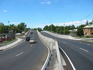
In April 1919 the Beerburrum branch of the Returned Sailors' and Soldiers' Imperial League announced the intention of the settlers to plant "an avenue of trees" on the main road from the station, with the object of forming a permanent memorial for Anzac Day. These memorial trees were planted in the main street and the street renamed Anzac Avenue in honour of the fallen comrades of the soldier settlers. This occurred in conjunction with the widening and metalling of the roadway due to building development on the southern side of the street. The Anzac Avenue Memorial Trees are now listed on the Queensland Heritage Register. [1]
The Prince of Wales (later Edward VIII) visited the Beerburrum Soldier Settlement on 3 August 1920. [1] The following year, the Beerburrum Soldier Settlement reached it zenith with a population of 1,200 people. [1]
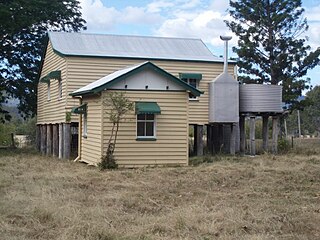
St George's Anglican Church was dedicated on 20 August 1922 by Canon D.J. Garland. [2] [3] The building was originally built as a chapel at the Enoggera army barracks during World War I by the Soldiers' Church of England Help Society. [4] Many of the furnishings and ornaments of the church were donated in memory of soldiers who had died, including the altar and its furnishings which were donated in the member of Earl Kitchener. [5]
Many settlers were not successful as the poor soil and low pineapple prices made it impossible for them to make a living as pineapple growers. Settlers began to leave the settlement. Many wished to transfer to other settlements but the government would not approve this. In the 12 months to June 1923, 200 men, women and children left Beerburrum. The town began to suffer and businesses closed, and in January 1924 the government began reducing its administrative staff at Beerburrum. In August that year there were still 214 returned servicemen on the settlement. Of this number 127 had applied for and been granted adjoining land forfeited by their neighbours. In November a further 82 settlers requested transfer to other settlements. [1]
The Revaluation Board of Soldiers' Settlements set up by the Queensland Government released a confidential report in October 1924 that advised there was very little prospect of the Beerburrum Settlement ever proving even a moderate success. By June 1928 only 75 soldier settlers remained in occupation at Beerburrum. Diversification into egg production, vegetable and watermelon growing had been the most profitable adjuncts that the farmers tried in order to survive financially. When the scheme was officially terminated in 1929, there were only 69 soldier settlers remaining at Beerburrum. [1]
Due to the failure of the soldier settlement, St George's Anglican church fell into disuse. It was officially closed in August 1931, after which the church was moved to Maleny, where it was dedicated to St George on 6 September 1931 by Archbishop Sharp. [3]
Signage to commemorate the Beerburrum Soldier Settlement was installed in 2008. This consists of three signs – one located on the eastern end of the median strip and two located centrally. [1]

Glass House Mountains is a rural hinterland town and locality in the Sunshine Coast Region, Queensland, Australia. In the 2021 census, the locality of Glass House Mountains had a population of 5,601 people.
Petrie is a suburb in the City of Moreton Bay, Queensland, Australia. In the 2021 census, Petrie had a population of 8,722 people.

Bathurst is about 12 kilometres (7.5 mi) inland from Port Alfred, on the R67 road, in the Eastern Cape province of South Africa, and is named after Henry Bathurst, 3rd Earl Bathurst, Secretary of State for the Colonies by Sir Rufane Donkin. Its chief claim to fame is that it was the early administrative centre established by the British Government for the 1820 British Settlers who were sent to the district as a buffer between the Cape Colony and the Xhosa pastoralists who were migrating southwards and westwards along the coast. Bathurst is now part of the Ndlambe Local Municipality in the Sarah Baartman District Municipality of the Eastern Cape.

The Big Pineapple is a heritage-listed tourist attraction at Nambour Connection Road, Woombye, Sunshine Coast Region, Queensland, Australia. It was designed by Peddle Thorp and Harvey, Paul Luff, and Gary Smallcombe and Associates. It is also known as Sunshine Plantation. It was added to the Queensland Heritage Register on 6 March 2009.

Kalinga Park is a heritage-listed park at 100 Bertha Street, Kalinga, City of Brisbane, Queensland, Australia. The eastern section of the park is in neighbouring Clayfield. It is also known as Anzac Memorial Park. It was added to the Queensland Heritage Register on 3 July 2007.

Toowong Cemetery is a heritage-listed cemetery on the corner of Frederick Street and Mt Coot-tha Road, Toowong, City of Brisbane, Queensland, Australia. It was established in 1866 and formally opened in 1875. It is Queensland's largest cemetery and is located on forty-four hectares of land at the corner of Frederick Street and Mount Coot-tha Road approximately four and a half kilometres west of Brisbane. It was previously known as Brisbane General Cemetery. It was added to the Queensland Heritage Register on 31 December 2002.

Beerburrum is a rural town and coastal locality in the Sunshine Coast Region, Queensland, Australia. In the 2021 census, the locality of Beerburrum had a population of 941 people.

Woombye is a rural town and locality in the Sunshine Coast Region, Queensland, Australia. In the 2021 census, the locality of Woombye had a population of 3,944 people.

Coominya is a rural town and locality in the Somerset Region in South East Queensland, Australia. The town is located 83 kilometres (52 mi) west of the state capital, Brisbane and approximately 2 kilometres (1.2 mi) from Wivenhoe Dam. In the 2021 census, the locality of Coominya had a population of 1,029 people.

Soldier settlement was the settlement of land throughout parts of Australia by returning discharged soldiers under soldier settlement schemes administered by state governments after World War I and World War II. The post-World War II settlements were co-ordinated by the Commonwealth Soldier Settlement Commission.

Anzac Avenue is a heritage-listed major arterial road lined with trees in the City of Moreton Bay, Queensland, Australia. It runs 17.8 kilometres (11.1 mi) from Petrie to Redcliffe, with most of the route signed as state route 71. The route was formerly the main route to the Redcliffe peninsula, until the Hornibrook Bridge was opened in 1935.

Drayton and Toowoomba Cemetery is a heritage-listed cemetery at the corner of South Street and Anzac Avenue, Harristown, Queensland, Australia. It was surveyed in May 1850, and is one of the earliest surviving cemeteries in Queensland. The cemetery is large, containing over 45,000 burials. It has been run by the City of Toowoomba, and its successor the Toowoomba Regional Council, since 1974; previously it was run by government-appointed trustees. Many prominent people associated with the Darling Downs are buried in the cemetery, and all sections of the cemetery remain in use. Notable Toowoomba stonemasons R. C. Ziegler & Son, Henry Bailey, Walter Bruce, John H. Wagner and the Bruce Brothers are all associated with monuments within the cemetery.
Coominya Soldier Settlement was a soldier settlement in Coominya in the present-day Somerset Region local government area of South East Queensland, Australia. 100 soldiers settled in the settlement, each on approximately 30-acre (12 ha) blocks.

The Hoop Pines are a heritage-listed pair of Araucaria cunninghamii trees at 34 Strathpine Road, Bald Hills, City of Brisbane, Queensland, Australia. They were added to the Queensland Heritage Register on 22 February 2002.

St Denys Anglican Church is a heritage-listed church at 17 Trevethan Lane, Amiens, Southern Downs Region, Queensland, Australia. It was built from 1923 to 1923. It is also known as Church of St Denys. It was added to the Queensland Heritage Register on 3 August 2005.

Murrumba Homestead Grounds is a heritage-listed site at 38 Armstrong Street, Petrie, City of Moreton Bay, Queensland, Australia. It was added to the Queensland Heritage Register on 16 February 2009.
Anzac Avenue Memorial Trees is a heritage-listed memorial at Anzac Avenue, Beerburrum, Sunshine Coast Region, Queensland, Australia. It was built in 1920. It was added to the Queensland Heritage Register on 16 October 2008.
Soldier Settler House is a heritage-listed homestead at Gladstone-Monto Road, Ubobo, Gladstone Region, Queensland, Australia. It was built in 1920. It is also known as Hecstanvale. It was added to the Queensland Heritage Register on 28 September 2001.
Beerburrum Road is a continuous 15.2-kilometre (9.4 mi) road route in the Moreton Bay and Sunshine Coast local government areas of Queensland, Australia. It is designated as part of State Route 60. It is a state-controlled district road, rated as a local road of regional significance (LRRS).
Glass House Mountains Road is a continuous 30.4-kilometre (18.9 mi) road route in the Moreton Bay and Sunshine Coast local government areas of Queensland, Australia. Part of it is designated as part of State Route 6. It is a state-controlled road, part regional and part district.
![]() This Wikipedia article was originally based on "The Queensland heritage register" published by the State of Queensland under CC-BY 3.0 AU licence (accessed on 7 July 2014, archived on 8 October 2014). The geo-coordinates were originally computed from the "Queensland heritage register boundaries" published by the State of Queensland under CC-BY 3.0 AU licence (accessed on 5 September 2014, archived on 15 October 2014).
This Wikipedia article was originally based on "The Queensland heritage register" published by the State of Queensland under CC-BY 3.0 AU licence (accessed on 7 July 2014, archived on 8 October 2014). The geo-coordinates were originally computed from the "Queensland heritage register boundaries" published by the State of Queensland under CC-BY 3.0 AU licence (accessed on 5 September 2014, archived on 15 October 2014).
![]() Media related to Beerburrum soldier settlement at Wikimedia Commons
Media related to Beerburrum soldier settlement at Wikimedia Commons