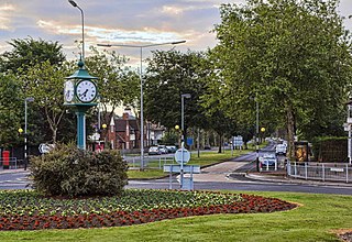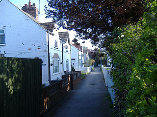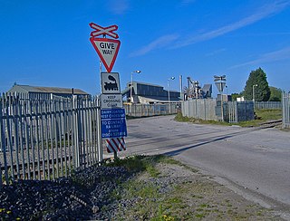
Hartshead is a village in Kirklees, West Yorkshire, England, 3.7 miles (6 km) west of Dewsbury and near to Hartshead Moor.

Woodhouse is a largely residential area just north of the city centre of Leeds and close to the University of Leeds. It is in the Hyde Park and Woodhouse ward of City of Leeds metropolitan district. The population of the ward at the 2011 Census was 25,914.

Liversedge is a town and former parish of Birstall, in the metropolitan borough of Kirklees, West Yorkshire, England. Historically part of the West Riding of Yorkshire, Liversedge lies between Cleckheaton and Heckmondwike. The Kirklees ward is now called Liversedge and Gomersal with a population at the 2011 Census of 19,420. Liversedge forms part of the Heavy Woollen District.
Spenborough was, from 1915 to 1974, a local government district in the administrative county of Yorkshire, West Riding, England.

Willerby is a village and civil parish located on the western outskirts of the city of Kingston upon Hull in the East Riding of Yorkshire, England.

The Wessenden Valley is a moorland valley in the Dark Peak, immediately south of Marsden in West Yorkshire, England. The name Wessenden derives from Old English and means the 'valley with rock suitable for whetstones'. The valley was formed by retreating glaciers at the end of the last ice age and continues to be cut by the Wessenden Brook a tributary of the River Colne with a catchment of 6.28 square miles (16.27 km2).

Barnburgh Main Colliery was a coal mine situated on the outskirts of the village of Barnburgh, about two miles north of Mexborough in the Dearne Valley, South Yorkshire, England. The sinking of the colliery was commenced in 1911 by the Manvers Main Colliery Company of Wath-upon-Dearne.

Anlaby Common is former common land, now an outer suburb of Kingston upon Hull. The area includes the residential areas which are located on the western urban fringe of Hull; the B1231 road passes through all of Anlaby Common's estates, east to west.

Hightown is a hamlet within the parish of Liversedge, West Yorkshire, England, with a diverse socioeconomic culture. Historically part of the West Riding of Yorkshire, to the north, neighbouring the border with Calderdale, is the Windybank council estate. To the east is Hightown Road, where some houses are valued at over a million pounds, and to the south bordering Mirfield and Roberttown is a very middle class private housing estate.

Ferry Fryston is a suburb of the town of Castleford in West Yorkshire, England. It is situated in the metropolitan borough of the City of Wakefield. The appropriate ward is called Airedale and Ferry Fryston.

Dungworth is a hamlet in the civil parish of Bradfield, west of Sheffield in South Yorkshire, England.

Drub is a hamlet in the Kirklees district, in the county of West Yorkshire, England. It is located between Cleckheaton, Birkenshaw, and Gomersal and is considered part of the latter.

Beggarington Hill is a hamlet in the county of West Yorkshire, England, in the City of Leeds and at the border of Kirklees. Historically, it was part of the West Ardsley civil parish. It is located immediately southwest of West Ardsley near the town of Batley, between Baghill Beck in the north and Hey Beck in the south. The A653 road runs approximately 0.6 miles (1.0 km) west of the settlement.

Frizinghall is a district in the Heaton ward of the City of Bradford, West Yorkshire, lying 2 miles (3 km) north of the city centre close to the town of Shipley, itself a part of the City of Bradford Metropolitan District along with such other nearby towns as Keighley and Ilkley.
Gipsyville is a western suburb of Kingston upon Hull, in the East Riding of Yorkshire, England.

Dairycoates is an area of Kingston upon Hull, East Riding of Yorkshire, England, a former hamlet.

Holme Beck is a watercourse in the Tong ward of the City of Bradford, West Yorkshire, England. It drains a shallow valley east of the watershed between Bradford and Leeds. Holme Beck begins in the village with no evidence of any continuation on the other side of the canal or motorway. Holme Beck is the main carrier for village drainage, it runs beneath the West Coast Main Line and then through the large marsh area of Holme Moss before joining the River Bela.

The Burnley Coalfield is the most northerly portion of the Lancashire Coalfield. Surrounding Burnley, Nelson, Blackburn and Accrington, it is separated from the larger southern part by an area of Millstone Grit that forms the Rossendale anticline. Occupying a syncline, it stretches from Blackburn past Colne to the Yorkshire border where its eastern flank is the Pennine anticline.

Stanley railway station on the Methley Joint Railway served the village of Stanley east of Outwood, Wakefield, West Yorkshire.

Egypt is a hamlet near Thornton, in the City of Bradford, West Yorkshire, England.


