This article may be expanded with text translated from the corresponding article in German. (July 2010)Click [show] for important translation instructions.
|
Beilstein | |
---|---|
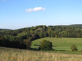
Beilstein seen from the southwest | |
Highest point | |
Elevation | 499 m (1,637 ft) |
Coordinates | 50°10′13″N9°24′10″E / 50.17028°N 9.40278°E Coordinates: 50°10′13″N9°24′10″E / 50.17028°N 9.40278°E |
Geography | |
Parent range | Spessart |
Geology | |
Mountain type | Basalt |
The Beilstein is a hill in the Main-Kinzig district of Hesse, Germany. It is part of the Spessart range and lies in the municipality of Jossgrund close to the Ortsteil of Lettgenbrunn . Its elevation is 499 metres above sea level.
Hesse or Hessia, officially the State of Hesse, is a federal state (Land) of the Federal Republic of Germany, with just over six million inhabitants. The state capital is Wiesbaden; the largest city is Frankfurt am Main.
Germany, officially the Federal Republic of Germany, is a country in Central and Western Europe, lying between the Baltic and North Seas to the north, and the Alps to the south. It borders Denmark to the north, Poland and the Czech Republic to the east, Austria and Switzerland to the south, France to the southwest, and Luxembourg, Belgium and the Netherlands to the west.
Spessart is a Mittelgebirge, a range of low wooded mountains, in the States of Bavaria and Hesse in Germany. It is bordered by the Vogelsberg, Rhön and Odenwald. The highest elevation is the Geiersberg at 586 metres NN.
The Beilstein is located at the end of the valley of the Jossa. It is part of the Mittelgebirge Spessart and lies in the Hessian part of the range, close to the border to Bavaria. The Beilstein lies between Lettgenbrunn and Bad Orb, just south of the 521 m high Hoher Berg .
Jossa is a river of Hesse, Germany. It is a tributary of the Sinn, which in turn flows into the Franconian Saale shortly before the latter discharges into the Main at Gemünden am Main.
A Mittelgebirge is a relatively low mountain range or highland area, a typical geographical feature of Central Europe, especially Central and Southern Germany; it refers to something between rolling low hill country or Hügelland and a proper mountain range like the High Alps.
Bavaria, officially the Free State of Bavaria, is a landlocked federal state of Germany, occupying its southeastern corner. With an area of 70,550.19 square kilometres, Bavaria is the largest German state by land area. Its territory comprises roughly a fifth of the total land area of Germany. With 13 million inhabitants, it is Germany's second-most-populous state after North Rhine-Westphalia. Bavaria's main cities are Munich and Nuremberg.
The Beilstein is part of the municipal territory of Jossgrund.
Jossgrund is a municipality in the Main-Kinzig district, in Hesse, Germany. It has around 3,500 inhabitants distributed among several formerly independent villages, now Ortsteile. The administration seat is at Oberndorf.
Unlike most of the Spessart, which consists mainly of Buntsandstein, the Beilstein is an outcropping of basalt. The upper slopes of the hill are wooded, but at the top basalt rocks are exposed. Around 10-20 million years ago, volcanic activity caused this to break through the local Buntsandstein, which is roughly 200 million years older. The Beilstein features characteristic basalt columns and the largest basalt cave in the Main-Kinzig district. [1]
The Buntsandstein or Bunter sandstone is a lithostratigraphic and allostratigraphic unit in the subsurface of large parts of west and central Europe. The Buntsandstein predominantly consists of sandstone layers of the Lower Triassic series and is one of three characteristic Triassic units, together with the Muschelkalk and Keuper that form the Germanic Trias Supergroup.
Basalt is a mafic extrusive igneous rock formed from the rapid cooling of magnesium-rich and iron-rich lava exposed at or very near the surface of a terrestrial planet or a moon. More than 90% of all volcanic rock on Earth is basalt. Basalt lava has a low viscosity, due to its low silica content, resulting in rapid lava flows that can spread over great areas before cooling and solidification. Flood basalt describes the formation in a series of lava basalt flows.
On the peak are the remains of a medieval hill castle known as Burg Beilstein. The place is first mentioned in 1059 as Bilstein as part of the border of the territory of Fulda monastery, but at that point it was likely not a castle but just a landmark. In 1313, the castle was bought by the Electorate of Mainz from the lords of Hohenlohe-Brauneck along with the area around Lettgenbrunn. The castle is last mentioned in 1427. [1] Two important ancient trade routes, the Eselsweg and the Birkenhainer Strasse pass through the area. [2] The former is overlooked by the Beilstein and was the likely reason for the castle's construction. [1] Today, only the foundation of a wall remains of the castle.
A hill castle is a castle built on a natural feature that stands above the surrounding terrain. It is a term derived from the German Höhenburg used in categorising castle sites by their topographical location. Hill castles are thus distinguished from lowland castles (Niederungsburgen).
Fulda Abbey, or the Princely Abbey of Fulda, or the Imperial Abbey of Fulda was a Benedictine abbey as well as an ecclesiastical principality centered on Fulda, in the present-day German state of Hesse. It was founded in 744 by Saint Sturm, a disciple of Saint Boniface. Through the 8th and 9th centuries, Fulda Abbey became a prominent center of learning and culture in Germany, and a site of religious significance and pilgrimage following the burial of Boniface. The growth in population around Fulda would result in its elevation to a prince-bishopric in the second half of the 18th century.
The Electorate of Mainz, previously known in English as Mentz and by its French name Mayence, was one of the most prestigious and influential states of the Holy Roman Empire. In the Roman Catholic hierarchy, the Archbishop-Elector of Mainz was the Primate of Germany, a purely honorary dignity that was unsuccessfully claimed from time to time by other archbishops. There were only two other ecclesiastical Prince-electors in the Empire: the Electorate of Cologne and the Electorate of Trier.
In the 1930s, an observation bunker for bomber training at Lettgenbrunn and Villbach (both today part of Jossgrund) was constructed on the peak. After the war it was blown up and only the foundations remain. [1]
In 1905, the Beilstein was included on a list of German natural landmarks. In 1930, parts of the hill were declared a nature reserve, one of the first in Hesse. The preserve today measures 5.75 hectares and hosts a large number of plant species such as Lilium martagon or Deutscher Streifenfarn . [1]
Hanau is a large town in the Main-Kinzig-Kreis, in Hesse, Germany. It is located 25 km east of Frankfurt am Main and is part of the Frankfurt Rhine-Main Metropolitan Region. Its station is a major railway junction and it has a port on the river Main, making it an important transport centre. The town is known for being the birthplace of Jakob and Wilhelm Grimm and Franciscus Sylvius. Since the 16th century it was a centre of precious metal working with many goldsmiths. It is home to Heraeus, one of the largest family-owned companies in Germany.
Schöllkrippen is a market community in the Aschaffenburg district in the Regierungsbezirk of Lower Franconia (Unterfranken) in Bavaria, Germany and seat of the Verwaltungsgemeinschaft of Schöllkrippen. It has a total population of around 4,000.
Bad Soden-Salmünster is a town in the Main-Kinzig district, in Hesse, Germany. It is situated on the river Kinzig, between Fulda and Hanau. It has a population of around 13,000.
Schlüchtern is a town in the Main-Kinzig district, in Hesse, Germany. It is located on the river Kinzig, approximately 30 km southwest of Fulda. Schlüchtern has a population close to 16,000.
Steinau an der Straße is a town of around 10,000 in the Main-Kinzig district, in Hesse, Germany. It is situated on the river Kinzig, 32 km southwest of Fulda. Its name, meaning "on the road", refers to the historic trade route Via Regia from Leipzig to Frankfurt on which it was located. Steinau is best known for the Brothers Grimm who spent part of their childhood here.
Bad Orb is a spa town in the Main-Kinzig-Kreis district of Hesse, Germany. It is situated 32 kilometres (20 mi) east of Hanau between the forested hills of the Spessart. Bad Orb has a population of over 9000. Its economy is dominated by the health and tourism sectors.
Biebergemünd is a municipality in the Main-Kinzig district, in Hesse, Germany. It has a population of over 8,000 and lies in the wooded hills of the Spessart.
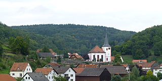
Flörsbachtal is a municipality in the Main-Kinzig district, in Hesse, Germany. It has a population close to 2,400. Flösbachtal contains both the oldest parish and the youngest settlement established in the Spessart hills. Located within the municipal territory is the Hermannskoppe, the highest elevation in the Hessian part of the Spessart and the Wiesbüttmoor, a rare hanging bog.
Großkrotzenburg is a municipality in the Main-Kinzig district, in Hesse, Germany. It has a population of around 7,500.
Linsengericht is a municipality in the Main-Kinzig district, in Hesse, Germany.
Sinntal is a municipality in the Main-Kinzig district, in Hesse, Germany. It has a population of around 8,900.
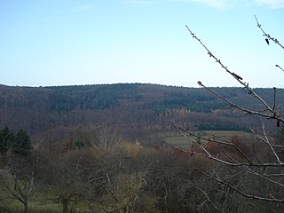
Heidkopf (Spessart) is a wooded hill of Bavaria, Germany, located in the Mittelgebirge Spessart.
Horst is a wooded hill of Hesse, Germany. It lies in the Mittelgebirge Spessart not far from the border to Bavaria.
Schwarzer Berg is a wooded hill located in the Main-Kinzig-Kreis of Hesse, Germany. It is part of the Mittelgebirge Spessart and lies between Bad Orb and Jossgrund.
The Eselsweg is a long-distance hiking trail that follows an ancient trade route through the Mittelgebirge Spessart, in the states of Hesse and Bavaria, Germany. It is 111 km long and leads from Schlüchtern in the valley of the Kinzig river to Großheubach on the river Main. The trail follows an ancient trade route on which donkey caravans used to transport salt, thus giving rise to the name.
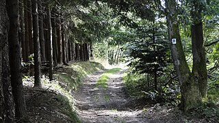
The Birkenhainer Straße is a long-distance hiking trail that follows an ancient trade route through the Mittelgebirge Spessart, in the states of Hesse and Bavaria, Germany. It is 71 km long and leads from Hanau to Gemünden am Main, cutting across the so-called Mainviereck, a large loop of the river Main. The trail follows an ancient trade route which in the Middle Ages was an important road for moving troops and for long-distance trade. The Birkenhainer Straße was a part of the link between Nuremberg and Antwerp. Its origins may lie back as far as the Neolithic period. The name likely derives from a prominent copse of birch trees that used to exist near the road at Geiselbach (Hesse).
The
Wikimedia Commons has media related to Beilstein (Spessart) . |
This Hesse location article is a stub. You can help Wikipedia by expanding it. |