In the geologic timescale, the Anisian is the lower stage or earliest age of the Middle Triassic series or epoch and lasted from 247.2 million years ago until 242 million years ago. The Anisian Age succeeds the Olenekian Age and precedes the Ladinian Age.
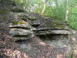
The Muschelkalk is a sequence of sedimentary rock strata in the geology of central and western Europe. It has a Middle Triassic age and forms the middle part of the three-part Germanic Trias lying above the older Buntsandstein and below the younger Keuper. The Muschelkalk ("mussel-chalk") consists of a sequence of limestone and dolomite beds.

The Late Triassic is the third and final epoch of the Triassic Period in the geologic time scale, spanning the time between 237 Ma and 201.4 Ma. It is preceded by the Middle Triassic Epoch and followed by the Early Jurassic Epoch. The corresponding series of rock beds is known as the Upper Triassic. The Late Triassic is divided into the Carnian, Norian and Rhaetian ages.
The Keuper is a lithostratigraphic unit in the subsurface of large parts of west and central Europe. The Keuper consists of dolomite, shales or claystones and evaporites that were deposited during the Middle and Late Triassic epochs. The Keuper lies on top of the Muschelkalk and under the predominantly Lower Jurassic Lias or other Early Jurassic strata.
The Zechstein is a unit of sedimentary rock layers of Late Permian (Lopingian) age located in the European Permian Basin which stretches from the east coast of England to northern Poland. The name Zechstein was formerly also used as a unit of time in the geologic timescale, but nowadays it is only used for the corresponding sedimentary deposits in Europe.
Bunter Pebble Beds is the name formerly given to a set of sandstone deposits within the New Red Sandstone containing rounded pebbles. They are thought to be alluvial deposits and, judging from the rounding of the mainly quartzite pebbles, to have resulted from prolonged transportation in a large and turbulent river, resulting in powerful abrasion.

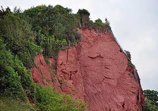
The New Red Sandstone, chiefly in British geology, is composed of beds of red sandstone and associated rocks laid down throughout the Permian to the end of the Triassic, that underlie the Jurassic-Triassic age Penarth Group. The name distinguishes it from the Old Red Sandstone which is largely Devonian in age, and with which it was originally confused due to their similar composition.

The Ecca Group is the second of the main subdivisions of the Karoo Supergroup of geological strata in southern Africa. It mainly follows conformably after the Dwyka Group in some sections, but in some localities overlying unconformably over much older basement rocks. It underlies the Beaufort Group in all known outcrops and exposures. Based on stratigraphic position, lithostratigraphic correlation, palynological analyses, and other means of geological dating, the Ecca Group ranges between Early to earliest Middle Permian in age.

One of the classic locations for the study of Triassic sandstones in the UK is at Alderley Edge in Cheshire. Numerous scientists from the early 19th century up to the present day have studied the area and it is a popular field site for universities around the UK.

In geology, a group is a lithostratigraphic unit consisting of a series of related formations that have been classified together to form a group. Formations are the fundamental unit of stratigraphy. Groups may sometimes be combined into supergroups.
The Lias Group or Lias is a lithostratigraphic unit found in a large area of western Europe, including the British Isles, the North Sea, the Low Countries and the north of Germany. It consists of marine limestones, shales, marls and clays.
The Rotliegend, Rotliegend Group or Rotliegendes is a lithostratigraphic unit of latest Carboniferous to Guadalupian age that is found in the subsurface of large areas in western and central Europe. The Rotliegend mainly consists of sandstone layers. It is usually covered by the Zechstein and lies on top of regionally different formations of late Carboniferous age.
The Germanic Trias Supergroup is a lithostratigraphic unit in the subsurface of large parts of western and central Europe and the North Sea. Almost all of the Germanic Trias was deposited during the Triassic period and consists of three clearly different units: Buntsandstein, Muschelkalk and Keuper, that gave the period its name. In the past the names of these three units were also used as units in the geologic timescale, but in modern literature they only have a lithostratigraphic meaning.
Gogolin Formation – Triassic geologic formation, hitherto named the Gogolin Beds, is the lowermost lithostratigraphical unit of the Lower Muschelkalk in the Silesian-Cracow Upland, underlain by the Upper Buntsandstein carbonates and overlain by the Górażdże Formation carbonates.
The Solling Formation is a geologic formation in Germany. Formerly considered earliest Triassic (Induan), but later dating places the formation from the Olenekian to Anisian of the Triassic period.

The North Sea basin is located in northern Europe and lies between the United Kingdom, and Norway just north of The Netherlands and can be divided into many sub-basins. The Southern North Sea basin is the largest gas producing basin in the UK continental shelf, with production coming from the lower Permian sandstones which are sealed by the upper Zechstein salt. The evolution of the North Sea basin occurred through multiple stages throughout the geologic timeline. First the creation of the Sub-Cambrian peneplain, followed by the Caledonian Orogeny in the late Silurian and early Devonian. Rift phases occurred in the late Paleozoic and early Mesozoic which allowed the opening of the northeastern Atlantic. Differential uplift occurred in the late Paleogene and Neogene. The geology of the Southern North Sea basin has a complex history of basinal subsidence that had occurred in the Paleozoic, Mesozoic, and Cenozoic. Uplift events occurred which were then followed by crustal extension which allowed rocks to become folded and faulted late in the Paleozoic. Tectonic movements allowed for halokinesis to occur with more uplift in the Mesozoic followed by a major phase of inversion occurred in the Cenozoic affecting many basins in northwestern Europe. The overall saucer-shaped geometry of the southern North Sea Basin indicates that the major faults have not been actively controlling sediment distribution.

The North German Basin is a passive-active rift basin located in central and west Europe, lying within the southeasternmost portions of the North Sea and the southwestern Baltic Sea and across terrestrial portions of northern Germany, Netherlands, and Poland. The North German Basin is a sub-basin of the Southern Permian Basin, that accounts for a composite of intra-continental basins composed of Permian to Cenozoic sediments, which have accumulated to thicknesses around 10–12 kilometres (6–7.5 mi). The complex evolution of the basin takes place from the Permian to the Cenozoic, and is largely influenced by multiple stages of rifting, subsidence, and salt tectonic events. The North German Basin also accounts for a significant amount of Western Europe's natural gas resources, including one of the world's largest natural gas reservoir, the Groningen gas field.
The Germanic Basin is a large region of sedimentation in Western and Central Europe that, during the Permian and Triassic periods, extended from England in the west to the eastern border of Poland in the east.

The geology of Germany is heavily influenced by several phases of orogeny in the Paleozoic and the Cenozoic, by sedimentation in shelf seas and epicontinental seas and on plains in the Permian and Mesozoic as well as by the Quaternary glaciations.
The Worcester Basin or Worcester Graben is a sedimentary basin in central England, filled with mainly Permian and Triassic rocks. It trends roughly north-south and lies between the East Malverns Fault in the west and the Inkberrow Fault in the east. It forms part of a series of Permo-Triassic basins that stretch north-south across England, including the Cheshire Basin, Stafford Basin and the East Irish Sea Basin. These basins resulted from a regional rifting event that affected parts of North-West Europe, eastern North America and East Greenland.


