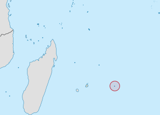
The Mascarene Islands or Mascarenes or Mascarenhas Archipelago is a group of islands in the Indian Ocean east of Madagascar consisting of islands belonging to the Republic of Mauritius as well as the French department of La Réunion. Their name derives from the Portuguese navigator Pedro Mascarenhas, who first visited them in April 1512. The islands share a common geological origin beneath the Mascarene Plateau known as the Mauritia microcontinent which was a Precambrian microcontinent situated between India and Madagascar until their separation about 70 million years ago. They form a distinct ecoregion with unique biodiversity and endemism of flora and fauna.
Rodrigues is a 108 km2 (42 sq mi) autonomous outer island of the Republic of Mauritius in the Indian Ocean, about 560 km (350 mi) east of Mauritius. It is part of the Mascarene Islands, which include Mauritius and Réunion. Like Agaléga, Rodrigues is a constituent island of the Republic of Mauritius, under the Constitution of Mauritius and still remains, as explicitly defined by the same Constitution, part of the Sovereignty of Mauritius, together with the following islands: "Agalega, Tromelin, Cargados Carajos, Chagos Archipelago ... Diego Garcia and other islands included in the State of Mauritius".

Pebble Beach is an unincorporated community on the Monterey Peninsula in Monterey County, California, United States. The small coastal residential community of mostly single-family homes is also notable as a resort destination, and the home of the golf courses of Cypress Point Club, Monterey Peninsula Country Club, and Pebble Beach Golf Links. Nonresidents are charged a toll to use 17-Mile Drive, the main road through Pebble Beach, making it a de-facto gated community.
The Outer Islands of Mauritius is the first-level administrative divisions of the country and consists of the islands of Mauritius and several outlying islands. The Outer Islands of Mauritius are managed under the aegis of the Prime Minister of Mauritius through Prime Minister's Office by the Outer Islands Development Corporation which is the authority empowered under the law to manage the Outer Islands of Mauritius. The Prime Minister is also Minister for Rodrigues, Outer Islands and Territorial Integrity. The Constitution of Mauritius states that the Republic of Mauritius includes the islands of Agaléga, Mauritius, Rodrigues, Saint Brandon, Tromelin Island, and the Chagos Archipelago. The Government of Mauritius claims sovereignty over the Chagos Archipelago, which the United Kingdom split from its territories to create the British Indian Ocean Territory before its independence in 1968. Additionally, France shares a sovereignty claim over Tromelin Island, an uninhabited island between Madagascar and Mauritius's main island.

Flacq is a district of Mauritius, situated in the east of the island. It is the largest district, with an area of 297.9 km². The population estimate is 138,221.

Savanne or Savannah is a district of Mauritius, situated in the south of the island. The district has an area of 244.8 square kilometres (94.5 sq mi). As of 31 December 2015, the estimated population was 68,585.
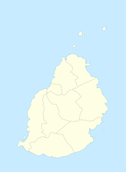
The Districts of the Republic of Mauritius are the second-level administrative divisions after the Outer Islands of Mauritius.

Round Island is an uninhabited islet 22.5 kilometres north of Mauritius. It has an area of 1.69 square kilometres and a maximum elevation of 280 metres. The island has been a nature reserve since 1957 and is administered jointly by the National Parks and Conservation Service and the Mauritian Wildlife Foundation. The island has been designated an Important Bird Area (IBA) by BirdLife International.

Mapou is a village in northern Mauritius, located in Rivière du Rempart District. The village is administered by the Mapou Village Council under the aegis of the Rivière du Rempart District Council. According to the census by Statistics Mauritius in 2011, the population was 1,275.
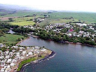
Souillac is a village close to the southernmost point of the main island of Mauritius. It is the seat of the district council of Savanne district. It was named after the Vicomte de Souillac, the island's governor from 1779-1787.

The Mauritian flying fox, also known as Greater Mascarene flying fox or Mauritius fruit bat is a large megabat species endemic to Mauritius and La Réunion.

Rivière Noire or Black River is a district on the western side of the island of Mauritius. Rivière Noire translates to Black River. This region receives less rainfall than the others. The district has an area of 259 square kilometres (100 sq mi) and the population was estimated to be 80,939 as of 31 December 2015. It is the third largest district of Mauritius in area, but the smallest in terms of population. The district is mostly rural, but it also include the western part of the city of Port Louis and western part of Quatre Bornes.
The Islets of Mauritius include circa 130 tiny islets and rocks scattered around the coast of Mauritius, Rodrigues, Agalega and St Brandon.
The wildlife of Mauritius consists of its flora and fauna. Mauritius is located in the Indian Ocean to the east of Madagascar. Due to its isolation, it has a relatively low diversity of wildlife; however, a high proportion of these are endemic species occurring nowhere else in the world. Many of these are now threatened with extinction because of human activities including habitat destruction and the introduction of non-native species. Some have already become extinct, most famously the dodo which disappeared in the 17th century.

Chamarel is a village in Mauritius mainly located in Rivière Noire District. The eastern part of the village lies in the Savanne District. The village is administered by the Chamarel Village Council under the aegis of the Rivière Noire District Council.

Le Pouce is the third highest mountain in Mauritius, at 812 meters. Only Piton de la Petite Rivière Noire and Pieter Both are taller. It is named Le Pouce because of the thumb-shaped peak of the mountain. It can be viewed from the capital of Mauritius, Port Louis, and is a popular hike for the view of the city. The mountain is in the Moka Range and is closest to the village of La Laura-Malenga in the Moka District. Charles Darwin ascended the mountain on 2 May 1836.

La Vallée de Ferney is a forest and wildlife reserve situated in the Bambou mountains north of Mahébourg in Grand Port District, Mauritius. It is managed by the La Vallée de Ferney Conservation Trust.
Grand Bois is a village located in the Savanne District of Mauritius. According to the 2015 census by Statistics Mauritius, the population was 7,982.

Parc naturel régional de la Martinique is one of 54 French regional nature parks. With a surface area of approximately 63,000 ha (240 sq mi), it covers more than half of the island, overlapping 32 of 34 communes - including approximately 100,000 inhabitants. The park works to preserve one of 34 biodiversity hotspots on the planet. The biodiversity hotspot map identifies areas for preservation by two criteria, one being a certain rate of endemism: that the flora and fauna are not found elsewhere, and because at least 70% of its primary vegetation has been lost.