
Caledon is a town in the Regional Municipality of Peel in the Greater Toronto Area of Ontario, Canada. The name comes from a shortened form of Caledonia, the Roman name for what is now Scotland. Caledon is primarily rural with a number of hamlets and small villages, but also contains the larger community of Bolton in its southeastern quadrant, adjacent to York Region. Some spillover urbanization also occurs in the south bordering the City of Brampton.
Rockcliffe Park is a neighbourhood in Rideau-Rockcliffe Ward, close to the centre of Ottawa, Ontario, Canada. Established in 1864, organized as a Police village in 1908, and an independent village from 1926, and ultimately amalgamated with the rest of Ottawa on January 1, 2001. As of 2011, it had a population of 2,021. In 1977 the entire village of Rockcliffe Park was designated a Heritage Conservation District. Rockcliffe Park is one of only a handful of surviving nineteenth-century communities of its kind in North America.

Halton Hills is a town in the Regional Municipality of Halton, located in the northwestern end of the Greater Toronto Area, Ontario, Canada with a population of 62,951 (2021).

Erin is a town in Wellington County, approximately 80 kilometres (50 mi) northwest of Toronto, Ontario, Canada. Erin is bordered by the Town of Caledon, Ontario to the east, the Town of Halton Hills to the south, the Township of Guelph/Eramosa to the west and the Township of East Garafraxa to the north.

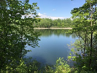
The Credit River is a river in southern Ontario, which flows from headwaters above the Niagara Escarpment near Orangeville and Caledon East to empty into Lake Ontario at Port Credit, Mississauga. It drains an area of approximately 1,000 square kilometres (390 sq mi). The total length of the river and its tributary streams is over 1,500 kilometres (930 mi).
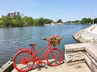
Port Credit is a neighbourhood in the south-central part of the City of Mississauga, Ontario, Canada, located at the mouth of the Credit River on the north shore of Lake Ontario. Its main intersection is Hurontario Street and Lakeshore Road, about 0.6 kilometres (0.37 mi) east of the river. Until 1974, Port Credit was an incorporated town. Its approximate boundaries are the Canadian National Railway to the north, Seneca Avenue to the east and Shawnmarr Road to the west. It had a population of 10,260 at the 2001 census.

Bolton is an unincorporated town that is the most populous community in the town of Caledon, Ontario, Canada, in the Regional Municipality of Peel. It is located beside the Humber River, approximately 50 kilometres northwest of Toronto. In regional documents, it is referred to as a 'Rural Service Centre'. It has 26,795 residents in 9,158 total dwellings. The downtown area that historically defined the village is in a valley, through which flows the Humber River. The village extends on either side of the valley to the north and south.

Westdale is a residential neighbourhood in Hamilton, Ontario, Canada. It is centred in the Westdale Village shopping district and located near McMaster University. It is bordered to the north by Cootes Paradise, an extensive nature reserve marking the western end of Lake Ontario, to the south by Main Street and Ainslie Wood, to the east by Highway 403, and to the west by McMaster University.
The Toronto and Region Conservation Authority (TRCA) is a conservation authority in southern Ontario, Canada. It owns about 16,000 hectares of land in the Toronto region, and it employs more than 400 full-time employees and coordinates more than 3,000 volunteers each year. TRCA's area of jurisdiction is watershed-based and includes 3,467 square kilometres (1,339 sq mi) – 2,506 on land and 961 water-based in Lake Ontario. This area comprises nine watersheds from west to east – Etobicoke Creek, Mimico Creek, Humber River, Don River, Highland Creek, Petticoat Creek, Rouge River, Duffins Creek and Carruthers Creek.

Tullamore is a semi-rural community on the boundary of Brampton and Caledon in Ontario, Canada. It was named after the settlers who arrived from the Irish village of 'Tullymore' in County Sligo. The community is centred on the intersection of Airport Road and Mayfield Road. It had a population of 6 in 2006. Many of the original Irish settlers gravesites can be found in St. Mary's Cemetery.

Alton is a community located in Caledon, Ontario. It is also part of the Peel Region. It was established in 1820. Alton has a population of 1 116 people.

Mayfield West is a suburban neighbourhood located within the largely rural Town of Caledon, in Peel Region in Ontario, Canada, immediately adjacent to the City of Brampton. It has a population of 14,800 people.
Wildfield is a small rural hamlet located within the town of Caledon in Ontario, Canada.

Alloa is a semi-rural hamlet located on the boundary of the City of Brampton and the Town of Caledon in Ontario, Canada. It is within the Regional Municipality of Peel.

Caledon Village is an unincorporated community located within the largely rural Town of Caledon in Ontario, Canada. It has a population of 1 909 people.

Terra Cotta is a hamlet located in the town of Caledon, within Peel Region, Ontario, Canada.
Inglewood is a village located within the town of Caledon, in Peel, Ontario, Canada. It has a population of 1 175 people.

Cheltenham is a small unincorporated village located within the Town of Caledon, in Peel Region, Ontario. It has a population of 729 people. The village is named after Cheltenham, England.
Cataract is a hamlet located within the town of Caledon in the regional municipality of Peel, Ontario, Canada. As of 2006, it had a population of 106 people.


