Belleterre, Quebec

Last updated
Belleterre
City
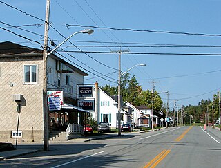
Belleterre 2004.JPG
Belleterre Quebec location diagram.png
Location within Témiscamingue RCM.
Canada Western Quebec location map.png
Red pog.svg
Belleterre
Location in western Quebec.
Coordinates: 47°23′N78°42′W / 47.383°N 78.700°W / 47.383; -78.700 Coordinates: 47°23′N78°42′W / 47.383°N 78.700°W / 47.383; -78.700 [1]
CountryFlag of Canada.svg  Canada
Province Flag of Quebec.svg  Quebec
Region Abitibi-Témiscamingue
RCM Témiscamingue
Constituted May 13, 1942
Government [2]
  Mayor Bruno Boyer
   Federal riding Abitibi—Témiscamingue
   Prov. riding Rouyn-Noranda–Témiscamingue
Area [2] [3]
  Total 604.10 km2 (233.24 sq mi)
  Land 551.29 km2 (212.85 sq mi)
Population (2011) [3]
  Total 298
  Density 0.5/km2 (1/sq mi)
  Pop (2006–11)Decrease2.svg 14.9%
  Dwellings 212
Time zone EST (UTC−5)
  Summer (DST) EDT (UTC−4)
Postal code(s) J0Z 1L0
Area code(s) 819

Belleterre is a ville in northwestern Quebec, Canada, in the MRC de Témiscamingue.

Ville is the modern French word of Latin origin now meaning "city" or "town", but the first meaning in the Middle Ages was "farm" and then "village". The derivative suffix -ville is commonly used in English in names of cities, towns and villages.
Quebec Province of Canada

Quebec is one of the thirteen provinces and territories of Canada. It is bordered to the west by the province of Ontario and the bodies of water James Bay and Hudson Bay; to the north by Hudson Strait and Ungava Bay; to the east by the Gulf of Saint Lawrence and the province of Newfoundland and Labrador; and to the south by the province of New Brunswick and the U.S. states of Maine, New Hampshire, Vermont, and New York. It also shares maritime borders with Nunavut, Prince Edward Island, and Nova Scotia. Quebec is Canada's largest province by area and its second-largest administrative division; only the territory of Nunavut is larger. It is historically and politically considered to be part of Central Canada.

Canada Country in North America

Canada is a country in the northern part of North America. Its ten provinces and three territories extend from the Atlantic to the Pacific and northward into the Arctic Ocean, covering 9.98 million square kilometres, making it the world's second-largest country by total area. Canada's southern border with the United States is the world's longest bi-national land border. Its capital is Ottawa, and its three largest metropolitan areas are Toronto, Montreal, and Vancouver. As a whole, Canada is sparsely populated, the majority of its land area being dominated by forest and tundra. Consequently, its population is highly urbanized, with over 80 percent of its inhabitants concentrated in large and medium-sized cities, many near the southern border. Canada's climate varies widely across its vast area, ranging from arctic weather in the north, to hot summers in the southern regions, with four distinct seasons.

Contents

History

In 1930, prospector William Logan discovered gold near Mud Lake (now called Lake Guillet). This led to the establishment of the Belleterre Gold Mines Company in 1935, and the formation of the Belleterre community at nearby Sables Lake to house the miners and their families. In 1942, the place was incorporated as a town and at its peak had some 2000 residents. But by 1957, the mine was depleted and closed. [1]

Gold Chemical element with atomic number 79

Gold is a chemical element with symbol Au and atomic number 79, making it one of the higher atomic number elements that occur naturally. In its purest form, it is a bright, slightly reddish yellow, dense, soft, malleable, and ductile metal. Chemically, gold is a transition metal and a group 11 element. It is one of the least reactive chemical elements and is solid under standard conditions. Gold often occurs in free elemental (native) form, as nuggets or grains, in rocks, in veins, and in alluvial deposits. It occurs in a solid solution series with the native element silver and also naturally alloyed with copper and palladium. Less commonly, it occurs in minerals as gold compounds, often with tellurium.

Demographics

Population trend: [4]

Private dwellings occupied by usual residents: 135 (total dwellings: 212)

Mother tongue: [5] [6]

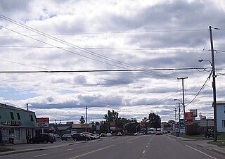
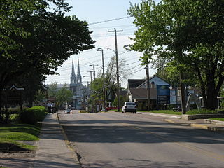
Belleterre main street Belleterre QC.JPG
Belleterre main street

See also

Related Research Articles

Alma, Quebec Town in Quebec, Canada

Alma is a town in the Canadian province of Quebec.

Dolbeau-Mistassini City in Quebec, Canada

Dolbeau-Mistassini is a town in northern Quebec, Canada, at the confluence of the Mistassibi River, Riviere aux Rats and the Mistassini River, on Lac Saint-Jean. Dolbeau-Mistassini is in the Maria-Chapdelaine Regional County Municipality and is the commercial hub of Lac-St-Jean with big stores and shopping centres.

Roberval, Quebec City in Quebec, Canada

Roberval is a city on the south-western shore of Lac Saint-Jean in the Le Domaine-du-Roy Regional County Municipality of Quebec, Canada. With a population of 10,227 in the Canada 2011 Census, it is the fourth largest city on this lake after Alma, Dolbeau-Mistassini and Saint-Félicien. It is the seat of the Domaine-du-Roy RCM and the main service centre for the region with a hospital and some government services. It is also the seat of the judicial district of Roberval.

Ville-Marie, Quebec City in Quebec, Canada

Ville-Marie is a town on Lake Temiscaming in western Quebec, Canada. It is the largest city and seat of the Témiscamingue Regional County Municipality, Quebec. As one of the oldest towns in the Abitibi-Témiscamingue region, it is considered the cradle of north-western Quebec and nicknamed "Pearl of Témiscamingue".

Malartic, Quebec City in Quebec, Canada

Malartic is a town on the Malartic River in northwestern Quebec, Canada, in the La Vallée-de-l'Or Regional County Municipality. It is located about 80 kilometres (50 mi) east of the centre of Rouyn-Noranda along Quebec Route 117 and the Canadian National Railway.

Lebel-sur-Quévillon City in Quebec, Canada

Lebel-sur-Quévillon is a city in the Canadian province of Quebec, located on Route 113 in the Jamésie region. It is located approximately 88 kilometres north of Senneterre and approximately 200 kilometres southwest of Chibougamau. It is surrounded by, but not a part of, the municipality of Baie-James.

Preissac, Quebec Municipality in Quebec, Canada

Preissac is a municipality in the Canadian province of Quebec, located in the Abitibi Regional County Municipality. The village of Preissac itself is located at the north end of Lake Preissac.

Duparquet, Quebec City in Quebec, Canada

Duparquet is a ville in northwestern Quebec, Canada in the MRC d'Abitibi-Ouest. It covers 157.4 km² and had a population of 657 as of the Canada 2011 Census.

Duhamel-Ouest Municipality in Quebec, Canada

Duhamel-Ouest is a municipality in northwestern Quebec, Canada in the Témiscamingue Regional County Municipality.

Kipawa, Quebec Municipality in Quebec, Canada

Kipawa is a village and municipality in western Quebec, Canada, in the Témiscamingue Regional County Municipality. It is located at the south end of Lake Kipawa, adjacent to the Kebaowek Reserve. The land including and surrounding Lake Kipawa and Kipawa Village has been inhabited for centuries. The original inhabitants were the Algonquin people. The first Europeans to come into Kipawa were fur traders and missionaries. Shortly after, The Hudson Bay Trading Company and various other lumber companies settled there too.

Laforce, Quebec Municipality in Quebec, Canada

Laforce is a municipality in northwestern Quebec, Canada, in the Témiscamingue Regional County Municipality.

Lorrainville, Quebec Municipality in Quebec, Canada

Lorrainville is a municipality in northwestern Quebec, Canada, in the Témiscamingue Regional County Municipality. It was founded in 1907 by Isaïe Douaire, who was a farmer from Ville Marie.

Moffet, Quebec Municipality in Quebec, Canada

Moffet is a municipality in northwestern Quebec, Canada, in the Témiscamingue Regional County Municipality. The municipality had a population of 196 as of the Canada 2011 Census. Moffet consists of farming and cattle. With few stores in the town. Towns people mostly speak French, Quebec's official language. Few know English. The town is the home of Lac Chevreuil "Lake Deer" and neighbors Lac Simard. Over the years it has become a visitors spot for fishing and camping. Visitors come from other parts of Canada and parts of the United States. The town is very small; most people live on the main road that passes through Chemin De Moffet and Rue Principale. Some are scattered away from town, but not far away. Neighboring towns of Moffet are to the southwest is Latulipe-et-Gaboury and to the east Laforce.

Saint-Eugène-de-Guigues, Quebec Municipality in Quebec, Canada

Saint-Eugène-de-Guigues, often shortened to Saint-Eugène, is a municipality in northwestern Quebec, Canada, in the Témiscamingue Regional County Municipality.

Latulipe-et-Gaboury, Quebec United township municipality in Quebec, Canada

Latulipe-et-Gaboury is a United township municipality in northwestern Quebec, Canada, in the Témiscamingue Regional County Municipality. The only other remaining united township municipality in Quebec is Stoneham-et-Tewkesbury.

Saint-Édouard-de-Fabre, Quebec Parish municipality in Quebec, Canada

Saint-Édouard-de-Fabre is a parish municipality in western Quebec, Canada, in the Témiscamingue Regional County Municipality.

Desbiens, Quebec City in Quebec, Canada

Desbiens is a ville in the Canadian province of Quebec, located in Lac-Saint-Jean-Est Regional County Municipality. It is on the shores of Lac Saint-Jean at the mouth of the Métabetchouane River.

Saint-Félicien, Quebec City in Quebec, Canada

Saint-Félicien is a city in the Canadian province of Quebec. The town is located within the Le Domaine-du-Roy Regional County Municipality in the Saguenay-Lac-Saint-Jean region. Its population as of 2006 is 10,477.

Lac-Bouchette, Quebec Municipality in Quebec, Canada

Lac-Bouchette is a municipality in Quebec, Canada. The town is located on the eastern shore of the eponymous Lake Bouchette, along Quebec Route 155 and the Canadian National Railway.

Saint-François-de-Sales, Quebec Municipality in Quebec, Canada

Saint-François-de-Sales is a municipality in Quebec, Canada.

References

  1. 1 2 "Belleterre (Ville)" (in French). Commission de toponymie du Québec. Retrieved 2010-12-31.
  2. 1 2 "Belleterre". Répertoire des municipalités (in French). Ministère des Affaires municipales, des Régions et de l'Occupation du territoire. Retrieved 2010-12-31.
  3. 1 2 "Belleterre census profile". 2011 Census data . Statistics Canada. Retrieved 2010-12-31.
  4. Statistics Canada: 1996, 2001, 2006, 2011 census
  5. "Belleterre community profile". 2006 Census data . Statistics Canada. Retrieved 2010-12-31.
  6. "Demographic Information" (PDF). www.villebelleterre.com. Retrieved Sep 21, 2017.