Saint-Eugène-de-Guigues, Quebec

Last updated
Saint-Eugène-de-Guigues
Municipality
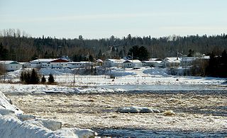
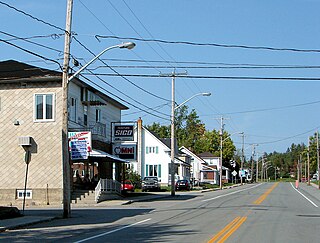
St-Eugene-de-Guigues QC.jpg
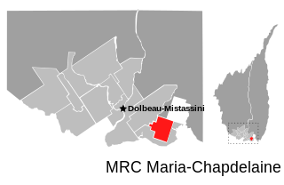
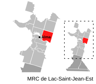
Saint-Eugene-de-Guigues Quebec location diagram.png
Location within Témiscamingue RCM.
Canada Western Quebec location map.png
Red pog.svg
Saint-Eugène-de-Guigues
Location in western Quebec.
Coordinates: 47°31′N79°21′W / 47.517°N 79.350°W / 47.517; -79.350 Coordinates: 47°31′N79°21′W / 47.517°N 79.350°W / 47.517; -79.350 [1]
CountryFlag of Canada.svg  Canada
Province Flag of Quebec.svg  Quebec
Region Abitibi-Témiscamingue
RCM Témiscamingue
Settled 1911
Constituted November 20, 1912
Government [2]
  Mayor Jacinthe Marcoux
   Federal riding Abitibi—Témiscamingue
   Prov. riding Rouyn-Noranda–Témiscamingue
Area [2] [3]
  Total 116.10 km2 (44.83 sq mi)
  Land 110.34 km2 (42.60 sq mi)
Population (2011) [3]
  Total 454
  Density 4.1/km2 (11/sq mi)
  Pop (2006–11)Decrease2.svg 4.2%
  Dwellings 185
Time zone EST (UTC−5)
  Summer (DST) EDT (UTC−4)
Postal code(s) J0Z 3L0
Area code(s) 819
Website www.st-eugene-de-guigues.qc.ca

Saint-Eugène-de-Guigues, often shortened to Saint-Eugène, is a municipality in northwestern Quebec, Canada, in the Témiscamingue Regional County Municipality.
Quebec Province of Canada

Quebec is one of the thirteen provinces and territories of Canada. It is bordered to the west by the province of Ontario and the bodies of water James Bay and Hudson Bay; to the north by Hudson Strait and Ungava Bay; to the east by the Gulf of Saint Lawrence and the province of Newfoundland and Labrador; and to the south by the province of New Brunswick and the U.S. states of Maine, New Hampshire, Vermont, and New York. It also shares maritime borders with Nunavut, Prince Edward Island, and Nova Scotia. Quebec is Canada's largest province by area and its second-largest administrative division; only the territory of Nunavut is larger. It is historically and politically considered to be part of Central Canada.

Canada Country in North America

Canada is a country in the northern part of North America. Its ten provinces and three territories extend from the Atlantic to the Pacific and northward into the Arctic Ocean, covering 9.98 million square kilometres, making it the world's second-largest country by total area. Canada's southern border with the United States is the world's longest bi-national land border. Its capital is Ottawa, and its three largest metropolitan areas are Toronto, Montreal, and Vancouver. As a whole, Canada is sparsely populated, the majority of its land area being dominated by forest and tundra. Consequently, its population is highly urbanized, with over 80 percent of its inhabitants concentrated in large and medium-sized cities, many near the southern border. Canada's climate varies widely across its vast area, ranging from arctic weather in the north, to hot summers in the southern regions, with four distinct seasons.

Témiscamingue Regional County Municipality Regional county municipality in Quebec, Canada

Témiscamingue is a regional county municipality in the Abitibi-Témiscamingue region of western Quebec, Canada. The county seat is Ville-Marie.

Contents

Demographics

Population trend: [4]

Private dwellings occupied by usual residents: 182 (total dwellings: 185)

Mother tongue: [5]

See also

Related Research Articles

Saint-Stanislas, Saguenay–Lac-Saint-Jean, Quebec Municipality in Quebec, Canada

Saint-Stanislas is a municipality in Maria-Chapdelaine Regional County Municipality in the Saguenay–Lac-Saint-Jean region of Quebec, Canada. Its population was 353 in the Canada 2011 Census.

Saint-Augustin, Saguenay–Lac-Saint-Jean, Quebec Parish municipality in Quebec, Canada

Saint-Augustin is a parish municipality in the Maria-Chapdelaine Regional County Municipality in the Saguenay–Lac-Saint-Jean region of Quebec, Canada. The municipality had a population of 400 as of the Canada 2011 Census.

Saint-Eugène-dArgentenay, Quebec Municipality in Quebec, Canada

Saint-Eugène-d'Argentenay is a municipality in the Canadian province of Quebec, located within the regional county municipality of Maria-Chapdelaine. The municipality had a population of 546 as of the Canada 2011 Census. Prior to 1997 it was known simply as Saint-Eugène.

Saint-Thomas-Didyme, Quebec Municipality in Quebec, Canada

Saint-Thomas-Didyme is a municipality in Maria-Chapdelaine Regional County Municipality in the Saguenay–Lac-Saint-Jean region of Quebec, Canada. It had a population of 677 in the Canada 2011 Census.

Notre-Dame-de-Lorette, Quebec Municipality in Quebec, Canada

Notre-Dame-de-Lorette is a municipality in the Canadian province of Quebec, located within the regional county municipality of Maria-Chapdelaine. With a population of 175 in the Canada 2006 Census, it is the least populated and northern-most municipality in the Saguenay–Lac-Saint-Jean region.

Béarn, Quebec Municipality in Quebec, Canada

Béarn is a municipality in northwestern Quebec, Canada in the Témiscamingue Regional County Municipality.

Fugèreville, Quebec Municipality in Quebec, Canada

Fugèreville is a municipality in northwestern Quebec, Canada in the Témiscamingue Regional County Municipality.

Laforce, Quebec Municipality in Quebec, Canada

Laforce is a municipality in northwestern Quebec, Canada, in the Témiscamingue Regional County Municipality.

Laverlochère, Quebec Municipality in Quebec, Canada

Laverlochère is a municipality in northwestern Quebec, Canada, in the Témiscamingue Regional County Municipality.

Angliers, Quebec Village municipality in Quebec, Canada

Angliers is a village in northwestern Quebec, Canada, in the Témiscamingue Regional County Municipality.

Saint-Bruno-de-Guigues Municipality in Quebec, Canada

Saint-Bruno-de-Guigues, often shortened to Guigues, is a municipality in northwestern Quebec, Canada, in the Témiscamingue Regional County Municipality.

Latulipe-et-Gaboury, Quebec United township municipality in Quebec, Canada

Latulipe-et-Gaboury is a United township municipality in northwestern Quebec, Canada, in the Témiscamingue Regional County Municipality. The only other remaining united township municipality in Quebec is Stoneham-et-Tewkesbury.

Saint-Édouard-de-Fabre, Quebec Parish municipality in Quebec, Canada

Saint-Édouard-de-Fabre is a parish municipality in western Quebec, Canada, in the Témiscamingue Regional County Municipality.

Desbiens, Quebec City in Quebec, Canada

Desbiens is a ville in the Canadian province of Quebec, located in Lac-Saint-Jean-Est Regional County Municipality. It is on the shores of Lac Saint-Jean at the mouth of the Métabetchouane River.

Saint-André-du-Lac-Saint-Jean, Quebec Village municipality in Quebec, Canada

Saint-André-du-Lac-Saint-Jean is a village municipality in Quebec, Canada.

Saint-François-de-Sales, Quebec Municipality in Quebec, Canada

Saint-François-de-Sales is a municipality in Quebec, Canada.

Saint-Prime, Quebec Municipality in Quebec, Canada

Saint-Prime is a municipality in Quebec, Canada, located within the regional county municipality of Le Domaine-du-Roy. The municipality had a population of 2,758 as of the Canada 2011 Census, and a land area of 147.16 km2.

Saint-Nazaire, Quebec Municipality in Quebec, Canada

Saint-Nazaire is a municipality in Quebec, Canada.

Saint-Henri-de-Taillon, Quebec Municipality in Quebec, Canada

Saint-Henri-de-Taillon is a municipality in Quebec, Canada.

Saint-Ludger-de-Milot Municipality in Quebec, Canada

Saint-Ludger-de-Milot is a municipality in Quebec, Canada.

References

  1. Reference number 56471 of the Commission de toponymie du Québec (in French)
  2. 1 2 "Saint-Eugène-de-Guigues". Répertoire des municipalités (in French). Ministère des Affaires municipales, des Régions et de l'Occupation du territoire. Retrieved 2010-12-31.
  3. 1 2 "Saint-Eugène-de-Guigues census profile". 2011 Census data . Statistics Canada. Retrieved 2010-12-31.
  4. Statistics Canada: 1996, 2001, 2006, 2011 census
  5. "Saint-Eugène-de-Guigues community profile". 2006 Census data . Statistics Canada. Retrieved 2010-12-31.