
The Parts of Kesteven are a traditional division of Lincolnshire, England. This division had long had a separate county administration, along with the two other Parts of Lincolnshire, Lindsey and Holland.
The Diocese of Lincoln forms part of the Province of Canterbury in England. The present diocese covers the ceremonial county of Lincolnshire.

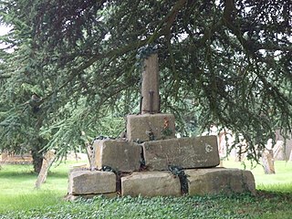
Aveland was a Wapentake of Kesteven from the time of the Danelaw until the Local Government Act 1888. Its meeting place was The Aveland at grid reference TF 0675 2961 in the parish of Aslackby.

Aslackby and Laughton is a civil parish in the South Kesteven district of Lincolnshire, England. According to the 2001 census the parish had a population of 243, in 102 households. increasing slightly to 251 in 118 households at the 2011 census. It consists of the village of Aslackby, the hamlet of Laughton, and scattered farms, and part of the hamlet of Graby.

Braceby is a village in the civil parish of Braceby and Sapperton, in the South Kesteven district of Lincolnshire, England. The village includes a roadside nature reserve sheltering 250 species of plant life.

Castle Bytham is a village and civil parish of around 300 houses in South Kesteven, Lincolnshire, England. It is located 9 miles (14 km) north of Stamford and 9 miles (14 km) west of Bourne.The population was measured at 768 in 317 households at the 2011 census.
Edenham is a village and civil parish in the South Kesteven district of Lincolnshire, England. It is approximately 3 miles (5 km) north-west of Bourne, and on the A151 road. While the civil parish is called 'Edenham', the parish council is called Edenham, Grimsthorpe, Elsthorpe & Scottlethorpe Parish Council. The population of the civil parish at the 2011 census was 291.

Swayfield is a village and civil parish in the South Kesteven district of Lincolnshire, England. The population of the civil parish at the 2011 census was 316. It is situated just over 3 miles (5 km) east from the A1 road, 9 miles (14 km) south-east from Grantham and 10 miles (16 km) north from Stamford. It has approximately 138 houses.
Careby Aunby and Holywell is a civil parish in the district of South Kesteven, south-west Lincolnshire, in England. It stretches from the county border with Rutland in the west to the River West Glen in the east. The B1176 road from Corby Glen passes through Careby and on past Aunby toward Stamford. The main London to Scotland railway line passes through the parish, the line upon which Mallard took the speed record for the LNER.

Skinnand is a deserted medieval village in Lincolnshire, England. It was a small farming community situated 9 miles (14 km) south of Lincoln and 11.5 miles (19 km) northwest of Sleaford, composed of a church and several houses. During the English Civil War of 1642-1646 the church fell into ruins. Today only fields and one deserted farmhouse remain.

Little Ponton is a village in the civil parish of Little Ponton and Stroxton, in the South Kesteven district of Lincolnshire, England. It lies 2 miles (3 km) south of Grantham, about 60 metres (200 ft) above sea level.

The first elections to Kesteven County Council were held on Thursday, 17 January 1889. Kesteven was one of three divisions of the historic county of Lincolnshire in England; it consisted of the ancient wapentakes of Aswardhurn, Aveland, Beltisloe, Boothby Graffoe, Flaxwell, Langoe, Loveden, Ness, and Winnibriggs and Threo. The Local Government Act 1888 established Kesteven as an administrative county, governed by a Council; elections were held every three years from 1889, until it was abolished by the Local Government Act 1972, which established Lincolnshire County Council in its place.
The third set of elections to Kesteven County Council were held on Thursday, 7 March 1895. Kesteven was one of three divisions of the historic county of Lincolnshire in England; it consisted of the ancient wapentakes of Aswardhurn, Aveland, Beltisloe, Boothby Graffoe, Flaxwell, Langoe, Loveden, Ness, and Winnibriggs and Threo. The Local Government Act 1888 established Kesteven as an administrative county, governed by a Council; elections were held every three years from 1889, until it was abolished by the Local Government Act 1972, which established Lincolnshire County Council in its place.
The fourth set of elections to Kesteven County Council were held in March 1898. Kesteven was one of three divisions of the historic county of Lincolnshire in England; it consisted of the ancient wapentakes of Aswardhurn, Aveland, Beltisloe, Boothby Graffoe, Flaxwell, Langoe, Loveden, Ness, and Winnibriggs and Threo. The Local Government Act 1888 established Kesteven as an administrative county, governed by a Council; elections were held every three years from 1889, until it was abolished by the Local Government Act 1972, which established Lincolnshire County Council in its place.
The fifth set of elections to Kesteven County Council were held on Thursday, 7 March 1901. Kesteven was one of three divisions of the historic county of Lincolnshire in England; it consisted of the ancient wapentakes of Aswardhurn, Aveland, Beltisloe, Boothby Graffoe, Flaxwell, Langoe, Loveden, Ness, and Winnibriggs and Threo. The Local Government Act 1888 established Kesteven as an administrative county, governed by a Council; elections were held every three years from 1889, until it was abolished by the Local Government Act 1972, which established Lincolnshire County Council in its place.
Elections to Kesteven County Council were held on Saturday, 15 April 1961. Kesteven was one of three divisions of the historic county of Lincolnshire in England; it consisted of the ancient wapentakes of Aswardhurn, Aveland, Beltisloe, Boothby Graffoe, Flaxwell, Langoe, Loveden, Ness, and Winnibriggs and Threo. The Local Government Act 1888 established Kesteven as an administrative county, governed by a Council; elections were held every three years from 1889, until it was abolished by the Local Government Act 1972, which established Lincolnshire County Council in its place.
Elections to Kesteven County Council were held on Saturday, 2 April 1955. Kesteven was one of three divisions of the historic county of Lincolnshire in England; it consisted of the ancient wapentakes of Aswardhurn, Aveland, Beltisloe, Boothby Graffoe, Flaxwell, Langoe, Loveden, Ness, and Winnibriggs and Threo. The Local Government Act 1888 established Kesteven as an administrative county, governed by a Council; elections were held every three years from 1889, until it was abolished by the Local Government Act 1972, which established Lincolnshire County Council in its place.
Elections to Kesteven County Council were held on Saturday, 6 March 1937. Kesteven was one of three divisions of the historic county of Lincolnshire in England; it consisted of the ancient wapentakes of Aswardhurn, Aveland, Beltisloe, Boothby Graffoe, Flaxwell, Langoe, Loveden, Ness, and Winnibriggs and Threo. The Local Government Act 1888 established Kesteven as an administrative county, governed by a Council; elections were held every three years from 1889, until it was abolished by the Local Government Act 1972, which established Lincolnshire County Council in its place.
Elections to Kesteven County Council were held on Saturday, 11 April 1964. Kesteven was one of three divisions of the historic county of Lincolnshire in England; it consisted of the ancient wapentakes of Aswardhurn, Aveland, Beltisloe, Boothby Graffoe, Flaxwell, Langoe, Loveden, Ness, and Winnibriggs and Threo. The Local Government Act 1888 established Kesteven as an administrative county, governed by a Council; elections were held every three years from 1889, until it was abolished by the Local Government Act 1972, which established Lincolnshire County Council in its place.

