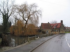
Castle Bytham is a village and civil parish of around 300 houses in South Kesteven, Lincolnshire, England. It is located 9 miles (14 km) north of Stamford and 9 miles (14 km) west of Bourne. The population was measured at 768 in 317 households at the 2011 census. [2]
At one time the village was an important commercial centre for the surrounding agricultural communities, but it is now largely a dormitory, although a number of farming families remain with a much reduced workforce. [3]
The name 'Bytham' is first recorded in 1067 (as a monastery that rapidly translated to Vaudey Abbey), and comes from the Old English word bythme meaning Valley bottom, broad valley. [5] In the Domesday survey of 1086 the village was known as West Bytham [6] as the castle had yet to be built. People have named the river that runs through the village the Tham or Am as a back-formation from the village name.[ citation needed ]
Morkery Wood housed a former bomb dump during the Second World War for the nearby airfields. In the early hours of 19 November 1942 Handley Page Halifax BB209 NP-G [7] of 158 Sqn, from RAF Rufforth in North Yorkshire, crashed near Stocken Hall Farm (in the wood). It had been hit by flak south-east of Paris coming back from a raid on Turin, Italy. [8] Half the aircrew were in the RCAF.
Overlooking the village is an 11th-century Norman castle mound. [9] The site of the castle in Saxon times was owned by Morcar, also known as Morkere, who was the brother of Ealdgyth, wife of King Harold. The castle, which gave its name to the village, was built soon after the Norman conquest and was given by the Conqueror to his half brother Odo, Bishop of Bayeux and Earl of Kent; [10] it was later owned by William le Gros, 1st Earl of Albemarle,[ citation needed ] and passed to the family of Coleville. During the First Barons' War it was occupied by William de Forz, 3rd Earl of Albemarle aided by William d'Aubigny, Sir Richard Siward, Henry de Hastings and William de Hastings.[ citation needed ]. In 1221, after a siege, the castle was captured by Henry III with the help of Hugh de Mortimer and William de Warenne, 5th Earl of Surrey and restored to its lord, the former rebel William de Coleville. [11]
The castle was burnt in the 15th century during the Wars of the Roses. [10] In the 16th century John Leland described remnants of the castle: "yet remained great walls of buildings". [10]
At lunchtime on Wednesday 1 February 1961 Jet Provost 'XN460' crashed near Cabbage Hill. Pilot Officer IF Mitchinson of Grove Park, London, parachuted to Scottlethorpe, four miles away. He had flown from RAF Syerston. Fire engines from Cottesmore, Oakham and Corby attended. [12] [13]
The nearest town is Stamford (even though Castle Bytham is in the Grantham postal area, with a Nottingham postcode). It is at the apex of the NG (Grantham), LE (Rutland) and PE (Stamford) postcodes.
The village is very close to the Rutland boundary. The civil parish extends much to the north-west of the village, up to Woolley's Lane, including Red Barn Quarry, owned by Bullimores. It also extends westwards to include all of Morkery Wood (originally named Morkerhaw – named after the Saxon earl Morcar mentioned above). [14] South of the A1 interchange to Woolley's Lane, the parish boundary is with North Witham, including Park House Farm. The eastern buildings of Stocken Hall Farm lie in the parish (with an LE15 postcode), with the rest in Stretton. To the east, Little Haw Wood is also in the parish.
Southwards, the civil parish extends to (and includes) Pillowsyke Holt, a piece of woodland near Holywell. Eastwards, the parish extends for about half a mile, where it includes the 30 acre Lawn Wood [15] which has been a nature reserve since 1995, joining two neighbouring meadows that were donated to Lincolnshire Wildlife Trust in 1993. The meadows are a good site for buttercups and yellow rattle, and are managed to encourage butterflies, including the ringlet, and the meadow brown. The wood is mainly oak and ash, but includes field maple, midland hawthorn and the uncommon wild service tree; woodland flora such as wood anemone, woodruff and early purple orchid also found there. Fallow deer and red deer are frequently seen in the reserve. [15]
About 1 mile (2 km) to the east lies Little Bytham. The two villages used to be called West and East Bytham. [3]
To the west, on the western side of the A1 road, is South Witham near the source of the River Witham. The village's vicar, and that of the Bythams Group, is also the wife of the vicar of South Witham.
Between the village and the A1 the Lincolnshire Wildlife Trust maintains an important wildlife reserve at Tortoiseshell Wood [19] (which borders on to the west of the civil parish) and some of the road verges are protected for wildlife by Lincolnshire County Council. Tortoiseshell Wood is in the parish of North Witham, although the edge lies on the parish boundary.
West of the village, towards Clipsham, is a Yew Tree Avenue maintained by the Forestry Commission, the trees cut into large topiary forms.
The Ecclesiastical parish is part of the Castle Bytham with Creeton group of the Deanery of Beltisloe. The incumbent is Revd S. M. Evans. [4] [20] [21]
Castle Bytham's community supports several events each year in the village hall. Every year Castle Bytham holds a midsummer fair and street market, with stalls, a duck grand prix, dog show, funfair, children's games, beer tents and barbecues. The fair has raised over £40,000 for local causes including a Christmas lunch for pensioners and a children's party, and village infrastructure improvements.[ citation needed ] Efforts are currently being made[ by whom? ] to improve the village recreation ground for the benefit of local young people and a 2010 Parish Plan suggested wider improvements.[ citation needed ]
The former RAF Coningsby station commander (1974–60) and Commandant of the Central Flying School (1979–83) lives in the village,[ who? ] and a former resident on Glen Road was Harold Wilson's press secretary, Trevor Lloyd-Hughes. [22] [23]
There is a village shop on Pinfold Road. Castle Bytham Post Office [24] was closed in 2008 despite local opposition. It had served Creeton, Swinstead, Swayfield, Little Bytham and Clipsham, and other nearby small villages – it has now been replaced by a mobile 'outreach' service.[ citation needed ]
There are two remaining public houses in the village: the Fox & Hounds and the Castle Inn. The New Inn on Station Road was converted to housing in the 1960s. [3]
The village had a railway station on the Midland and Great Northern Joint Railway, the remains of which can still be seen. This railway station was rather unusual, being a single platform in a deep cutting through the village. The railway station was not originally planned by the railway, but was added after considerable local lobbying. [25] [26] It remained open, as did the goods yard on the other side of the road, until the line closed in 1959. [3] [26] [27] [28] West of the village the line of the railway now forms a road crossing under the A1.
The church, started in the 12th century, and restored in 1900, is dedicated to St James [29] and is one of a group of parishes in the rural deanery of Beltisloe. It contains an unusual memento of the English Restoration: a ladder, formerly used in the tower, with a carved inscription which reads "THIS WARE THE MAY POVL 1660" [10] (see photograph), suggesting that May celebrations were held in the village (as they were throughout the country) to mark the Restoration of King Charles II. [4]
There was at one time a Methodist chapel in High Street (now a private house), served by visiting ministers from Stamford. [30] On its closure in 1972 the Methodist Circuit still sent a preacher to the village for a few years, service taking place in the parish church.[ citation needed ]
South Kesteven is a local government district in Lincolnshire, England, forming part of the traditional Kesteven division of the county. Its council is based in Grantham. The district also includes the towns of Bourne, Market Deeping and Stamford, along with numerous villages and surrounding rural areas.
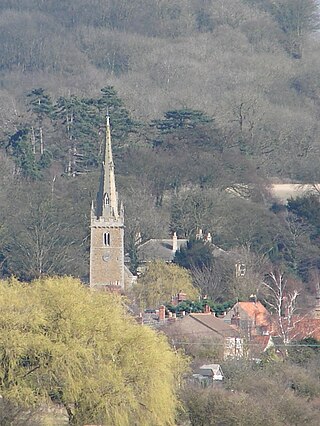
Barkston is an English village and civil parish in the South Kesteven district of Lincolnshire. The parish population was 497 at the 2001 census and 493 at the 2011 census. The village lies about 4 miles (6 km) north of the market town of Grantham, on the A607, just south of the junction with the A153 to Ancaster.
Lincolnshire is a large county in England with a sparse population distribution, which leads to problems funding all sorts of transport. The transport history is long and varied, with much of the road network still based on the Roman model, and the once extensive rail network a shadow of its former self.
Ropsley is a village in the South Kesteven district of Lincolnshire, England. The village is situated approximately 5 miles (8 km) east from Grantham, and falls within the civil parish of Ropsley and Humby.
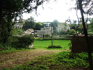
Stoke Rochford is a small English village and civil parish 5.5 miles (9 km) south of Grantham in the South Kesteven district of Lincolnshire. The population at the time of the 2011 census was 230. It has two notable Grade I listed buildings: Stoke Rochford Hall and the doubly dedicated St Mary and St Andrew's Church.
Belton and Manthorpe is a civil parish in the South Kesteven district of Lincolnshire, England, consisting of Belton and Manthorpe, just north of Grantham. According to the 2001 census it had a population of 517 in 192 households. By 2011 the authorities recorded 528 people in 216 homes.
Bitchfield is a village in the civil parish of Bitchfield and Bassingthorpe, in the South Kesteven district of Lincolnshire, England. It consists of two groups of buildings connected by Dark Lane, known as Bitchfield and Lower Bitchfield, collectively called Bitchfield. The village is situated approximately 6 miles (10 km) south-east from Grantham, and on the B1176 road, running east and parallel to the A1. In 1921 the parish had a population of 95. On 1 April 1931 the parish was abolished and merged with Bassingthorpe to form "Bitchfield and Bassingthorpe".
South Witham is a village and civil parish in the South Kesteven district of Lincolnshire, England. The population of the civil parish at the 2011 census was 1,533. It is situated 10 miles (16 km) south of Grantham, 10 miles east of Melton Mowbray and 10 miles (16 km) north of Oakham. The village is close to the Leicestershire and Rutland borders.
Colsterworth is a village and civil parish in the South Kesteven district of Lincolnshire, England, less than half a mile (0.8 km) west of the A1, about 7 miles (11 km) south of Grantham, and 12 miles (19 km) north-west of Stamford. The village with the hamlet of Woolsthorpe-by-Colsterworth had a recorded population of 1,713 at the time of the 2011 census, in an area of 1,465 hectares.
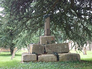
Edenham is a village and civil parish in the South Kesteven district of Lincolnshire, England. It is approximately 3 miles (5 km) north-west of Bourne, and on the A151 road. While the civil parish is called 'Edenham', the parish council is called Edenham, Grimsthorpe, Elsthorpe & Scottlethorpe Parish Council. The population of the civil parish at the 2011 census was 291.
North Witham is a small village and nominally a civil parish in South Kesteven, Lincolnshire, England. The village is located along the upper course of the River Witham 1.5 miles downstream (north) of South Witham, and approximately 9 miles (14 km) south from the nearest major town, Grantham. It has an estimated population of 143 in around 72 households, at a density of 0.1/hectare.
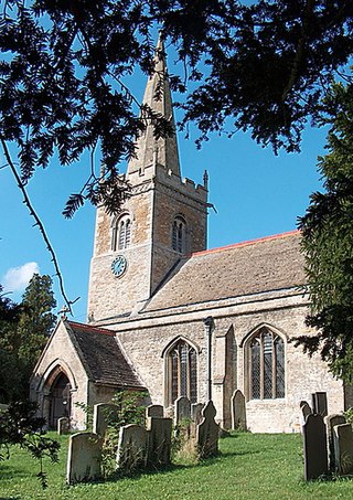
Little Bytham is a village and civil parish in the South Kesteven district of Lincolnshire, England. The population of the civil parish at the 2011 census was 384. It lies on the B1176 road, 4 miles (6 km) south from Corby Glen and 6 miles (10 km) north from Stamford.
Swayfield is a village and civil parish in the South Kesteven district of Lincolnshire, England. The population of the civil parish at the 2011 census was 316. It is situated just over 3 miles (5 km) east from the A1 road, 9 miles (14 km) south-east from Grantham and 10 miles (16 km) north from Stamford. It has approximately 138 houses.
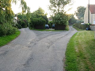
Stainby is a village and former civil parish, now in the parish of Gunby and Stainby, in the South Kesteven district of Lincolnshire, England. It is situated 2 miles (3.2 km) west from the A1 road, 1.5 miles (2.4 km) east from the Viking Way and the Leicestershire border, and 8 miles (13 km) south from Grantham. In 1921 the parish had a population of 117.
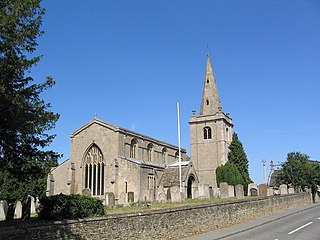
Witham on the Hill is a village and civil parish in the South Kesteven district of Lincolnshire, England. The population of the civil parish was 260 at the 2011 census.
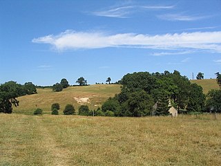
Careby Aunby and Holywell is a civil parish in the district of South Kesteven, south-west Lincolnshire, in England. It stretches from the county border with Rutland in the west to the River West Glen in the east. The B1176 road from Corby Glen passes through Careby and on past Aunby toward Stamford. The main London to Scotland railway line passes through the parish, the line upon which Mallard took the speed record for the LNER.
Little Ponton is a village in the civil parish of Little Ponton and Stroxton, in the South Kesteven district of Lincolnshire, England. It lies 2 miles (3 km) south of Grantham, about 60 metres (200 ft) above sea level.
Beltisloe is a Deanery of the Diocese of Lincoln in England, and a former Wapentake.
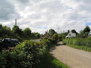
Counthorpe is a hamlet in the civil parish of Counthorpe and Creeton in the South Kesteven district of Lincolnshire, England. It adjoins the hamlet of Creeton and lies 5 miles (8 km) south-west from Bourne and 3 miles (5 km) south from Corby Glen, and on the River Glen.
Counthorpe and Creeton is a civil parish in the South Kesteven district of Lincolnshire, England. According to the 2001 census it had a population of 97 across 45 homes.
Media related to Castle Bytham at Wikimedia Commons