
Woolsthorpe by Belvoir, also known as Woolsthorpe is a village and civil parish in the South Kesteven district of Lincolnshire, England. The population of the civil parish at the 2011 census was 415. It is situated approximately 5 miles (8 km) west from Grantham, and adjoins the county border with Leicestershire. The neighbouring village of Belvoir lies on the other side of the border. Grantham Canal is situated 1 mile (1.6 km) to the north-east at its closest point.
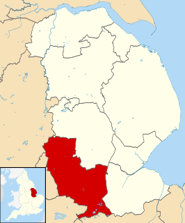
South Kesteven is a local government district in Lincolnshire, England, forming part of the traditional Kesteven division of the county. It covers Grantham, Stamford, Bourne and Market Deeping. The 2011 census reports 133,788 people at 1.4 per hectare in 57,344 households.

Holland Fen with Brothertoft is a civil parish in Lincolnshire, England, consisting, as the name indicates, of Holland Fen and Brothertoft, but also includes the areas known as Pelhams Land, Harts Ground and Pepper Gowt Plot. The population of the civil parish at the 2011 census was 669.

Aslackby and Laughton is a civil parish in the South Kesteven district of Lincolnshire, England. According to the 2001 census the parish had a population of 243, in 102 households. increasing slightly to 251 in 118 households at the 2011 census. It consists of the village of Aslackby, the hamlet of Laughton, and scattered farms, and part of the hamlet of Graby.

Aubourn Haddington and South Hykeham was a former civil parish in the North Kesteven district of Lincolnshire, England. According to the 2001 census it had a population of 885.

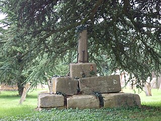
Bitchfield is a small village in the South Kesteven district of Lincolnshire, England. It consists of two groups of buildings connected by Dark Lane, known as Bitchfield and Lower Bitchfield, collectively called Bitchfield. The village is situated approximately 6 miles (10 km) south-east from Grantham, and on the B1176 road, running east and parallel to the A1.

Castle Bytham is a village and civil parish of around 300 houses in South Kesteven, Lincolnshire, England. The population was measured at 768 in 317 households at the 2011 census.
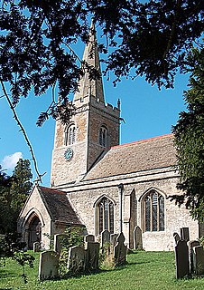
Edenham is a village and civil parish in the South Kesteven district of Lincolnshire, England. It is approximately 3 miles (5 km) north-west of Bourne, and on the A151 road. While the civil parish is called "Edenham", the parish council is called Edenham, Grimsthorpe, Elsthorpe & Scottlethorpe Parish Council. The population of the civil parish at the 2011 census was 291. The parish is principally located in the valley of the East Glen which flows through the village.

Bytham Castle was a castle in the village of Castle Bytham in Lincolnshire
Little Bytham is a village and civil parish in the South Kesteven district of Lincolnshire, England. The population of the civil parish at the 2011 census was 384. It lies on the B1176 road, 4 miles (6 km) south from Corby Glen and 6 miles (10 km) north from Stamford.

Swayfield is a village and civil parish in the South Kesteven district of Lincolnshire, England. The population of the civil parish at the 2011 census was 316. It is situated just over 3 miles (5 km) east from the A1 road, 9 miles (14 km) south-east from Grantham and 10 miles (16 km) north from Stamford. It has approximately 138 houses.
Witham on the Hill is a village and civil parish in the South Kesteven district of Lincolnshire, England. The population of the civil parish was 260 at the 2011 census.
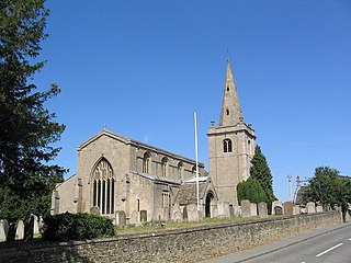
Ingoldsby is a small village in the South Kesteven district of Lincolnshire, England. It is situated 7 miles (11 km) south-east from the market town of Grantham, 32 miles (51 km) south of the county town of Lincoln, and 33 miles (53 km) east of the City of Nottingham. The village contains approximately 121 households.

Careby is the principal village in the a civil parish of Careby Aunby and Holywell [in which the population is included] in the South Kesteven district of South Kesteven, Lincolnshire, England. The River West Glen flows through the parish, near Careby, forming part of the parish boundary.

Lenton is a hamlet in the district of South Kesteven, Lincolnshire, England. It is situated approximately 7 miles (11 km) south-east from Grantham, and is part of the Lenton, Keisby and Osgodby civil parish.
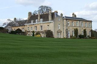
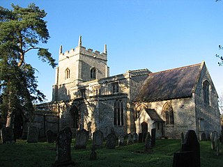
Holywell is a tiny settlement in the a civil parish of Careby Aunby and Holywell, in the South Kesteven district of Lincolnshire, England. It lies 5.5 miles (9 km) north from Stamford and 6 miles (10 km) south-west from Bourne. It is a collection of houses around a country house and park. The park includes a small private church dedicated to St Wilfrid. Ornamental lakes have been restored over the last 20 years, and new gardens laid out. In 2009 the gardens were open to the public through the National Garden Scheme.

Ropsley and Humby is a civil parish in the South Kesteven district of Lincolnshire, England. According to the 2001 Census it had a population of 808, increasing to 816 at the 2011 census. The parish consists of the small villages of Ropsley and Great Humby and the larger Little Humby, and the Deserted Medieval Villages of Overton Green and Ogarth.

Gunby and Stainby is a civil parish in the South Kesteven district of Lincolnshire, England. According to the 2001 Census it had a population of 141, falling to 136 at the 2011 census. It includes the hamlets of Gunby and Stainby.
Lenton, Keisby and Osgodby is a civil parish in South Kesteven, Lincolnshire, England. The population of the civil parish at the 2011 census was 187. It is located along the river and in the valleys of the East Glen at its headwaters near Ingoldsby, where several minor streams join together.
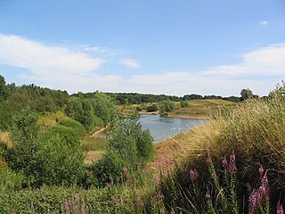
Stanton's Pit is an 8.05-hectare Local Nature Reserve situated between Little Bytham and Witham-on-the-Hill, villages in the South Kesteven district of Lincolnshire. It is owned and managed by Lincolnshire Wildlife Trust. The reserve mostly comprises a disused sand pit with adjacent grasslands which was donated by its former owner to the Lincolnshire Wildlife Trust so that it could be classified as a Local Nature Reserve. It has been designated as such on the basis of its ornithological interest, with 50 species of birds recorded visiting the site and 19 breeding, including little grebe, little ringed plover, sand martin, turtle dove and lesser whitethroat. Wading birds known to occupy the site in autumn include little stint, ruff and spotted redshank, greenshank, and common, curlew, green and wood sandpipers. Stanton's Pit is suspected to be situated on a migratory route from The Wash to Rutland Water. The site is bounded to the north by a minor road between Little Bytham and Witham-on-the-Hill, to the south and west by farmland and to the east by Bush Lees wood.
