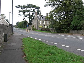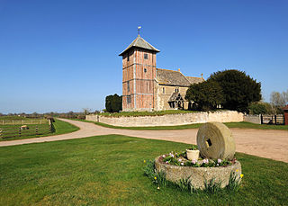
Sausthorpe is a small village and civil parish in the East Lindsey district of Lincolnshire, England, 8 miles (13 km) east of Horncastle and 3 miles (4.8 km) north-west of Spilsby. It lies on the southern edge of the Lincolnshire Wolds – a designated Area of Outstanding Natural Beauty – in the valley of the River Lymn. Farming remains the dominant economic activity in the area. The population was 305 in the 2011 census and estimated at 306 in 2019.

Rudgeway is a village in South Gloucestershire in south west England, located between Alveston and Almondsbury on the A38 trunk road. It lies west of Earthcott, Latteridge, Iron Acton and Yate on the B4059 road.

Gatcombe Park is a country house between the villages of Minchinhampton and Avening in Gloucestershire, England. Originally constructed in the 1770s, it was rebuilt from 1820 by George Basevi for the economist David Ricardo. Since 1976 it has been the country home of Anne, Princess Royal. Gatcombe is a Grade II* listed building. Parts of the grounds open for events, including horse trials and craft fairs.

Teddington is a village and parish in Gloucestershire, England.

Alstone is a village and former civil parish, now in the parish of Teddington, in the Tewkesbury district, in the county of Gloucestershire, England, situated between the towns of Tewkesbury and Winchcombe. In 1931 the parish had a population of 50.

Barton is a hamlet in the civil parish of Barton and Pooley Bridge, in Eden District, Cumbria, England. It lies about 3 kilometres (1.9 mi) to the north east of Pooley Bridge, east of the River Eamont and west of the B5320 road from Pooley Bridge to Eamont Bridge. The parish, which includes Barton and the larger settlement of Pooley Bridge, was renamed from "Barton" to "Barton and Pooley Bridge" on 1 April 2019, and had a population of 238 at the 2011 Census.

Prescott is a settlement and civil parish in the Cotswolds within the English county of Gloucestershire. There are scattered farms and houses. There may once have been a settlement around the chapel.

Stanton is a village and civil parish in Tewkesbury Borough, Gloucestershire, England. The village is a spring line settlement at the foot of the Cotswold escarpment, about 2.5 miles (4 km) southwest of Broadway in neighbouring Worcestershire. Broadway is Stanton's postal town. The 2011 Census recorded the parish's population as 198.

Clifton upon Teme is a village and civil parish in the Malvern Hills District in the county of Worcestershire, England.

Upleadon is a village and civil parish situated 10.5 km north-west of Gloucester. Soon after the Norman conquest Upleadon became part of the estates of Gloucester Abbey and was recorded as such in the Domesday Book. Taking advantage of the nearby river, there was a period when iron forges were a focal point for the community but these were subsequently converted into a flour-mill. The village today extends southwards alongside the River Leadon and has a population of 213 according to the Gloucestershire County Council.

Inglesham is a small village and civil parish in the Borough of Swindon, Wiltshire, England, notable for the Grade-I listed St John the Baptist Church. The village is just off the A361 road about 1 mile (1.6 km) south-west of Lechlade in Gloucestershire. Most of the population lives in the hamlet of Upper Inglesham, which is on the main road about 1.3 miles (2 km) south of the village.
Middleton, Lancashire is a civil parish in Lancaster, Lancashire, England. It contains nine listed buildings that are recorded in the National Heritage List for England. All of the listed buildings are designated at Grade II, the lowest of the three grades, which is applied to "buildings of national importance and special interest". The parish contains the village of Middleton, and at one time the Middleton Tower Holiday Camp, which converted some of the existing buildings for its purposes. Otherwise the parish is mainly rural. Most of the listed buildings are, or originated as, houses, farmhouses and associated structures. In addition a folly and a public house are listed.
Hazel Grove and Bramhall are towns in the Metropolitan Borough of Stockport, Greater Manchester, England. The towns, together with the village of Woodford, contain 29 listed buildings that are recorded in the National Heritage List for England. Of these, one is listed at Grade I, the highest of the three grades, one is at Grade II*, the middle grade, and the others are at Grade II, the lowest grade. Most of the listed buildings are houses and associated structures, farmhouses and farm buildings. The other listed buildings include churches and lych gates, and two war memorials.
Marple is a town in the Metropolitan Borough of Stockport, Greater Manchester, England. The town, together with the villages of High Lane, Marple Bridge, Mellor, and Strines, and the surrounding countryside, contains 141 listed buildings that are recorded in the National Heritage List for England. Of these, one is listed at Grade I, the highest of the three grades, three are at Grade II*, the middle grade, and the others are at Grade II, the lowest grade.
Warburton is a civil parish in the Metropolitan Borough of Trafford, Greater Manchester, England. It contains 22 listed buildings that are recorded in the National Heritage List for England. Of these, one is listed at Grade I, the highest of the three grades, and the others are at Grade II, the lowest grade. The parish contains the village of Warburton, and is otherwise rural. Most of the listed buildings are houses, farmhouses and farm buildings. The other listed buildings include churches and associated structures, a war memorial, and an enclosure containing stocks and a cross base, with its wall also listed.
Dunham Massey is a civil parish in the Metropolitan Borough of Trafford, Greater Manchester, England. It contains 48 listed buildings that are recorded in the National Heritage List for England. Of these, three are listed at Grade I, the highest of the three grades, one is at Grade II*, the middle grade, and the others are at Grade II, the lowest grade.

Colesbourne is a village and civil parish in the Cotswold district of Gloucestershire, England. The village and parish lies within the Cotswolds, a designated Area of Outstanding Natural Beauty.

Tidmington is a village and civil parish in the Stratford-on-Avon District of Warwickshire, England. It is 11 miles (18 km) south from the town of Stratford-upon-Avon, and at the extreme southern edge of the county bordering Gloucestershire. Within the parish is the Grade II* listed c.1600 Tidmington House, and the Grade II* early 13th-century church of unknown dedication. At the 2001 Census, which for statistical purposes now includes the neighbouring parish of Burmington, the combined population was 153.

Todenham is a village and civil parish in the Cotswold district of Gloucestershire, England. The village is significant for its Grade I listed 14th-century parish church.


