Related Research Articles
Buncombe County is a county located in the U.S. state of North Carolina. It is classified within Western North Carolina. The 2020 census reported the population was 269,452, making it the 7th-most populous county in North Carolina. Its county seat is Asheville. Buncombe County is part of the Asheville, NC Metropolitan Statistical Area.
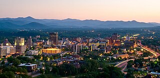
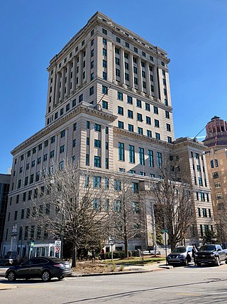
Asheville is a city in and the county seat of Buncombe County, North Carolina, United States. Located at the confluence of the French Broad and Swannanoa rivers, it is the most populous city in Western North Carolina, and the state's 11th-most-populous city. According to the 2020 census, the city's population was 94,589, up from 83,393 in the 2010 census. It is the principal city in the three-county Asheville metropolitan area, which had an estimated population of 417,202 in 2023.

Bent Creek is a census-designated place (CDP) in Buncombe County, North Carolina, United States. The population was 1,287 at the 2010 census. The Bent Creek area has mountain bike trails within the Pisgah National Forest.

The French Broad River is a river in the U.S. states of North Carolina and Tennessee. It flows 218 miles (351 km) from near the town of Rosman in Transylvania County, North Carolina, into Tennessee, where its confluence with the Holston River at Knoxville forms the beginning of the Tennessee River. The river flows through the counties of Transylvania, Buncombe, Henderson, and Madison in North Carolina, and Cocke, Jefferson, Sevier, and Knox in Tennessee. It drains large portions of the Pisgah National Forest and the Cherokee National Forest.

Pisgah National Forest is a National Forest in the Appalachian Mountains of western North Carolina. It is administered by the United States Forest Service, part of the United States Department of Agriculture. The Pisgah National Forest is completely contained within the state of North Carolina. The forest is managed together with the other three North Carolina National Forests from common headquarters in Asheville, North Carolina. There are local ranger district offices located in Pisgah Forest, Mars Hill, and Nebo.

The North Carolina Arboretum is an arboretum and botanical garden located within the Bent Creek Experimental Forest of the Pisgah National Forest at 100 Frederick Law Olmsted Way, southwest of Asheville, North Carolina near the Blue Ridge Parkway. It is open daily except for Christmas Day. There is no admission charge, but some parking fees do apply.
Bent Creek may refer to:

Western North Carolina is the region of North Carolina which includes the Appalachian Mountains; it is often known geographically as the state's Mountain Region. It contains the highest mountains in the Eastern United States, with 125 peaks rising to over 5,000 feet in elevation. Mount Mitchell at 6,684 feet, is the highest peak of the Appalachian Mountains and mainland eastern North America. The population of the 23 most commonly associated counties for the region, as measured by the 2020 U.S. Census, is 1,149,405. The region accounts for approximately 11% of North Carolina's total population.

Lake James is a large reservoir in the mountains of Western North Carolina which straddles the border between Burke and McDowell Counties. It is named for tobacco tycoon and benefactor of Duke University James Buchanan Duke. The lake, with surface elevation of 1200 ft, lies behind a series of 4 earthen dams. It was created by Duke Power between 1916 and 1923 as a hydro-electric project. It still generates power today and is the uppermost lake on the Catawba River system.

Carya tomentosa, commonly known as mockernut hickory, mockernut, white hickory, whiteheart hickory, hognut, bullnut, is a species of tree in the walnut family Juglandaceae. The most abundant of the hickories, and common in the eastern half of the United States, it is long lived, sometimes reaching the age of 500 years. A straight-growing hickory, a high percentage of its wood is used for products where strength, hardness, and flexibility are needed. The wood makes excellent fuel wood, as well. The leaves turn yellow in Autumn.

The Asheville metropolitan area is a metropolitan area centered on the principal city of Asheville, North Carolina. The U.S. Office of Management and Budget defines the Asheville, NC Metropolitan Statistical Area, a metropolitan statistical area used by the United States Census Bureau and other entities, as comprising the four counties of Buncombe, Haywood, Henderson, and Madison. The area's population was 424,858 according to the 2010 census, and 469,454 according to the 2020 census.

The Wood River is a short river in the southern region of the U.S. state of Oregon, and part of the Klamath Basin drainage. It flows 18 miles (29 km) through the Fremont-Winema National Forests, Bureau of Land Management land, and private property in southern Oregon. Its watershed consists of 220 square miles (570 km2) of conifer forest, rural pasture land, and marsh. The river provides habitat for many species of wildlife including an adfluvial (migratory) and resident populations of native Great Basin redband trout.
Alexander State Forest is located in Rapides Parish, Louisiana near the town of Woodworth. It was established in 1923 as a state demonstration forest. It contains the Indian Creek Recreation Area and the Alexander State Forest Headquarters Building, constructed in 1935, is on the National Register of Historic Places.

The South Toe River is a river in Yancey County in Western North Carolina. The name Toe is taken from its original name Estatoe, pronounced 'S - ta - toe', a native American name associated with the Estatoe trade route leading down from the NC mountains through Brevard where there is a historical plaque with information that affirms the route, on into South Carolina where a village of the same name was located.
Bent Creek Campus of the Appalachian Forest Experiment Station is a national historic district located near Asheville, in the Appalachian Mountains, Buncombe County, North Carolina.
Margaret Stoughton Abell was an American forester.
Clarence Korstian was an influential professor of forestry and the founding dean of the Duke University School of Forestry in 1938. Korstian was one of the leaders in North Carolina forestry during the nearly half century he lived in the state.
The Southern Research Station (SRS) is one component of seven units that provide the framework for the US Forest Service (USFS) Research and Development organization. Forest Service R&D is described as "...the most extensive natural resources research organization in the world".
Lake Ashnoca is a manmade lake in Buncombe County, North Carolina, near Enka. The lake was created by damming the Ragsdale Creek. It has been designated as trout fishing waters by the North Carolina Wildlife Resources Commission.
References
- ↑ "Bent Creek". Geographic Names Information System . United States Geological Survey, United States Department of the Interior . Retrieved March 27, 2024.
- 1 2 Harshbarger, Thomas J.; Porter, Pamela E. (June 1982). "Effects of a Dam and Sewage Outflow on a Small Oligotrophic Stream in the Southern Appalachians". USDA Forest Service Research Notes SE (Report). Southeastern Forest Experiment Station, U.S. Department of Agriculture, Forest Service. p. 1.
- 1 2 Molloy, Johnny (2010-07-13). The Best in Tent Camping: The Carolinas: A Guide for Car Campers Who Hate RVs, Concrete Slabs, and Loud Portable Stereos. Menasha Ridge Press. pp. 32–33. ISBN 978-0-89732-798-5.
- ↑ Powell, William S.; Hill, Michael (2010-06-15). The North Carolina Gazetteer, 2nd Ed: A Dictionary of Tar Heel Places and Their History. Univ of North Carolina Press. p. 42. ISBN 978-0-8078-9829-1.
- 1 2 Bent Creek Research and Demonstration Forest: Scientific Forestry for Informed Choices. Forest Service, U.S. Department of Agriculture. 1995. pp. 2–6.
- ↑ "NC Wildlife will stock 67,000 trout in December: Where to fish, what to know". The Asheville Citizen Times. Retrieved 2024-03-11.
- ↑ Seaton, Iris. "Answer Woman: How popular is Lake Powhatan campground? How many campsites?". The Asheville Citizen Times. Retrieved 2024-03-11.
- ↑ Bent Creek Research and Demonstration Forest: Scientific Forestry for Informed Choices. Southern Research Station, Forest Service, U.S. Department of Agriculture. 1995. p. 5.