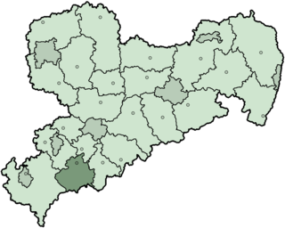
Aue-Schwarzenberg is a former district in the Free State of Saxony, Germany. It was bounded by the Czech Republic and the districts of Vogtlandkreis, Zwickauer Land, Stollberg and Annaberg.

Fußball Club Erzgebirge Aue e.V., commonly known as simply FC Erzgebirge Aue or Erzgebirge Aue, is a German football club based in Aue-Bad Schlema, Saxony. The former East German side was a founding member of the 3. Liga in 2008–09, after being relegated from the 2. Bundesliga in 2007–08. The city of Aue-Bad Schlema has a population of about 20,800, making it one of the smallest cities to ever host a club playing at the second highest level of German football. However, the team attracts supporters from a larger urban area that includes Chemnitz and Zwickau, whose own football sides are among Aue's traditional rivals.

Aue is a small town in Germany at the outlet of the river Schwarzwasser into the river Zwickauer Mulde in the Ore Mountains, and has roughly 16,000 inhabitants. It was merged into the new town Aue-Bad Schlema in January 2019. Aue was the administrative seat of the former district of Aue-Schwarzenberg in Saxony, and is part of the Erzgebirgskreis since August 2008. It belongs to the Silberberg Town League

Eibenstock is a town in the western Ore Mountains, in the Erzgebirgskreis, Saxony, Germany. It is situated near the river Mulde.
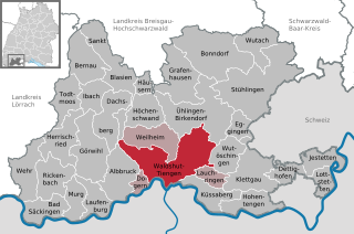
Waldshut-Tiengen, commonly known as Waldshut, is a city in southwestern Baden-Württemberg right at the Swiss border. It is the district seat and at the same time the biggest city in Waldshut district and a "middle centre" in the area of the "high centre" Lörrach/Weil am Rhein to whose middle area most towns and communities in Waldshut district belong. There are furthermore complexities arising from cross-border traffic between this area and the Swiss cantons of Aargau, Schaffhausen and Zürich. This classification relates to Walter Christaller's Central Place Theory, however, and not to any official administrative scheme.

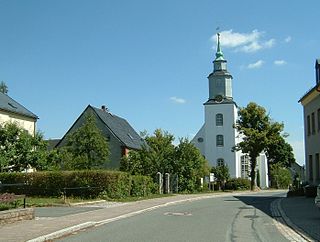
Schwarzenberg is a town in the district of Erzgebirgskreis in Saxony’s Ore Mountains, near the German–Czech border. The town lies roughly 15 km southeast of Aue, and 35 km southwest of Chemnitz.

Schneeberg is a town in Saxony’s district of Erzgebirgskreis. It has roughly 16,400 inhabitants and belongs to the Town League of Silberberg. It lies 4 km west of Aue, and 17 kilometres (11 mi) southeast of Zwickau.

Bergstadt Lößnitz, sometimes also called Muhme (“Aunt”) for its age, is a town in the district of Erzgebirgskreis, Saxony, Germany, and belongs to the Town League of Silberberg. Its name comes from the Slavic lesnice, meaning “forest place”.

Grünhain-Beierfeld is a town in the district of Erzgebirgskreis in Saxony, Germany lying 8 km east of Aue. It came into being on 1 January 2005 through the merger of the town of Grünhain and the community of Beierfeld.

Johanngeorgenstadt is a mining town in Saxony’s Ore Mountains, 17 km south of Aue, and 27 km northwest of Karlovy Vary. It lies in the district of Erzgebirgskreis, on the border with the Czech Republic, is a state-recognized health resort (Erholungsort), and calls itself Stadt des Schwibbogens. Its population decline since the 1950s has been extremely severe falling from 45,000 residents in 1953 to only about one tenth of that now.
The town of Lauter lies in the district of Erzgebirgskreis in the Free State of Saxony, Germany, between the two towns of Aue and Schwarzenberg. It lies in the Ore Mountains, 4 km southeast of Aue, and 4 km northwest of Schwarzenberg, has 4,927 inhabitants in an area of 21.55 km² and belongs to the Town League of Silberberg. Since 1 January 2013, it is part of the town Lauter-Bernsbach.
Wanfried is a town in the Werra-Meißner-Kreis in northeasternmost Hesse, Germany. It is classified as a Landstadt, a designation given in Germany to a municipality that is officially a town (Stadt), but whose population is below 5,000. It literally means “country town”.

Schenklengsfeld is a community in Hersfeld-Rotenburg district in eastern Hessen, Germany lying roughly 30 km northeast of Fulda and 60 km southeast of Kassel.

Bockau is a community in the district of Erzgebirgskreis in the Free State of Saxony in Germany. The community is known for growing and researching herbs. Owing to its centuries-old cultivation of angelica, whose roots are used in making liqueurs, Bockau is also known locally by the nickname Wurzelbucke.

Breitenbrunn is a community in the Ore Mountains in the district of Erzgebirgskreis in the Free State of Saxony in Germany.
Markersbach is a former municipality on the river Große Mittweida in the district of Erzgebirgskreis in Saxony, Germany. Since 1 January 2008, Markersbach and Raschau have formed the municipality of Raschau-Markersbach.
Pöhla is a village and a former municipality lying in the valley of the river Pöhlwasser, in the district of Aue-Schwarzenberg in Saxony, Germany. Since 1 January 2008, it is part of the town Schwarzenberg.
Schönheide is a community in Saxony's district of Erzgebirgskreis. It lies in the western Ore Mountains, and was founded as an industrial village.
Hundshübel is a village in Erzgebirgskreis district of Saxony, forming a subdivision of the municipality of Stützengrün in the Ore Mountains. It is located north of Eibenstock Dam on federal highway B 169.

The Erla Ironworks has its origins in one of the oldest hammer mills in the Upper Ore Mountains, which was first recorded in 1380 as the Hammer in der Erl, making the ironworks the oldest existing business in the German state of Saxony.


