Bharasar

Last updated

Bharasar
village
India Gujarat location map.svg
Red pog.svg
Bharasar
Location in Gujarat, India
India location map.svg
Red pog.svg
Bharasar
Bharasar (India)
Coordinates: 23°11′38.59″N69°33′38.12″E / 23.1940528°N 69.5605889°E / 23.1940528; 69.5605889 Coordinates: 23°11′38.59″N69°33′38.12″E / 23.1940528°N 69.5605889°E / 23.1940528; 69.5605889
CountryFlag of India.svg  India
State Gujarat
District Kachchh
Elevation
137 m (449 ft)
Languages
  Official Gujarati, Hindi
Time zone UTC+5:30 (IST)
PIN
370 030, Post Bharasar, Bhuj-Kutch
Telephone code91 2832
Vehicle registration GJ-12
Nearest cityBhuj
Website gujaratindia.com

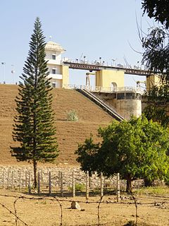
Bharasar is a small village in the Kutch District of Gujarat, India. [1]

Gujarat State in India

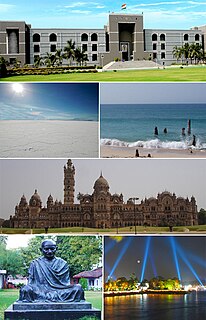
Gujarat is a state on the western coast of India with a coastline of 1,600 km (990 mi) – most of which lies on the Kathiawar peninsula – and a population in excess of 60 million. It is the sixth largest Indian state by area and the ninth largest state by population. Gujarat is bordered by Rajasthan to the northeast, Daman and Diu to the south, Dadra and Nagar Haveli and Maharashtra to the southeast, Madhya Pradesh to the east, and the Arabian Sea and the Pakistani province of Sindh to the west. Its capital city is Gandhinagar, while its largest city is Ahmedabad. The Gujarati-speaking people of India are indigenous to the state. The economy of Gujarat is the fifth-largest state economy in India with 14.96 lakh crore (US$210 billion) in gross domestic product and a per capita GDP of 157,000 (US$2,200).

India Country in South Asia

India, also known as the Republic of India, is a country in South Asia. It is the seventh largest country by area and with more than 1.3 billion people, it is the second most populous country as well as the most populous democracy in the world. Bounded by the Indian Ocean on the south, the Arabian Sea on the southwest, and the Bay of Bengal on the southeast, it shares land borders with Pakistan to the west; China, Nepal, and Bhutan to the northeast; and Bangladesh and Myanmar to the east. In the Indian Ocean, India is in the vicinity of Sri Lanka and the Maldives, while its Andaman and Nicobar Islands share a maritime border with Thailand and Indonesia.

The Bharasar Gram panchayat is the local administrative governing body, and the village being a Bhuj Taluka, is partially funded and accountable to authorities in nearby Bhuj City.

A gram panchayat is the only grassroots-level of panchayati raj formalised local self-governance system in India at the village or small-town level, and has a sarpanch as its elected head.

Bhuj City in Gujarat, India

Bhuj is a Municipality and District Headquarter of Kutch District in the state of Gujarat, India.

The main religion of the villagers is Hinduism, Swaminarayan Sampraday. Nearby villages include Manukwa, Naranpur, Sukhpur, and Samatra.

Hinduism is an Indian religion and dharma, or way of life, widely practised in the Indian subcontinent and parts of Southeast Asia. Hinduism has been called the oldest religion in the world, and some practitioners and scholars refer to it as Sanātana Dharma, "the eternal tradition", or the "eternal way", beyond human history. Scholars regard Hinduism as a fusion or synthesis of various Indian cultures and traditions, with diverse roots and no founder. This "Hindu synthesis" started to develop between 500 BCE and 300 CE, after the end of the Vedic period, and flourished in the medieval period, with the decline of Buddhism in India.

Swaminarayan Sampraday, formally called Uddhav Sampraday, is a Hindu sect propagated by Swaminarayan. Swaminarayan was handed the leadership of the Uddhav Sampraday by his guru Ramanand Swami to continue to propagate the teachings and philosophy of Vishishtadvaita, which originates from the Sri Sampradaya. His main teaching was that Sri krishna purushottam narayan the resider of akshardham at midst of golok is supreme and should alone be worshipped

Samatra village in Gujarat, India

Samatra is a small village located in the Kutch district of Gujarat state, India. The first settlement was established by two Varsani brothers by the names of Velji Bapa and Manji Bapa. From this other families, such as, the Gami, Pindoria, Hirani, Bhanderi, Kerai and Bhudiya families, gradually joined in and strengthened and united the community as a whole. However, this is not the earliest known Varsani history. In 1386, in a small village called Savalia, it is acknowledged that Varsanis once lived here before travelling and inhabiting several other small villages until finally settling down.

The village mainly consists of farmland on the outskirts, with many residential homes, along with two bank branches and a girls' school.

Many residents have emigrated to the United Kingdom in London or Bolton, and some have to Kenya.

United Kingdom Country in Europe

The United Kingdom (UK), officially the United Kingdom of Great Britain and Northern Ireland, and sometimes referred to as Britain, is a sovereign country located off the north-western coast of the European mainland. The United Kingdom includes the island of Great Britain, the north-eastern part of the island of Ireland, and many smaller islands. Northern Ireland is the only part of the United Kingdom that shares a land border with another sovereign state, the Republic of Ireland. Apart from this land border, the United Kingdom is surrounded by the Atlantic Ocean, with the North Sea to the east, the English Channel to the south and the Celtic Sea to the south-west, giving it the 12th-longest coastline in the world. The Irish Sea lies between Great Britain and Ireland. With an area of 242,500 square kilometres (93,600 sq mi), the United Kingdom is the 78th-largest sovereign state in the world. It is also the 22nd-most populous country, with an estimated 66.0 million inhabitants in 2017.

Bharasar is one of the 24 villages/ghaams that have formed the Shree Kutch Leva Patel Community (SKLPC).

History

Within the area is the ancient Harappan Dam of Bharasar, which is the area of the origin of the tributary of the river Zadko from the hills of Khatrod Lanki area near hills of Bharasar.

Originally, Haraappan Dam was 500 meters south. Actual overflow of the water from the dam was collected by a small reservoir near the old Bharasar (Harappan time - 2000BC). It was called Bhara Sar, which refers to Sarovar, suggesting a lake was located there. Later, Maharao shri Bharmalji resettled the Village, and it was called a new name, Bhara Sar.

Overflow of dam water from the reservoir was utilised for irrigation in the lower area by means of ground water channels cut in the stones of the grounds. When required, the necessary water was acquired from the original dam above the level of the big dam, the actual Harappan dam.

Related Research Articles

Derwent Reservoir (Derbyshire) reservoir in Derbyshire, England

Derwent Reservoir is the middle of three reservoirs in the Upper Derwent Valley in the northeast of Derbyshire, England. It lies approximately 10 miles (16 km) from Glossop and 10 miles (16 km) from Sheffield. The River Derwent flows first through Howden Reservoir, then Derwent Reservoir and finally through Ladybower Reservoir. Between them they provide practically all of Derbyshire's water, as well as to a large part of South Yorkshire and as far afield as Nottingham and Leicester.

Kutch district District of Gujarat in India

Kutch district is a district of Gujarat state in western India. Covering an area of 45,674 km², it is the largest district of India. The population of Kutch is about 2,092,000. It has 10 Talukas, 939 villages and 6 Municipalities. The Kutch district is home to the Kutchi people who speak the Kutchi language.

2001 Gujarat earthquake January 26, 2001 earthquake in western India

The 2001 Gujarat earthquake, also known as the Bhuj earthquake, occurred on 26 January, India's 52nd Republic Day, at 08:46 AM IST and lasted for over 2 minutes. The epicentre was about 9 km south-southwest of the village of Chobari in Bhachau Taluka of Kutch District of Gujarat, India.

Mayani Bird Sanctuary is a bird sanctuary located in Mayani, in Maharashtra, India. Mayani is well connected from district places like Satara and Sangali, and around 20 km from Vita. It is a market place for near by villages and a developed place with colleges and medical facilities.

Shing Mun Reservoir

Jubilee Reservoir is a reservoir in Hong Kong. It is located in Shing Mun, the area between Tsuen Wan and Sha Tin, in the New Territories.

Kabini River river in India

The Kabini, also called Kapila, is one of the major tributaries of the river Cauvery in southern India. It originates in the Wayanad District of Kerala state by the confluence of the Panamaram River and the Mananthavady River. It flows eastward to join the Kaveri River at Tirumakudalu Narasipura in Karnataka.

Mettur Dam dam in Tamil Nadu, India

The Mettur Dam is one of the largest dams in India and the largest in Tamilnadu located across the river Cauvery where it enters the plains. Built in 1934, it took 9 years to complete. Maximum height and width of the Dam are 214 and 171 feet respectively.The Dam receives inflows from its own catchment area, Kabini Dam and Krishna Raja Sagara Dams located in Karnataka. There is a park at the base of the dam called Ellis Park maintained by the Tamil Nadu Public Works Department. It provides irrigation and drinking water facilities for more than 12 districts of Tamilnadu and hence is revered as the life and livelihood-giving asset of Tamil Nadu

The Jalaput Dam is a hydroelectric dam built on the Machkund River, a tributary of the Godavari River in India which rises in the Mudugal hills of Visakhapatnam District and nearby Ondra Gadda it becomes the boundary between Andhra Pradesh and Odisha. For over 48 km the river runs nearly north along a meandering course through the Padwa Valley. About 48 km south of Jeypore, it winds westward along the edge of the Plateau and then suddenly tums at a short angle to the south-west down a steep descent popularly known as Duduma Falls.

Dholavira archaeological site in Kutch, Gujarat in western India

Dholavira is an archaeological site at Khadirbet in Bhachau Taluka of Kutch District, in the state of Gujarat in western India, which has taken its name from a modern-day village 1 kilometre (0.62 mi) south of it. This village is 165 km (103 mi) from Radhanpur. Also known locally as Kotada timba, the site contains ruins of an ancient Indus Valley Civilization/Harappan city. Dholavira’s location is on the Tropic of Cancer. It is one of the five largest Harappan sites and most prominent archaeological sites in India belonging to the Indus Valley Civilization. It is also considered as having been the grandest of cities of its time. It is located on Khadir bet island in the Kutch Desert Wildlife Sanctuary in the Great Rann of Kutch. The 47 ha quadrangular city lay between two seasonal streams, the Mansar in the north and Manhar in the south. The site was occupied from c.2650 BCE, declining slowly after about 2100 BCE. It was briefly abandoned then reoccupied until c.1450 BCE.

Surkotada archeological site in Kutch, Gujarat, India

Surkotada is an archaeological site located in Rapar Taluka of Kutch district, Gujarat, India which belongs to the Indus Valley Civilisation (IVC). It is a smaller fortified IVC site with 1.4 hectares in area.

Rapar city in Gujarat, India

Rapar is a city and a municipality in Kutch district in the Indian state of Gujarat. Particularly this area of Kutch is called Vagad. The name derives from famous Vaghela rulers. It means the land of Vaghelas.

Sugden Reservoir

The Sugden Reservoir is a Massachusetts reservoir located in Spencer, Massachusetts. It forms the headwaters of Shaw Brook, which is a tributary to Turkey Hill Creek, a major tributary to the Seven Mile River. This water body is part of the Chicopee River Watershed.

Jayakwadi Dam dam in India

The harsh project is one of the largest irrigation projects in the Indian state of Maharashtra. It is a multipurpose project. The water is mainly used to irrigate agricultural land in the drought-prone Marathwada Region region of the state. It also provides water for drinking and industrial usage to nearby towns and villages and to the municipalities and industrial areas of Aurangabad and Jalna district. The surrounding area of the dam has a garden and a bird sanctuary.

Meghpur, Bhuj Village in Gujarat, India

Meghpur is a village in Kutch, state of Gujarat in western India.

Anangpur Dam dam in India

The Anangpur Dam, located close to the Anagpur village in Faridabad district of Haryana, India, is 2 kilometres (1.2 mi) away from the more famous Surajkund. This unique Indian hydraulic engineering structure was built during the reign of King Anangpal of the Tomar dynasty in 8th century. It is approachable by road from Delhi from the Delhi - Mathura road. The ruins of the fortifications found in Anangpur village establishes by an inference that it was built by Anangpal as part of the Lal Kot that was developed as the first city of Delhi in the 8th century. Area around it is an important biodiversity area contiguous to Asola Bhatti Wildlife Sanctuary within the Northern Aravalli leopard wildlife corridor.

Kukma village in Gujarat, India

Kukma or Kookma is a village near the Bhuj town, taluka in Kachchh District of Indian State of Gujarat. It is located at a distance of 16 kilometers from Bhuj, the headquarters of Kachchh District.

Kattinakere (ಕಟ್ಟಿನಕೆರೆ) also called B Sagadde is a hamlet in Soraba Tq, Karnataka state, India. The village is named after a tank near the village. This village reservoir is fed by rainwater from nearby mountains. The water in the reservoir and its channels flow on and gather more water along the way to become the river Dandavathi. Kattinakere has a population of around 35 who are mainly agriculturists. The Hindu brahmins living here are descendants of Ahichatra Brahmins brought by Mayura Sharma to teach and perform Vedas. Not so far from this place live people who immigrated from coastal areas of Karnataka South of the Sahyadri Mountains. Their settlement is called Hullihakkalu or Muttipura.

Hamirsar Lake lake in Bhuj, Kutch district, Gujarat, India

Hamirsar Lake is a man made lake situated in the centre of Bhuj, the headquarters of Kutch district, Gujarat, India.

Suvarnavathi Reservoir

Suvarnavathi Reservoir also called as Suvarnavathi Dam is located near Chamarajanagar, Karnataka, 14 km from Chamarajanagara town. The Dam is built across Suvarnavathi river which is a sub-river of Kaveri river. The dam is adjacent to the Punajanur state forest which serve as border between Karnataka and Tamil Nadu states.

References