Ankleshwar, is a city and a municipality in the Bharuch district of the state of Gujarat, India. The city is located 14 kilometres from Bharuch.
Bharuch, formerly known as Broach, is a city at the mouth of the river Narmada in Gujarat in western India. Bharuch is the administrative headquarters of Bharuch District.

Narmada district is an administrative district in the state of Gujarat in India. The district headquarters are located at Rajpipla. The district is bounded by Vadodara and Chhota Udaipur districts in the north, by Nandurbar district of Maharashtra state in the east, by Surat and Tapi districts in the south and by Bharuch district in the west. The district occupies an area of 2,755 km² and has a population of 590,297. It was 10.44% urban as of 2011. As of 2011, it is the third least populous district of Gujarat, after Dang and Porbandar.

Rajpipla is a city and a municipality in the Narmada district in the Indian state of Gujarat.
Mandleshwar is a town and nagar panchayat in the Khargone district of the India state of Madhya Pradesh. It is on the banks of Narmada River, 8 kilometres (5.0 mi) east of Maheshwar and 99 kilometres (62 mi) south of Indore. It is a "Pavitra nagri" as termed by the government of Madhya Pradesh, as it is an ancient town. It is the education centre of Maheshwar block, the location of the district court and district jail of Khargone, and is also the political centre of Maheshwar block.

Bharuch in India, is a district in the southern part of the Gujarat peninsula on the west coast of state of Gujarat with a size and population comparable to that of Greater Boston. Bharuch derives its name from the great sage Bhrigu. The original name of Bharuch is 'Bhrigukachchha'. Bhrigu Rishi was one of the ten sons of Lord Brahma. There is also a story which indicates that Bhrigu along with his kin asked for temporary access to Bharuch which then belonged to Lakshmi since Bharuch is located on the banks of river Narmada also known as Rudra Deha. Chanra Mauli Mahadev is the Kul Devata of Bhargavs of Bharuch. Bhrigu never left the place and the Ashram of Brighu Rishi is located on the banks of Narmada. The Narmada River outlets into the Gulf of Khambat through its lands and that shipping artery gave inland access to the kingdoms and empires located in the central and northern parts of the sub-continent of India.

Budhni (बुधनी), also spelled Budni or Budhani, is a town and a Nagar Palika in Sehore district in the state of Madhya Pradesh, India. It is situated on Bhopal to Hoshangabad road at a distance of 7 km from Hoshangabad in north direction on the banks of Narmada River.It is also famous for Tractor testing i.e. CFMTTI (Institute under central government or Tractor Nagar.
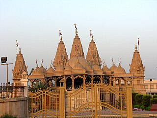
Anklesvar INA is a town and an industrial notified area in Bharuch district in the state of Gujarat, India.

Bodeli is a town and taluka in Chhota Udaipur district in the eastern part of the state of Gujarat, India.
Deodara is a census town in Mandla district in the state of Madhya Pradesh, India. It is an extended part of Mandla city. It connects the city centre to the local tourist spot of Shehestra Dhara, a holy site situated on the bank of Narmada river. Poor roads and no government water pipeline availability are some of the concerning issues of the locals residing here. There are many beautiful Ghats on the bank of River Narmada situated here like Gau Ghat and Chakrateerath Gath.It is considered as an urban panchayat which is part of Mandla city.
Dharampuri is a town and headquarters of a tehsil in Dhar district in the state of Madhya Pradesh, India. It is situated on banks of river Narmada. It is a place of some historical and archaeological interest.
Ethapur (Yethapur) is a panchayat town in Pethanaickenpalayam Taluk in Salem District in the state of Tamil Nadu, India. Ethapur also referred as "Vasishtronum" named by Vashista one of the Saptarishis.
Kasrawad is a tehsil and nagar panchayat in Khargone district in the Indian state of Madhya Pradesh.

Ekta Nagar is a census town in Narmada district in the Indian state of Gujarat. This town is famous tourist location, as Statue of Unity is located here. The town also has a Ekta Nagar railway station
Parikshitgarh is a town and a Nagar Panchayat in Meerut district in the Indian State "Uttar Pradesh".
Polay Kalan is a town and a Nagar Panchayat and Tehsil in Shajapur district in the Indian state of Madhya Pradesh.
Vasna is a town and an Industrial Notified Area of the Borsad municipality in Anand district in the Western Indian state of Gujarat.
Banapura is a small town in the Hoshangabad District of Madhya Pradesh, India. Banapura is a twin city of Seoni Malwa.

Nemawar is a small town in Dewas District, Madhya Pradesh, India. Handia is located on the left bank of the Narmada river opposite to Handia. However, it belongs to Khategaon block and tehsil of the Dewas district
Tarasadi is city and a Municipality in Surat district in the Indian state of Gujarat. The town is located 45 km North-East of Surat on Surat-Mumbai highway near Kosamba.

