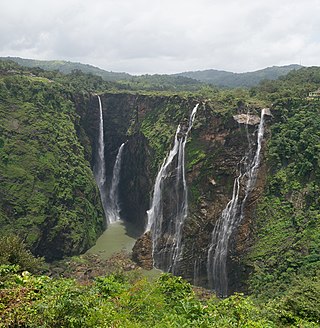
Jog Falls is a waterfall on the Sharavati river located in the Western Ghats running between Uttara Kannada and Shimoga districts of Karnataka, India. It is the third highest plunge waterfall in India. It is a segmented waterfall which depends on rain and season to become a plunge waterfall. The falls are major attractions for tourists and is ranked 36th in the list of free-falling waterfalls, 490th in the world by list of waterfalls by total height, 128th in the list of single-drop waterfalls in the World by the waterfall database.

Simdega is a city in the Indian state of Jharkhand. Simdega is the administrative headquarters of the eponymous district and Subdivision. The city stands at an elevation of approximately 418 metres (1371 feet) above sea level and covers an area of 3,750 km2 (1,450 sq mi). Bounded in the north by Gumla, on the east by Ranchi and West Singhbhum, on the west by Jashpur Nagar, Chhattisgarh and on the south by Rourkela, Odisha. The distance between Rourkela and Simdega is 83 km. It is accessible by road through National Highways from Rourkela and Ranchi. The nearest railway station is Rourkela railway station.
Garhwa is a town and a municipality in, and headquarters of, Garhwa district in the state of Jharkhand, India. Uttar Pradesh, Chhattisgarh and Bihar are nearby states. Garhwa Road (Rehla) is a major Railway Junction where thousands of passengers find this station most convenient to catch their train for Delhi and Kolkata. You can find bus services for Ranchi, Ambikapur, Gaya etc.
Satpura Tiger Reserve (STR) also known as Satpura National Park is located in the Narmadapuram District of Madhya Pradesh in India. Its name is derived from the Satpura range. It covers an area of 524 km2 (202 sq mi). Satpura National Park, along with the adjoining Bori and Pachmarhi wildlife sanctuaries, provides 2,200 km2 (850 sq mi) of unique central Indian highland ecosystem. It was set up in 1981.

Dhanbad district is one of the twenty-four districts of Jharkhand state, India, and Dhanbad is the administrative headquarters of this district. As of 2011, it is the second most populous district of Jharkhand, after Ranchi. It also has the lowest sex ratio in Jharkhand, at 908.

Dudhsagar Falls is a four-tiered waterfall located on the Mandovi River in the Indian state of Goa. It is 60 km from Panaji by road and is located on the Belgavi–Vasco Da Gama rail route about 46 km east of Madgaon and 80 km south of Belgavi. Dudhsagar Falls is amongst India's tallest waterfalls with a height of 310 m (1017 feet) and an average width of 30 metres (100 feet).
Godachinmalki Falls in Godachinamalaki village is a waterfall located on Markandeya river in Belgaum district, Gokak Taluk, Karnataka, India. It is 15 kilometers away from Gokak and 40 kilometers from Belgaum. It is located in a deep green valley.

Bhandardara is a holiday resort village near Igatpuri, in the western ghats of India. The village is located in the Akole tehsil, Ahmednagar district of the state of Maharashtra, about 185 kilometers (115 mi) from Mumbai and 155 kilometers (96 mi) from Ahmednagar.
Barkakana is a census town in the Patratu CD block in the Ramgarh subdivision of the Ramgarh district in the state of Jharkhand, India.
Malkera is a census town in Baghmara CD block in Dhanbad Sadar subdivision of Dhanbad district in the Indian state of Jharkhand.
Topchanchi is a census town in Topchanchi CD block in Dhanbad Sadar subdivision of Dhanbad district in the Indian state of Jharkhand.

Pussellawa Sinhala: පුස්සැල්ලාව. Tamil: புசல்லாவ, is a l town in Kandy District, Sri Lanka. It is located along the A5 road between Gampola and Nuwara Eliya.
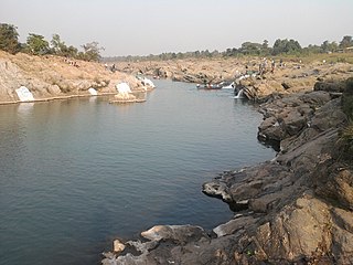
Sadni Falls is a waterfall located about 3 kilometres (1.9 mi) from Rajadera village in Gumla district in the Indian state of Jharkhand.
Ramgarh district is one of the 24 districts in the Indian state of Jharkhand. It was also a military district during the British Regime, referred to then as Ramgarh district.
Mahuda is a census town in Baghmara CD block in Dhanbad Sadar subdivision of Dhanbad district in the Indian state of Jharkhand.

Dhanbad Junction railway station, station code DHN, is a railway station of the Indian railway serving the city of Dhanbad, the headquarters of Dhanbad district in the Indian state of Jharkhand. It is the largest railway station in Jharkhand, handling over 100 trains and 100000+ passengers every day. Dhanbad is also the headquarters of the Dhanbad Rail Division of the East Central Railway zone. Grand Chord rail-line that connects Howrah and New Delhi passes through Dhanbad junction. Dhanbad is located at 23°47′32″N86°25′42″E. It has an elevation of 235 metres (771 ft).
Moonidih is an inhabited place in Dhanbad CD block in Dhanbad Sadar subdivision of Dhanbad district in the Indian state of Jharkhand
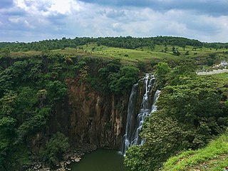
The Patalpani Waterfall is a waterfall on the Choral River, a tributary of the Narmada, located in the Mhow Tehsil of Indore district in the state of Madhya Pradesh, India.
Hariharpur is a census town in Topchanchi CD block in Dhanbad Sadar subdivision of Dhanbad district in the Indian state of Jharkhand.
Matigara is a census town in Baghmara CD block in Dhanbad Sadar subdivision of Dhanbad district in the Indian state of Jharkhand.


