
Fatehabad district is one of the twenty two districts of the state of Haryana, India. Fatehabad was founded by Firuz Shah Tughlaq. Fatehabad district was carved out of Hisar district on 15 July 1997.
Assan Khurd is a census town in Panipat district of Haryana, India. Khurd and Kalan are Persian language words which means small and big respectively when two villages have same name then it is distinguished as Kalan or Khurd with the village name.
Ellenabad, previously known as Kharial is a city with a municipal committee, near Sirsa City in the Sirsa district of the state of Haryana, India. It is located on the south bank of the Ghaggar River in the heart of Bagar tract areas of Punjab, Haryana and Rajasthan and serves as a port of entry into the state of Haryana from the Rajasthan side. Its location make it more strategic as not only it is located near Rajasthan border in Haryana but Punjab border is also near to it. Because of this the city has a kind off cosmopolitan culture of Punjabis particularly Malwayi culture, Rajasthani Marwadi culture, Deshwali Haryanvi culture and native Bagri culture and traditions or a mix of all of them or some of them. The Ellenabad city is divided into 17 wards for which elections are held every five years. As of 2011, the city had a population of 52,285, divided between two governing bodies: Ellenabad Municipal Committee with 44,452 persons and Ellenabad Rural Gram panchayat with 7,833. As of 2022, the city is estimated to have a population exceeding 60,000. There has been a rising demand to merge both administrative bodies into one and upgrade it to Municipal Council level. Ellenabad Municipal Committee has total administration over 8,387 houses to which it supplies basic amenities like water and sewerage. It is also authorize to build roads within Municipal Committee limits and impose taxes on properties coming under its jurisdiction.
Kalanwali is a town with a municipal committee in Sirsa district in the Indian state of Haryana. Being very near the Punjab border, most of the people in this area have Haryanvi, Hindi and Punjabi as their mother tongue.
Uchana is a developing town and a municipal committee, near city of Jind in Jind district in the Indian state of Haryana.
Rania is a town and a municipal committee in Sirsa district located on the upper bank of Ghaggar River in the Indian state of Haryana. Rania Town is a grain market in Sirsa district. Nearby cities to Rania includes Sirsa and Ellenabad. It shares its RTO office with Ellenabad which is also has its headquarters in Ellenabad. Earlier it was a part of Ellenabad subdivision but later carved out separately as a subdivision in Sirsa district of Haryana. It is at a distance of 22 km each from Sirsa and Ellenabad in opposite direction on Haryana State Highway 32A i.e. Bhambhoor-Jiwan Nagar Road which connects to Haryana State Highway 32 in Jiwan Nagar on one end and Haryana State Highway 23 in Bhambhoor on the other end.
Sampat Singh is a former Finance Minister of Haryana, India. As a Janata Party candidate, he was elected to the Haryana Legislative Assembly from the Bhattu Kalan constituency in 1982 and has been re-elected on five occasions. He was leader of the opposition from 1991 to 1996. His six election successes made him the most senior Indian National Congress legislator in 12th Haryana assembly. He has held many important portfolios in state government as minister.
Kanwari, also spelled Kunwari, or Kwari, is a village of 7,000 population, in Hansi-I Tehsil, Hisar-1 Rural Development Block, Hansi and Hisar of Hisar District of Hisar Division in the Haryana state of India. It is part of the saat bas bhaichara grouping of 7 villages. The village has 4 panna/patti (subdivisions), named as Nangalia Panna , upparla Panna , parla Panna , etc. with a total revenue land area of 43903 kanal or 5487 acre as per HALRIS records.
Khurd and Kalan are administrative designations used in India and Pakistan to indicate the smaller (Khurd) and larger (Kalan) segments of a town, village or settlement. They are usually added after place names. For instance, Berote Khurd and Berote Kalan in Abbottabad District in the Khyber-Pakhtunkhwa province, Dangoh Khurd in Una District of Himachal Pradesh and the many villages in delhi such as Holambi Khurd and Holambi Kalan, Pooth Khurd and Pooth Kalan and Mangolpur Khurd and Mangolpur Kalan in North west and north districts of Delhi and the famous Dariba Kalan jewellery market in Delhi, there was also a smaller street nearby, known as Dariba Khurd or Chhota Dariba, both mean small, now known as Kinari Bazaar.
Dhabi Kalan is a village in the Bhattu Kalan block, Fatehabad District, Hisar Division in Haryana, India.Khurd is a Persian language word which means "small". Dhabi Kalan is located 7 km from its Mandal main town Bhattu Kalan and 25 km from the district headquarter Fatehabad. The Distance to Hisar is 55 km. The distance to State capital Chandigarh is 260 km. The village is situated 230 km from the national capital New Delhi.
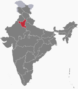
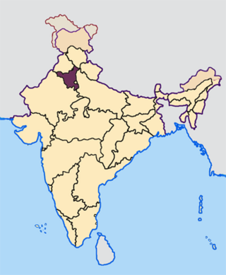
The following outline is provided as an overview of and topical guide to Haryana.
Bidhwan is a village and administrative unit with a democratically elected panchayat samiti in the Loharu, Siwani Tehsil of Bhiwani District under Bhiwani-Mahendragarh Lok Sabha constituency and Hisar Division of Haryana state, India.
Harigarh is a village in Safidon tehsil of Jind district in the Indian state of Haryana. It forms a part of Hisar division. It is located 33 kilometres (21 mi) east of its district headquarters at Jind, 12 kilometres (7.5 mi) from Safidon and 184 kilometres (114 mi) from the state capital at Chandigarh.
Adampur, also Mandi Adampur, is a town, municipality, revenue tehsil, rural development block and Vidhan Sabha constituency in Hisar district of Hisar division of Haryana state in northern India. It is 38 km northwest of Hisar city.
Kalali is a village and administrative unit with a democratically elected panchayat samiti in the Loharu, Siwani Tehsil of Bhiwani District under Bhiwani-Mahendragarh Lok Sabha constituency and Hisar Division of Haryana state.
Mandholi Kalan, next to Mandholi Khurd, Rambass situated 5 km from Mandholi Gopalwas, Kasni Kalan and Isharwal, is a village and administrative unit with a democratically elected panchayat samiti in the Loharu, Loharu Tehsil of Bhiwani District under Bhiwani-Mahendragarh Lok Sabha constituency and Hisar Division of Haryana state.
Mandholi Khurd, next to Mandholi Kalan, is a village and administrative unit with a democratically elected panchayat samiti in the Loharu, Siwani Tehsil of Bhiwani District under Bhiwani-Mahendragarh Lok Sabha constituency and Hisar Division of Haryana state.
Akanwali is a village in Tohana Tehsil in Fatehabad district of Haryana, India. It belongs to Hisar Division.
Barnala Khurd is a village in Shaheed Bhagat Singh Nagar district of Punjab State, India. Kalan is Persian language word which means Big and Khurd is Persian word which means small when two villages have same name then it is distinguished as Kalan means Big and Khurd means Small with Village Name. It is situated on Ludhiana-Rahon road and located 4.1 kilometres (2.5 mi) away from Rahon, 20 kilometres (12 mi) from Banga, 12 kilometres (7.5 mi) from district headquarter Shaheed Bhagat Singh Nagar and 93 kilometres (58 mi) from state capital Chandigarh. The village is administrated by Sarpanch an elected representative of the village.
Kakaut (or Kakot) village is located in Kaithal Tehsil of Kaithal district in Haryana, India. It is situated 9 kilometres (5.6 mi) away from Kaithal, which is both district & sub-district headquarter of Kakaut village. As per 2009 stats, Kakaut village is also a gram panchayat.

