Bhudhaar

Last updated

Bhudhaar
Location Andhra Pradesh, India
Established20 November 2018 (2018-11-20)
Website http://bhudhaar.ap.gov.in/

Bhudhaar is a e-governance project that is intended to assign an 11 digit unique number [1] to every land parcel in the state of Andhra Pradesh [2] as part of the "land hub in E-Pragati programme". [3] Bhudhaar is the first in India to address issues in land record management. Union Government of India also implementing Unique Land Parcel Identification Number (ULPIN) Project with the reference [4] from this Bhudhaar Project. Bhuseva Authority, an inter-departmental committee was formulated to implement and monitor the progress. [5] Eventually all land related transactions will use Bhudhaar as single source of truth to reduces land related disputes. On 18 February 2019, the Andhra pradesh Assembly gave its consent to the legal usage of the Bhudhaar Number in land documents. [6] This project is being regularly monitored by AP CM Dashboard (CORE Dashboard) which was developed and managed by Real Time Governance Society (RTGS) in real time basis.

Contents

Necessity

Land in the state of Andhra Pradesh is generally categorized into agricultural lands, rural properties, and urban properties (like houses, house sites, vacant lands) and forest land. These lands and their records are mainly managed by eight departments in the state. On 13 June 2015 the Revenue Department of the state launched the [7] Mee Bhoomi portal [8] to enable citizens and land owners to view their land records and ownership status at any time. Although people were given land records publicly, it did not solve the integration problem as each department has their own procedural guidelines in providing services to citizens which causes hardship in getting seamless and integrated services.

For instance, a property buyer has to go the corresponding municipality office to enter his name in municipal records as the new property owner. This process [9] takes a long time and causes inefficiency in land governance.

Land related Departments in Andhra Pradesh and their respective functions.
DepartmentFunction
RevenueMaintaining the agricultural land records and collection of taxes [10]
Panchayat RajMaintaining the village lands and properties along with records, tax collections
Municipal AdministrationMaintaining the urban lands and properties along with records, tax collections, and land use development plans
RegistrationRegistration of ownership changes by means of sales, gift, succession [11]
Survey & SettlementsMaintaining the village level and field level maps along with cadastral maps
ForestMaintaining the forest lands and its records [12]
EndowmentsMaintaining the endowment lands and its records
WakfMaintaining the wakf lands and its records

Issuing process

To create a single source of truth on land records and to manage land records efficiently, the Bhuseva Authority started the Bhudhaar program and distributed a number to each property. In this project, all land related departments are to integrate their services to the Bhuseva core platform and assign a Bhudhaar number to all properties along with built up properties when successful transactions are completed.

Land records [13] consists two types of data. Textual data (like village name, name of land owner, survey number, extent, owner ID proofs like Aadhaar, voter ID or other related documents) and spatial data (the data depicting the sketch of the land, its measurements (in links/meters/feet), adjacent fields, location on ground). The Bhudhaar number issued in two stages.

Progress

As of 22 February 2019, nearly 53% of temporary Bhudhaar numbers were generated. [14]

Type of LandTotal Land ParcelsRegistered Land ParcelsRegistered Land ParcelsBhudhaar Generation
Private LandGovernment LandTotalTemporary BhudhaarPermanent BhudharTotal
Number(%) on Total Land Parcels(%) on Registered Land ParcelsNumber%
Revenue2394596620146412174992342474999199742331997423383.4199.150019974233
Municipal32021154673534514259245151745067114.0796.4300451517
Panchayat84211405231066509995605099956509995660.5697.49005099956
Total35569221258448312305061524750912552570625524860025525706

Nationwide Usage

Although the present Bhudhaar project has plans to extend nationwide, [15] it was missing scientific approach and harmonization in assigning unique numbers to various regions. To collect taxes and to generate revenue from different properties, each urban or local administration authorities use various assessment numbers. The state of Andhra Pradesh uses the digital door numbering program. [16] [17] To bridge the gap, a nationwide comprehensive system is needed. While preserving the existing assigning process, a brand new Bhudhaar numbering system with a 12 digit alphanumeric pattern can be used.

First two digits—State codes (census code for temporary bhudhaar number, vehicle registration code for permanent bhudhaar number)

Third and fourth digits—District code in the respective states

Fifth and sixth digits—Sub-district code in respective districts.

Seventh and eighth digits—Village/block/ward level code in the respective sub-district/municipality.

Last four digits—random 4 digits containing alphanumeric letters.

Related Research Articles

<span class="mw-page-title-main">Postal code</span> Series of letters and digits for sorting mail

A postal code is a series of letters or digits or both, sometimes including spaces or punctuation, included in a postal address for the purpose of sorting mail.

<span class="mw-page-title-main">Srikakulam</span> Place in Andhra Pradesh, India

Srikakulam is a city and the headquarters of Srikakulam district in the Indian state of Andhra Pradesh. As of 2011 census, it has a population of 165,735. There are many other places of Buddhist Tourism such as Salihundam, Kalinga Patnam, Dabbaka Vaani Peta, Nagari Peta, Jagati Metta, Singupuram etc. in Srikakulam District. The Buddhist heritage site of Salihundam has some unique features. It has a beautiful star atop a stupa, rock cut massive stupas inside chaitya grihas, brick stupas with wheel pattern plan, votive stupas, inscriptions on the steps leading to the stupas and museum housing over two dozen sculpted statue and figurines of Buddha, Jain Teerthankars and other deities

<span class="mw-page-title-main">West Godavari district</span> District of Andhra Pradesh in India

The West Godavari district is a coastal district in the Indian state of Andhra Pradesh with an administrative headquarters in Bhimavaram. As of the 2011 Census of India, the district has an area of 2,178 km2 (841 sq mi) and a population of 1,779,935. It is bounded by the Krishna district and Bay of Bengal to the south, East Godavari district to the east, and Eluru district, Kolleru Lake and Upputeru Drain to the northwest.

<span class="mw-page-title-main">Vehicle registration plates of India</span>

All motorised vehicles plying on public roads in India are tagged with a registration or licence number. The vehicle registration plate is issued by a Regional Transport Office (RTO), the district-level authority on road matters in the respective state or Union Territory. The number plates are mandatory on both front and rear of the vehicle and are required to be in modern arabic numerals with latin letters. Complete specification of registration plates are specified under the HSRP: High Security Registration Plate rules.

In India, mobile numbers on GSM, WCDMA, LTE and NR networks start with either 9, 8, 7 or 6. Each telecom circle is allowed to have multiple private operators; earlier it was two private + BSNL/MTNL, subsequently it changed to three private + BSNL/MTNL in GSM; now each telecom circle has all four operators including Reliance Jio, Bharti Airtel, Vodafone idea ltd and BSNL/MTNL.

<span class="mw-page-title-main">Vizianagaram district</span> District of Andhra Pradesh in India

Vizianagaram district is one of the six districts in the Uttarandhra region of the Indian state of Andhra Pradesh with its headquarters located at Vizianagaram. The district was once the part of ancient Kalinga.Saripilli Dibbilingeswara temple, Jayathi Mallikarjuna Temple are the finest examples of ancient Eastern Ganga Dynasty built monuments in the district. The district is bounded on the east by the district of Srikakulam, north by Parvathipuram Manyam south by Visakhapatnam, Anakapalli, southeast by the Bay of Bengal, and west by Alluri Sitharama Raju district. It was formed on 1 June 1979, with some parts carved from the neighbouring districts of Srikakulam and Visakhapatnam. The district is named after the princely state of Vizianagaram. In 2011, it was the least populous district in Andhra Pradesh.

<span class="mw-page-title-main">Srikakulam district</span> District of Andhra Pradesh in India

Srikakulam district is one of the twenty-six districts of the Indian state of Andhra Pradesh, located in the Uttarandhra region of the state, with its headquarters located at Srikakulam. It is one of the six districts, located in the extreme northeastern direction of the state. It was under Ganjam district till 1936 April 1, then merged under Vizagapatam district in Madras state. Srikakulam district forms the core area of Kalinga where most of its historical capitals like Kalinganagari, pithunda, Dantapuram are located.

<span class="mw-page-title-main">Visakhapatnam district</span> District in Andhra Pradesh, India

Visakhapatnam district is one of the six districts in the Uttarandhra region of the Indian state of Andhra Pradesh, headquartered at Visakhapatnam. It is one of the twenty-six districts in Andhra Pradesh state. The district shares borders within the north and east, Vizianagaram district and South Anakapalli district in the south-west and Bay of Bengal in the south.

<span class="mw-page-title-main">Bobbili</span> Town in Andhra Pradesh, India

Bobbili is a town in Vizianagaram district of the Indian state of Andhra Pradesh.

<span class="mw-page-title-main">Andhra Pradesh State Road Transport Corporation</span> Indian state bus operator

Andhra Pradesh State Road Transport Corporation, officially Andhra Pradesh Raastra Roadu Ravaana Samstha, is the state-owned road transport corporation in the Indian state of Andhra Pradesh. Its headquarters is located at NTR Administrative Block of RTC House in Pandit Nehru bus station of Vijayawada. Many other Indian metro towns in Telangana, Tamil Nadu, Karnataka, Odisha, Yanam, Kerala, Maharashtra and Chhattisgarh are also linked with the APSRTC services.

<span class="mw-page-title-main">Telephone numbers in India</span>

Telephone numbers in India are administered under the National Numbering Plan of 2003 by the Department of Telecommunications of the Government of India. The numbering plan was last updated in 2015. The country code "91" was assigned to India by the International Telecommunication Union in the 1960s.

<span class="mw-page-title-main">Aadhaar</span> Indian national identification number

Aadhaar is a 12-digit unique identity number that can be obtained voluntarily by all residents of India, based on their biometrics and demographic data. The data is collected by the Unique Identification Authority of India (UIDAI), a statutory authority established in January 2009 by the Government of India, under the jurisdiction of the Ministry of Electronics and Information Technology, following the provisions of the Aadhaar Act, 2016.

<span class="mw-page-title-main">Mee Seva (Andhra Pradesh)</span>

MeeSeva is a good governance initiative that incorporates the vision of National eGov Plan "Public Services Closer to Home" and facilitates single entry portal for entire range of G2C and G2B services.

<span class="mw-page-title-main">Digital India</span> Online infrastructure in India

Digital India is a campaign launched by the Government of India to make its services available to citizens electronically via improved online infrastructure and by increasing Internet connectivity. The initiative includes plans to connect rural areas with high-speed internet networks. It consists of three core components: the development of secure and stable digital infrastructure, delivering government services digitally, and universal digital literacy.

<span class="mw-page-title-main">J. Satyanarayana</span>

J. Satyanarayana is a retired 1977 batch Indian Administrative Service officer of Andhra Pradesh cadre. Satyanarayana is the former chairman of Unique Identification Authority of India (UIDAI), the nodal agency of Government of India for implementing Aadhaar. He also served as the Communications and Information Technology Secretary of India.

Mee-Bhoomi is a land records portal started by the Revenue Department of Andhra Pradesh. It allows visitors to find information on land, including ownership details. The website is in Telugu language. The purpose of Mee-Bhoomi is that the people of Andhra Pradesh can easily see their land records. On this portal, one can view the Adangal, 1-B form records with the survey number, account number, Aadhaar number and the names of the applicants. This portal offers an online link between an Aadhaar number and land records.

<span class="mw-page-title-main">Andhra Pradesh (1956–2014)</span> Former state in India with Hyderabad as its capital

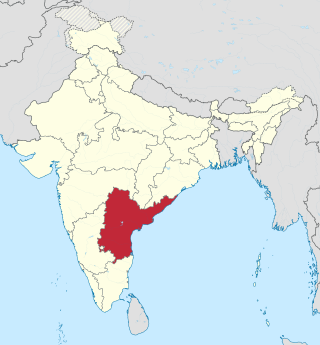
Andhra Pradesh, retrospectively referred to as United Andhra Pradesh, Undivided Andhra Pradesh, or Ummadi Andhra Pradesh, was a state in India formed by States Reorganisation Act, 1956 with Hyderabad as its capital and was reorganised by Andhra Pradesh Reorganisation Act, 2014. The state was made up of three distinct cultural regions of Telangana, Rayalaseema, and Coastal Andhra. Before the 1956 reorganisation, Telangana had been part of Hyderabad State ruled by Nizam of Hyderabad, whereas Rayalaseema and Coastal Andhra had been part of Andhra State, formerly a part of Madras Presidency ruled by British India.

Being described as the Aadhaar for land, Unique Land Parcel Identification Number (ULPIN) is a 14-digits alphanumeric unique ID for each and every land parcel in India. Ultimately ULPIN will be used as single source of truth for land records in near future as it is designed to uniquely identify every surveyed land parcel in india based on the Textual records of rights (RoR) along with its corresponding geo coordinates. This ULPIN project concept was taken from Bhudhaar project in Andhra Pradesh and announced in October 2020 with a plan to assign ULPIN to all land parcels in India by March 2022.

References

  1. "Launching of Bhudhaar". The Hindu . 20 November 2018.
  2. "Land parcels in Andhra to get unique code under Bhudhaar programme". The Times of India . 23 August 2018.
  3. "Land Hub".
  4. "NIC Concept Note on ULPIN" (PDF).
  5. "ప్రగతి సూచిక - భూసేవ". bhuseva.ap.gov.in. Retrieved 4 February 2019.
  6. "Bhudhaar Act" (PDF).[ permanent dead link ]
  7. Sridhar, G. Naga (13 June 2015). "AP launches 'Mee Bhoomi' digital depository of land records". @businessline. Retrieved 19 March 2019.
  8. "MEE BHOOMI::Home". www.meebhoomi.ap.gov.in. Archived from the original on 14 August 2019. Retrieved 19 March 2019.
  9. "Land Records and Titles in India". PRSIndia. 1 March 2018. Retrieved 15 March 2019.
  10. "CCLA :: CHIEF COMMISSIONER OF LAND ADMINISTRATION". ccla.ap.gov.in. Archived from the original on 21 June 2019. Retrieved 15 March 2019.
  11. ":: IGRS ::". registration.ap.gov.in. Archived from the original on 21 June 2019. Retrieved 15 March 2019.
  12. "A.P. Forest Department". www.forests.ap.gov.in. Retrieved 15 March 2019.
  13. "Bhseva Hand Out" (PDF). Archived from the original (PDF) on 2 December 2021. Retrieved 21 June 2019.
  14. "ప్రగతి సూచిక - భూసేవ". bhuseva.ap.gov.in. Retrieved 22 February 2019.
  15. "'Bhu Seva' project to be rolled out by October". The Hindu. 1 February 2018. ISSN   0971-751X . Retrieved 5 February 2019.
  16. "Chandrababu Naidu to inaugurate digital door numbers in Tirupati today". The Hans India. 22 September 2018. Retrieved 6 February 2019.
  17. "Survey underway for assigning Digital Door Numbers". The Hans India. 19 December 2018. Retrieved 6 February 2019.