Aquaforte is a town on the south shore of Newfoundland's Avalon Peninsula in the province of Newfoundland and Labrador, Canada.
Dover Grammar School for Girls is a community grammar school for girls, aged between 11 and 18, and boys aged between 16 and 18, in Dover, England. The school has a range of subjects in the curriculum, as well as extra-curricular activities such as sports, art and drama clubs; the clubs run at lunchtimes and after-school.

Pustków Żurawski is a village in the administrative district of Gmina Kobierzyce, within Wrocław County, Lower Silesian Voivodeship, in south-western Poland. Prior to 1945 it was in Germany. It lies approximately 4 kilometres (2 mi) west of Kobierzyce and 23 km (14 mi) south-west of the regional capital Wrocław.
Nurczyk-Kolonia is a village in the administrative district of Gmina Nurzec-Stacja, within Siemiatycze County, Podlaskie Voivodeship, in north-eastern Poland, close to the border with Belarus.

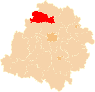
Gusin is a village in the administrative district of Gmina Świnice Warckie, within Łęczyca County, Łódź Voivodeship, in central Poland. It lies approximately 4 kilometres (2 mi) north-east of Świnice Warckie, 17 km (11 mi) west of Łęczyca, and 46 km (29 mi) north-west of the regional capital Łódź.
Huta is a village in the administrative district of Gmina Kiełczygłów, within Pajęczno County, Łódź Voivodeship, in central Poland.
Jadwisin is a village in the administrative district of Gmina Piaski, within Świdnik County, Lublin Voivodeship, in eastern Poland.

Nowy Sokołów is a village in the administrative district of Gmina Końskie, within Końskie County, Świętokrzyskie Voivodeship, in south-central Poland. It lies approximately 12 kilometres (7 mi) south-west of Końskie and 37 km (23 mi) north-west of the regional capital Kielce.

Rudna Mała is a village in the administrative district of Gmina Głogów Małopolski, within Rzeszów County, Subcarpathian Voivodeship, in south-eastern Poland. It lies approximately 8 kilometres (5 mi) south of Głogów Małopolski and 8 km (5 mi) north-west of the regional capital Rzeszów.

Błaziny Dolne is a village in the administrative district of Gmina Iłża, within Radom County, Masovian Voivodeship, in east-central Poland. It lies approximately 4 kilometres (2 mi) south of Iłża, 31 km (19 mi) south of Radom, and 122 km (76 mi) south of Warsaw.
Puszcza is a village in the administrative district of Gmina Rościszewo, within Sierpc County, Masovian Voivodeship, in east-central Poland.

Popowo-Letnisko is a village in the administrative district of Gmina Somianka, within Wyszków County, Masovian Voivodeship, in east-central Poland. It lies approximately 12 kilometres (7 mi) west of Somianka, 23 km (14 mi) west of Wyszków, and 38 km (24 mi) north of Warsaw.

Ciężkowice is a village in the administrative district of Gmina Polska Cerekiew, within Kędzierzyn-Koźle County, Opole Voivodeship, in south-western Poland. It lies approximately 2 kilometres (1 mi) south of Polska Cerekiew, 16 km (10 mi) south of Kędzierzyn-Koźle, and 52 km (32 mi) south of the regional capital Opole.

Grodzisko is a village in the administrative district of Gmina Rzeczenica, within Człuchów County, Pomeranian Voivodeship, in northern Poland. It lies approximately 5 kilometres (3 mi) south-east of Rzeczenica, 18 km (11 mi) north-west of Człuchów, and 122 km (76 mi) south-west of the regional capital Gdańsk.

Jastrzębie is a village in the administrative district of Gmina Osieczna, within Starogard County, Pomeranian Voivodeship, in northern Poland. It lies approximately 8 kilometres (5 mi) north-west of Osieczna, 31 km (19 mi) south-west of Starogard Gdański, and 69 km (43 mi) south-west of the regional capital Gdańsk.

Dawidy is a village in the administrative district of Gmina Pasłęk, within Elbląg County, Warmian-Masurian Voivodeship, in northern Poland. It lies approximately 10 kilometres (6 mi) north of Pasłęk, 19 km (12 mi) east of Elbląg, and 66 km (41 mi) north-west of the regional capital Olsztyn.

Bębnikąt is a settlement in the administrative district of Gmina Stargard, within Stargard County, West Pomeranian Voivodeship, in north-western Poland. It lies approximately 7 kilometres (4 mi) east of Stargard and 38 km (24 mi) east of the regional capital Szczecin.

Hřebeč is a village and municipality in Kladno District in the Central Bohemian Region of the Czech Republic.
Bitinkodji is a village and rural commune in Niger.
Kaerepere is a village in Kehtna Parish, Rapla County in northern-central Estonia.


