Oberhaching is a municipality in Bavaria, Germany, with 13,638 inhabitants (2020) on an area of 26.6 km2 (10.3 sq mi). It is located 15 km (9.3 mi) south of Munich city centre and has a 1,250 year history.

Warngau is a municipality in the Miesbach District of Bavaria, Germany. It is located at 47°50′N11°44′E and has a population of 3,489.
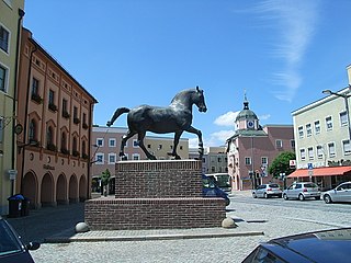
Pfarrkirchen is a municipality in southern Lower Bavaria Germany, the capital of the district Rottal-Inn. It has about 12,500 inhabitants and is an important school centre with about 10,000 pupils from all over Lower Bavaria. The town spreads over an area of about 52 square kilometers and lies approximately 377 meters above sea level. Pfarrkirchen lies at the small river "Rott", which gives the "Rottal" region its name. One of Pfarrkirchen's important industries include abattoirs which is due to the rural environment.

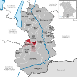
Benediktbeuern is a municipality in the district of Bad Tölz-Wolfratshausen in Bavaria, Germany, 2 kilometers, or 1.25 miles from Bichl. The village has 3,602 residents as of 31 December 2019.

Oberschleißheim is a municipality in the district of Munich, in Bavaria, Germany. It is located 13 km north of Munich (centre). As of 2005 it had a population of 11,467.
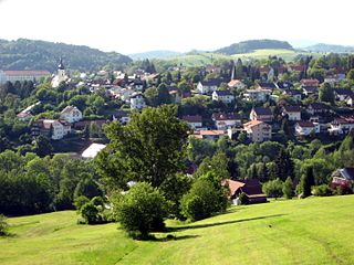
Grafenau is a town in the Freyung-Grafenau district, in Bavaria, Germany. 32 km north of Passau, the town is situated in the Bavarian Forest and is the base of the Bavarian Forest National Park Authority. Grafenau is a holiday destination with a variety of kinds of accommodation from self-catering apartments to a "holiday village".

Lenggries is a municipality and a town in Bavaria, Germany. It is the center of the Isarwinkel, the region along the Isar between Bad Tölz and Wallgau. The town has about 9,500 inhabitants. By area, it is the largest rural municipality ("Gemeinde") in what was formerly West Germany, and the 7th-largest overall.

Petershausen is a municipality in the district of Dachau in Bavaria in Germany.

Haidmühle is a municipality in the district of Freyung-Grafenau in Bavaria in Germany.
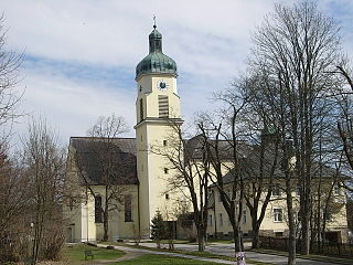
Spiegelau is a municipality in the district of Freyung-Grafenau in Bavaria in Germany. It lies in the heart of the Bavarian Forest.

Oberau is a municipality in the district of Garmisch-Partenkirchen, in Bavaria, Germany.
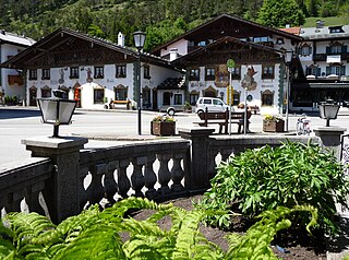
Wallgau is a municipality in the district of Garmisch-Partenkirchen, in Bavaria, Germany.

Riedbach is a municipality in the district of Haßberge in Bavaria in Germany. It is situated 20 km northeast of Schweinfurt and 8 km north of Haßfurt.

Velden is a market town and municipality in the district of Landshut in Bavaria in Germany.

Schwangau is a municipality in the district of Ostallgäu in Bavaria, Germany. The village lies 4 km from the larger town of Füssen and just 1.5 km from Hohenschwangau, a collection of tourist-oriented facilities adjacent to the major tourist attractions of Schloss Neuschwanstein and Schloss Hohenschwangau.

Teisnach is a larger municipality in the district of Regen in Bavaria in Germany.

Großkarolinenfeld is a municipality in the district of Rosenheim in Bavaria in Germany.
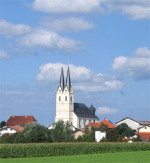
Tuntenhausen is a municipality in the district of Rosenheim in Bavaria in Germany.

Steingaden is a town and municipality in the Weilheim-Schongau district of Upper Bavaria, Germany. It is the site of the 12th-century Steingaden Abbey and the Wies Church, a UNESCO World Heritage Site.
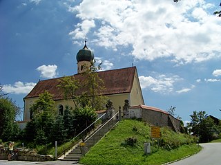
Haselbach is a municipality in the district of Straubing-Bogen in Bavaria, Germany.


