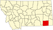
Powder River County is a county in the U.S. state of Montana. As of the 2020 census, the population was 1,694. Its county seat is Broadus.
Broadus is a town in and the county seat of Powder River County, Montana, United States. The population was 456 at the 2020 census.
Mansfield is a town in Cattaraugus County, New York, United States. The population was 843 at the 2020 census. The name was thought to be that of a noble family in England.
Horsham is a census-designated place in Horsham Township, Montgomery County, Pennsylvania, United States. The population was 15,193 at the 2020 census. It is home to the Biddle Air National Guard Base at the former site of Naval Air Station Joint Reserve Base Willow Grove.
Hanna is an unincorporated community in western Duchesne County, Utah, United States, on the Uintah and Ouray Indian Reservation.
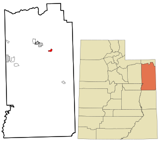
Jensen is a census-designated place in eastern Uintah County, Utah, United States. The population was 372 at the 2020 census. It lies along the Green River and U.S. Route 40, southeast of the city of Vernal, the county seat of Uintah County, and about 17 miles west of the Colorado border. Although Jensen is unincorporated, it has a post office, with the ZIP code of 84035.

Keystone is an unincorporated community and census-designated place in central Keith County, Nebraska, United States. As of the 2010 census its population was 59.

Sperry is an unincorporated community and census-designated place in central Des Moines County, Iowa, United States. It lies along local roads north of the city of Burlington, the county seat of Des Moines County. Its elevation is 751 feet (229 m). Although Sperry is unincorporated, it has a post office with the ZIP code of 52650, which opened on 5 February 1870.
Conroy is an unincorporated community and census-designated place (CDP) in central Iowa County, Iowa, United States. It lies along local roads southeast of the city of Marengo, the county seat of Iowa County. Its elevation is 879 feet (268 m). Conroy has a post office with the ZIP Code of 52220, which opened on 5 January 1885. As of the 2020 census the population was 252.
Little Cedar is an unincorporated community and census-designated place in central Mitchell County, Iowa, United States. As of the 2020 census it had a population of 64. Little Cedar has a post office with the ZIP code of 50454.

Toeterville is an unincorporated community and census-designated place in northwestern Mitchell County, Iowa, United States. As of the 2020 census it had a population of 53.

Cohagen is an unincorporated community in southeastern Garfield County, Montana, United States. It lies along Highway 59 southeast of the town of Jordan, the county seat of Garfield County.
Sanders is an unincorporated community in northeastern Treasure County, Montana, United States, along the Yellowstone River. It lies along local roads east of the town of Hysham, the county seat of Treasure County. Sanders' post office first opened on March 30, 1904, and closed on October 14, 1905, only to be reopened on December 1, 1906. Although the post office finally closed on July 29, 1994, the community still has a separate ZIP code of 59076.
Otter is an unincorporated community in southwestern Powder River County, Montana, United States, in the Custer National Forest. It lies along local roads southwest of the town of Broadus, the county seat of Powder River County. Its elevation is 3,484 feet (1,062 m). Although Otter is unincorporated, it has a post office, with the ZIP code of 59062.
Powderville, also Elkhorn Crossing is an unincorporated community in northeastern Powder River County, Montana, United States, along the Powder River. It is a small cluster of buildings that lies along local roads northeast of the town of Broadus, the county seat of Powder River County. Its elevation is 2,828 feet (862 m).
Sonnette is an unincorporated community in west central Powder River County, Montana, United States. The community is situated near the headwaters of Pumpkin Creek, just west of the Custer National Forest. It lies along local roads northwest of the town of Broadus, the county seat of Powder River County.

Beulah is a census-designated place (CDP) in eastern Crook County, Wyoming, United States, along Sand Creek, a tributary of the Belle Fourche River. According to local residents, the population is 33. When the 2010 census reported the population as 73, the highway sign at the town entrance was changed. In 2012, Beulah residents succeeded in appealing to the Wyoming Governor to remove the new sign and replace it with one that proclaimed the population to be 33.
Acton is an Census Designated Place in northwestern Yellowstone County, Montana, United States. It has a postal ZIP code (59002) and lies along Montana Highway 3 northwest of the city of Billings, the county seat of Yellowstone County.

Moorhead is an unincorporated community in southern Powder River County, Montana, United States. It lies along Moorhead Road, approximately 35 miles (56 km) south of the town of Broadus, the county seat of Powder River County.
Epsie is an unincorporated community in western Powder River County, Montana, United States. It lies along U.S. Highway 212, 12.7 miles (20.4 km) west of the town of Broadus, the county seat of Powder River County.