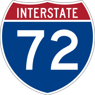
Interstate 72 (I-72) is an Interstate Highway in the midwestern United States. Its western terminus is in Hannibal, Missouri, at an intersection with U.S. Route 61 (US 61); its eastern terminus is at Country Fair Drive in Champaign, Illinois. The route runs through the major cities of Decatur, Illinois, and Springfield, Illinois. In 2006, the Illinois General Assembly dedicated all of I-72 as Purple Heart Memorial Highway. The stretch between Springfield and Decatur is also called Penny Severns Memorial Expressway, and the section between mile 35 and the Mississippi River is known as the Free Frank McWorter Historic Highway.
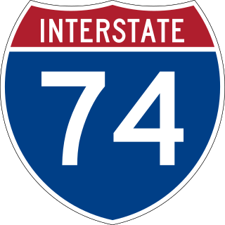
Interstate 74 (I-74) is an Interstate Highway in the Midwestern and Southeastern United States. Its western end is at an interchange with I-80 in Davenport, Iowa ; the eastern end of its Midwest segment is at an interchange with I-75 in Cincinnati, Ohio. The major cities that I-74 connects to include Davenport, Iowa; Peoria, Illinois; Bloomington, Illinois; Champaign, Illinois; Indianapolis, Indiana; and Cincinnati, Ohio. I-74 also exists as several disconnected sections of highways in North Carolina.

A cloverleaf interchange is a two-level interchange in which all turns are handled by slip roads. To go left, vehicles first continue as one road passes over or under the other, then exit right onto a one-way three-fourths loop ramp (270°) and merge onto the intersecting road. The objective of a cloverleaf is to allow two highways to cross without the need for any traffic to be stopped by traffic lights. The limiting factor in the capacity of a cloverleaf interchange is traffic weaving.
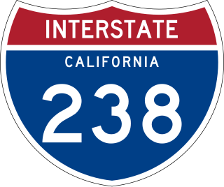
Route 238, consisting of State Route 238 (SR 238) and Interstate 238 (I-238), is a mostly north–south state and auxiliary Interstate highway in the San Francisco Bay Area of California. The southern segment is signed as SR 238 and is a divided multilane surface highway that runs parallel to the Hayward hills between I-680 in Fremont and I-580 in Castro Valley. The northern segment is signed as I-238 and is a six-lane freeway that runs more east–west between I-580 and I-880 in San Leandro.

Interstate 295 (I-295), sometimes called the Providence Beltway, is an auxiliary Interstate Highway in the US states of Rhode Island and Massachusetts. It is maintained by the Rhode Island Department of Transportation (RIDOT) and the Massachusetts Department of Transportation (MassDOT). Spanning nearly 27 miles (43 km), it forms a western beltway around Providence, Rhode Island, and is a bypass of I-95 as it travels through the capital city. I-895 was proposed as a complementary eastern beltway to complete a full loop around the city in the 1960s but was ultimately scrapped in the 1980s.
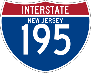
Interstate 195 (I-195) is an auxiliary route of the Interstate Highway System located in the US state of New Jersey. Its western end is at I-295 and Route 29 just south of Trenton in Hamilton Township, Mercer County, while its eastern end is at the Garden State Parkway, Route 138, and Route 34 in Wall Township, Monmouth County. I-195 is 34.17 miles (54.99 km) in length. The route is mostly a four-lane highway that mainly runs through agrarian and wooded areas in Central Jersey. It has an interchange with the New Jersey Turnpike (I-95) in Robbinsville Township and serves as a main access road to New Jersey's state capital of Trenton, the Horse Park of New Jersey, the Six Flags Great Adventure amusement park, and the Jersey Shore. I-195 is occasionally referred to as the Central Jersey Expressway. On April 6, 1988, President Ronald Reagan signed H.R. 4263 naming I-195 in New Jersey the James J. Howard Interstate Highway, in honor of the late James J. Howard.

Interstate 88 (I-88) is an Interstate Highway in the US state of Illinois that runs from an interchange with I-80 near Silvis and Moline to an interchange with I-290 and I-294 in Hillside, near Chicago. I-88 is 140.60 miles (226.27 km) long. This route is not contiguous with I-88 in New York. Since 2010, most of I-88 has been part of the Chicago–Kansas City Expressway. The highway also runs through the cities of Aurora, Naperville, DeKalb, and Dixon. East of Rock Falls, the route is a part of the Illinois Tollway system.

Interstate 195 (I-195) is an auxiliary Interstate Highway running a combined 44.55 miles (71.70 km) in the US states of Rhode Island and Massachusetts. It travels from a junction with I-95 in Providence, Rhode Island, east to a junction with I-495 and Massachusetts Route 25 in Wareham, Massachusetts. It runs east–west and passes through the cities of Fall River, Massachusetts, and New Bedford, Massachusetts. The portion of I-195 in East Providence is also known as the East Providence Expressway.

Interstate 275 (I-275) is an Interstate Highway in Tennessee that serves Knoxville by connecting the downtown with I-75/I-640/US Route 25W (US 25W). Measuring 2.98 miles (4.80 km) in length, it runs from a northern terminus at the junction with I-75/I-640/US 25W to a southern terminus at I-40. I-275 was formerly a section of I-75, which was rerouted onto I-640 in 1980 after a section of that route was completed.
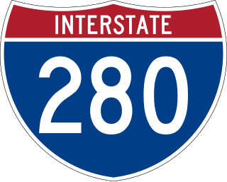
Interstate 280 (I-280) is an auxiliary Interstate Highway that makes up the western and southern portions of the beltway around the Quad Cities of Illinois and Iowa. The freeway starts at I-80 near Davenport, Iowa, and ends at I-80 near Colona, Illinois; its eastern part runs concurrent with I-74 to return to I-80. I-280 forms the southern part of a circle around the Quad Cities as well as forming part of a bypass for US Route 61 (US 61) around Davenport. This road is 26.98 miles (43.42 km) long.

In the field of road transport, an interchange or a grade-separated junction is a road junction that uses grade separations to allow for the movement of traffic between two or more roadways or highways, using a system of interconnecting roadways to permit traffic on at least one of the routes to pass through the junction without interruption from crossing traffic streams. It differs from a standard intersection, where roads cross at grade. Interchanges are almost always used when at least one road is a controlled-access highway or a limited-access divided highway (expressway), though they are sometimes used at junctions between surface streets.
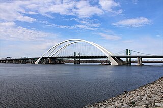
The Interstate 74 Bridge, officially known as the Iowa-Illinois Memorial Bridge, and often called The Twin Bridges, or the I-74 Bridge, are basket-handle, through arch twin bridges that carry Interstate 74 across the Mississippi River and connect Bettendorf, Iowa, and Moline, Illinois. It is located near the geographic center of the Quad Cities.

Interstate 270 (I-270) makes up a large portion of the outer belt freeway in Greater St. Louis. The counterclockwise terminus of I-270 is at the junction with I-55 and I-255 in Mehlville, Missouri; the clockwise terminus of the freeway is at the junction with I-55 and I-70 north of Troy, Illinois. The entire stretch of I-270 is 50.59 miles (81.42 km).

Interstate 680 (I-680) in Nebraska and Iowa is the northern bypass of the Omaha–Council Bluffs metropolitan area. I-680 spans 16.49 miles (26.54 km) from its southern end in western Omaha, Nebraska, to its eastern end near Crescent, Iowa. The freeway passes through a diverse range of scenes and terrains—the urban setting of Omaha, the Missouri River and its valley, the rugged Loess Hills, and the farmland of Pottawattamie County, Iowa.
Interstate 74 (I-74) in the US state of Illinois is a major northwest–southeast Interstate Highway that runs across the central portion of the state. It runs from the Iowa state line at the Mississippi River near the city of Rock Island and runs southeast to the Indiana state line east of Danville, a distance of 220.34 miles (354.60 km). The highway runs through the major cities of Champaign, Bloomington, Peoria, and Moline.

U.S. Highway 6 (US 6) is an east–west United States Numbered Highway which runs 322 miles (518 km) across the U.S. state of Iowa. The route is signed in places as the Grand Army of the Republic Highway. Like all state highways in Iowa, it is maintained by the Iowa Department of Transportation. The route begins at the Missouri River crossing at Council Bluffs. From there, it travels east through Oakland and Atlantic. North of Atlantic, the highway overlaps Interstate 80 (I-80) until De Soto. Between De Soto and Adel, the highway overlaps US 169 before splitting off to the east toward Des Moines. Through the Des Moines area, the highway runs about one mile (1.6 km) north or south of the I-35/I-80 corridor.
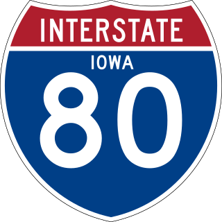
Interstate 80 (I-80) is a transcontinental Interstate Highway in the United States, stretching from San Francisco, California, to Teaneck, New Jersey. In Iowa, the highway travels west to east through the center of the state. It enters the state at the Missouri River in Council Bluffs and heads east through the southern Iowa drift plain. In the Des Moines metropolitan area, I-80 meets up with I-35 and the two routes bypass Des Moines together. On the northern side of Des Moines, the Interstates split and I-80 continues east. In eastern Iowa, it provides access to the University of Iowa in Iowa City. Northwest of the Quad Cities in Walcott is Iowa 80, the world's largest truck stop. I-80 passes along the northern edge of Davenport and Bettendorf and leaves Iowa via the Fred Schwengel Memorial Bridge over the Mississippi River into Illinois.

Interstate 74 (I-74) is the central freeway through the Iowa Quad Cities. It roughly divides Davenport to the west and Bettendorf to the east. The Interstate Highway begins at an interchange with I-80 at the northeastern edge of Davenport and continues into Illinois at the Mississippi River by crossing the I-74 Bridge. The freeway was built in stages during the late 1960s and early 1970s.

U.S. Highway 61 (US 61) is a United States Highway that serves eastern Iowa. It enters the state from Missouri near Keokuk with US 136. North of Keokuk, it is overlapped by US 218 for a few miles. It the follows the course of the Mississippi River past Montrose and Fort Madison. It meets US 34 at Burlington. It passes through Wapello and bypasses Muscatine and Blue Grass on its way toward Davenport. There, it follows Interstate 280 (I-280) and I-80 around the Quad Cities. North of Davenport, it follows a freeway north toward DeWitt where it meets US 30. The highway continues north through Maquoketa and reaches the Dubuque area. There it is joined by US 151 and briefly by US 52. The two highways enter the downtown area on an expressway. Due to the proximity of the Mississippi River and railroad tracks that lie between, the routes have an indirect junction with US 20. The two highways leave the state and enter Wisconsin about one-half mile (800 m) north of the Illinois–Wisconsin state line.
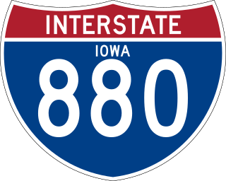
Interstate 880 (I-880) is an auxiliary Interstate Highway in Iowa. Its route was created in 2019 from a section of I-680 in order to facilitate the movement of I-29 traffic around Council Bluffs in the event of Missouri River flooding. It follows the same routing as Interstate 80N (I-80N), which originally connected I-29 and I-80 from 1966 to 1973.


