The Burke and Wills expedition was organised by the Royal Society of Victoria in Australia in 1860–61. It consisted of 19 men led by Robert O'Hara Burke and William John Wills, with the objective of crossing Australia from Melbourne in the south, to the Gulf of Carpentaria in the north, a distance of around 3,250 kilometres. At that time most of the inland of Australia had not been explored by non-Indigenous people and was largely unknown to the European settlers.

Cloncurry is a town and locality in the Shire of Cloncurry, Queensland, Australia. It is the administrative centre of the shire. At the 2016 census, Cloncurry recorded a population of 2,719 people.

Normanton is a small cattle town and coastal locality in the Shire of Carpentaria in Queensland, Australia. In the 2016 census, Normanton had a population of 1,210 people of whom 743 were Indigenous Australians.

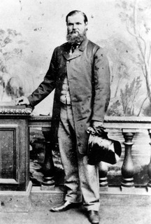
Robert O'Hara Burke was an Irish soldier and police officer who achieved fame as an Australian explorer. He was the leader of the ill-fated Burke and Wills expedition, which was the first expedition to cross Australia from south to north, finding a route across the continent from the settled areas of Victoria to the Gulf of Carpentaria. The expedition party was well equipped, but Burke was not experienced in bushcraft. A Royal Commission report conducted upon the failure of the expedition was a censure of Burke's judgement.

Innamincka, formerly Hopetoun, is a town and locality in north-east South Australia, with a population of 44 people. It is 821 kilometres north-east of Adelaide and 365 kilometres north-east from the closest town, Lyndhurst. It is also 66 kilometres north-east of the Moomba Gas Refinery. The town lies within the Innamincka Regional Reserve and is surrounded by the Strzlecki Desert to the south and the Sturt Stony Desert to the north. The township is situated along the Cooper Creek, a part of the Lake Eyre Basin.
The following lists events that happened during 1860 in Australia.
William Landsborough was an explorer of Australia and notably he was the first explorer to complete a North-to-South crossing of Australia. He was a member of the Queensland Legislative Council.

Burketown is an isolated outback town and coastal locality in the Shire of Burke, Queensland, Australia. In the 2016 census, Burketown had a population of 238 people. It is located 898 km west of Cairns on the Albert River and Savannah Way in the area known as the Gulf Savannah. The town is the administrative centre of the vast Burke Shire Council.

Pooncarie is a village in south-western New South Wales, Australia in Wentworth Shire. It is on the eastern side of the Darling River between Wentworth and Menindee. The surrounding region of Pooncarie is semi-arid with an outback landscape rich in eucalypt woodlands

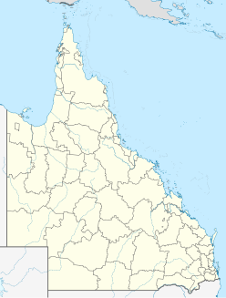
The Shire of Diamantina is a local government area in Central West Queensland, bordering South Australia and the Northern Territory. Its administrative centre is in the town of Bedourie.

South West Queensland is a remote region in the Australian state of Queensland which covers 319,808 km2 (123,479 sq mi). The region lies to the south of Central West Queensland and west of the Darling Downs and includes the Maranoa district and parts of the Channel Country. The area is noted for its cattle grazing, cotton farming, opal mining and oil and gas deposits.

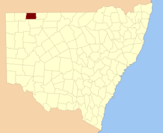
Caryapundy Station most commonly known as Caryapundy or Caryapundy Swamp is a pastoral lease that once operated as a cattle station in the channel country of outback New South Wales.

Edwin James Welch was an English naval cadet, surveyor, photographer, newspaper proprietor, writer and journalist. Welch discovered John King, sole survivor of the Burke and Wills expedition.

Burke and Wills Plant Camp is a heritage-listed campsite near Betoota within the locality of Birdsville, Shire of Diamantina, Queensland, Australia. It is also known as Return Camp 46 and Burke and Wills Camp R46. It was added to the Queensland Heritage Register on 11 December 2008.

Claypans is a locality in the Murray Mallee region of South Australia. Claypans had a Methodist church in 1928. The school opened in 1907 and closed in 1947. The name refers to the claypan at which the settlers camped on their first night.

The Gregory River is a river located in the Northern Territory and the state of Queensland, Australia. The river is the largest perennial river in arid and semi-arid Queensland, one of the few permanently flowing rivers in the northwest of Queensland.

Burke and Wills Camp B/CXIX is a heritage-listed campsite at Burke and Wills Access Road, Normanton, Shire of Carpentaria, Queensland, Australia. It is also known as Walker's Camp. It was added to the Queensland Heritage Register on 14 August 2008.

The Wilson River, part of the Lake Eyre Basin, is an ephemeral river located in the Channel Country in western Queensland, Australia.
Connulpie, New South Wales is a remote civil Parish, of the County of Delalah a cadasteral division of New South Wales.

Dr. Hermann Beckler was a German doctor with an interest in botany. He went to Australia to collect specimen for Ferdinand von Mueller and served as medical officer and botanist for the Victoria Exploring Expedition in 1860.