Binuangan, Obando

Last updated
Binuangan
FvfObando9965 29.JPG
View of the island barangay from Salambao
Binuangan, Obando
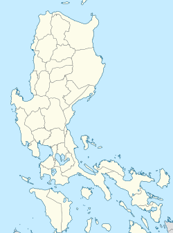
Philippines location map (Luzon).svg
Red pog.svg
Binuangan
Coordinates: 14°43′16″N120°54′23″E / 14.72111°N 120.90639°E / 14.72111; 120.90639
CountryFlag of the Philippines.svg  Philippines
Region Central Luzon
Province Bulacan
Municipality Obando
Government
   Barangay Chairman Jerry Silverio Mendoza
Population
 (2020)
  Total5,045
ZIP code
3021
Area code 44

Binuangan is a barangay in the coastal municipality of Obando in Bulacan, the Philippines. It is an island on an estuary formed by the confluence of Binuangan River and Muzon River along the coast of the Manila Bay, north of Isla Pulo, Tanza, Navotas. The barangay is surrounded by intertidal mudflats and sandbars with fish pens separating it from the mainland of Obando to the east. It is bordered by the barangays of Tawiran and Paco on the north, Lawa to the east, Salambao on the south, and the Bulakan barangay of Taliptip to the west. As of the 2020 census, Binuangan had a population of 5,045. [1] Binuangan is an ancient barangay, mentioned in the earliest known document of the Philippines, the Laguna Copperplate Inscription in 900 AD. [2]
Contents

See also

Related Research Articles

<span class="mw-page-title-main">Calabarzon</span> Administrative region of the Philippines

Calabarzon, formally known as the Southern Tagalog Mainland, is an administrative region in the Philippines, designated as Region IV-A. The region comprises five provinces: Batangas, Cavite, Laguna, Quezon, and Rizal; and one highly urbanized city, Lucena. The region is the most populous region in the Philippines according to the Philippine Statistics Authority, having over 14.4 million inhabitants in 2020, and is also the country's second most densely populated after the National Capital Region. 

<span class="mw-page-title-main">Bulacan</span> Province in Central Luzon, Philippines

Bulacan, officially the Province of Bulacan, is a province in the Philippines located in the Central Luzon region. Its capital is the city of Malolos. Bulacan was established on August 15, 1578, and part of the Metro Luzon Urban Beltway Super Region.

<span class="mw-page-title-main">Tondo, Manila</span> District in Metro Manila, Philippines

Tondo is a district located in Manila, Philippines. It is the largest in terms of area and population of Manila's sixteen districts, with a Census-estimated 631,313 people in 2015 and consists of two congressional districts. It is also the second most densely populated district in the city.

<span class="mw-page-title-main">Valenzuela, Metro Manila</span> Highly Urbanized City in Metro Manila, Philippines

Valenzuela, officially known as the City of Valenzuela, is a 1st class highly urbanized city in the National Capital Region of the Philippines. According to the 2020 census, it has a population of 714,978 people. 

<span class="mw-page-title-main">Navotas</span> Highly Urbanized City in Metro Manila, Philippines

Navotas, officially known the City of Navotas, is a 1st class highly urbanized city in the National Capital Region of the Philippines. According to the 2020 census, it has a population of 247,543 people. 

<span class="mw-page-title-main">Meycauayan</span> Component city in Central Luzon

Meycauayan, officially known as the City of Meycauayan, is a 3rd class component city in the province of Bulacan, Philippines. According to the 2020 census, it has a population of 225,673 people.  It is one of the oldest towns in the province.

<span class="mw-page-title-main">Laguna Copperplate Inscription</span> 10th-century inscription found in the Philippines

The Laguna copperplate inscription is an official acquittance inscribed onto a copper plate in the Shaka year 822. It is the earliest known calendar-dated document found within the Philippine Islands.

<span class="mw-page-title-main">Bulakan, Bulacan</span> Municipality in Central Luzon

Bulakan, officially the Municipality of Bulakan, is a 1st class municipality in the province of Bulacan, Philippines. According to the 2020 census, it has a population of 81,232 people. 

<span class="mw-page-title-main">Bocaue</span> Municipality in Central Luzon

Bocaue, officially the Municipality of Bocaue, is a 1st class municipality in the province of Bulacan, Philippines. According to the 2020 census, it has a population of 141,412 people. 

<span class="mw-page-title-main">Obando, Bulacan</span> Municipality in Central Luzon

Obando, officially the Municipality of Obando, is a 2nd class municipality in the province of Bulacan, Philippines. According to the 2020 census, it has a population of 59,978 people. 

<span class="mw-page-title-main">Hagonoy, Bulacan</span> Municipality in Central Luzon

Hagonoy, officially the Municipality of Hagonoy, is a 1st class municipality in the province of Bulacan, Philippines. According to the 2020 census, it has a population of 133,448 people. 

<span class="mw-page-title-main">Marilao</span> Municipality in Central Luzon

Marilao, officially the Municipality of Marilao, is a 1st class municipality in the province of Bulacan, Philippines. According to the 2020 census, it has a population of 254,453 people. 

<span class="mw-page-title-main">Pandi, Bulacan</span> Municipality in Central Luzon

Pandi, officially the Municipality of Pandi, is a 2nd class municipality in the province of Bulacan, Philippines. According to the 2020 census, it has a population of 155,115 people. 

<span class="mw-page-title-main">Pulilan</span> Municipality in Central Luzon

Pulilan, officially the Municipality of Pulilan, is a 1st class municipality in the province of Bulacan, Philippines. According to the 2020 census, it has a population of 108,836 people. 

<span class="mw-page-title-main">Tagalog people</span> Austronesian ethnic group indigenous to Southern Luzon

The Tagalog people are the largest ethnolinguistic group in the Philippines, numbering at around 30 million. An Austronesian people, the Tagalog have a well developed society due to their cultural heartland, Manila, being the capital city of the Philippines. They are native to the Metro Manila and Calabarzon regions of southern Luzon, and comprise the majority in the provinces of Bulacan, Bataan, Nueva Ecija and Aurora in Central Luzon and in the islands of Marinduque and Mindoro in Mimaropa.

<span class="mw-page-title-main">Tondo (historical polity)</span> City-state in what is now Manila, Philippines, from c. 900 to 1589

In early Philippine history, the Tagalog settlement at Tondo was a major trade hub located on the northern part of the Pasig River delta, on Luzon island.

<span class="mw-page-title-main">Obando Church</span> Church in Bulacan, Philippines

The Parish of San Pascual Baylon and National Shrine of Nuestra Señora Inmaculada Concepcion de Salambao(Tagalog: Parokya ni San Pascual Baylon at Pambansang Dambana ng Nuestra Señora Inmaculada Concepcion de Salambao), also known as Obando Church, is a Roman Catholic church located in the municipality of Obando in the province of Bulacan, Philippines. Founded by Franciscan missionaries, under the Spanish Empire, it is the venue of the three-day Obando Fertility Rites held annually in honor of three patron saints, namely: St. Pascual Baylon, St. Claire of Assisi and Our Lady of Salambao, a celebration that was mentioned by Jose Rizal, the Philippine national hero, in the pages of his Spanish-language novel, the Noli Me Tangere. During the month of May, parishioners and other devotees perform the three-day Obando Dance inside the church, followed by a street procession.

Bulacan is a province of the Philippines. It was established on 15 August 1578.

<span class="mw-page-title-main">Isla Pulo</span>

Pulo Island, commonly known as Isla Pulo, is a long, narrow island surrounded by mudflats in the Manila Bay coast of Navotas, about 13 kilometers (8.1 mi) north of Manila in the Philippines. It is a sitio in Barangay Tanza, connected to the mainland of Navotas by a 500-meter-long (1,600 ft) bamboo bridge. The island is known for its mangroves for which it was declared a "marine tree park" and as one of four ecotourism sites in Metro Manila established under the National Ecotourism Strategy in 1999. In 2014, it was home to a resettlement site of about 137 indigent families that mostly occupied the island's southern tip.

References

  1. "Barangay Binuangan - Philippine Standard Geographic Code". Philippine Statistics Authority . Retrieved 2022-06-30.
  2. Postma, Antoon (April–June 1992). "The Laguna Copper-Plate Inscription: Text and Commentary". Philippine Studies. Ateneo de Manila University. 40 (2): 182–203. JSTOR   42633308.