Rizal, officially the Province of Rizal, is a province in the Philippines located in the Calabarzon region in Luzon. Its capital is the city of Antipolo. It is about 16 kilometers (9.9 mi) east of Manila. The province is named after José Rizal, one of the main national heroes of the Philippines. It is bordered by Metro Manila to the west, Bulacan to the north, Quezon to the east and Laguna to the southeast. The province also lies on the northern shores of Laguna de Bay, the largest lake in the country. Rizal is a mountainous province perched on the western slopes of the southern portion of the Sierra Madre mountain range.

Malabon, officially the City of Malabon, is a 1st class highly urbanized city in the National Capital Region of the Philippines. According to the 2020 census, it has a population of 380,522 people.

Navotas, officially the City of Navotas, is a 1st class highly urbanized city in the National Capital Region of the Philippines. According to the 2020 census, it has a population of 247,543 people.

The legislative districts of Rizal are the representations of the province of Rizal in the various national and local legislatures of the Philippines. At present, the province is represented in the House of Representatives of the Philippines by its four congressional districts, with the districts' representatives being elected every three years. Additionally, each district is allotted a certain number of seats in the Rizal Provincial Board, with board members also being elected every three years.

In early Philippine history, the Tagalog settlement at Tondo, sometimes referred to as the Kingdom of Tondo, was a major trade hub located on the northern part of the Pasig River delta on Luzon island. Together with Maynila, the polity (bayan) that was also situated on the southern part of the Pasig River delta, Tondo had established a shared monopoly on the trade of Chinese goods throughout the rest of the Philippine archipelago, making it an established force in trade throughout Southeast Asia and East Asia.
The geography of the City of Manila is characterized by its coastal position at the estuary of the Pasig River that flows to Manila Bay. The city is located on a naturally protected harbor, regarded as one of the finest harbors in Asia. The scarce availability of land is a contributing factor that makes Manila the densest populated city in the world.
Numerous events and festivals are held annually in Metro Manila. They include:
Tanza was one of the fourteen barangays of the city of Navotas in Metro Manila, Philippines. It occupied the northernmost portion of the city including Isla Pulo which is separated from the city proper, and was bounded by Brgy. Binauangan and Salambao in Obando, Bulacan to the north, Manila Bay and Brgy. San Roque to the west, Brgy. Hulong Duhat and Dampalit, Malabon to the east and Brgy. Tangos North to the south.

Mel Lopez Boulevard, formerly known as President Ferdinand E. Marcos Highway or simply as Marcos Road, is a 6.2-kilometer (3.9 mi), six-to-ten lane divided highway in northern Manila, Philippines, connecting Bonifacio Drive in Port Area and Intramuros in the south with Radial Road 10 (R-10) in Navotas in the north. The highway is the main component of the R-10 network, which runs north of the Pasig River until Anda Circle, and is an extension of Bonifacio Drive, running north–south through the Manila North Port area serving the coastal districts of Tondo and Port Area, as well as San Nicolas and Intramuros.

Radial Road 10, more commonly referred to as R-10, is a planned network of roads and bridges that all together would form the tenth radial road of Manila in the Philippines. It is the westernmost of the radial roads north of the Pasig River running north–south close to the shoreline of Manila Bay. When completed, the road would link the City of Manila with Navotas, and the northern coastal provinces of Bulacan, Pampanga, and Bataan in Central Luzon.

North Bay Boulevard is a 2.34-kilometer-long (1.45 mi) two- to four-lane access road in the Navotas Fish Port Complex of northern Metro Manila, Philippines. It is one of the main roads in Navotas which travels north-south through the southern parts of the city running parallel to Radial Road 10 (R-10) to the west. The road links the Balut area of Tondo in Manila and San Rafael Village in the south to the central Navotas barangay of Bagumbayan South in the north. It was named after its location in Manila Bay north of the Manila North Harbor complex.

The following outline is provided as an overview of and topical guide to Metro Manila:

The following is an alphabetical list of articles related to the Philippine capital region of Metro Manila.

The Estero de Sunog Apog is one of the rivulets, known as esteros, which delineated the small islands which historically constituted the City of Manila and its predecessors, the Tagalog polities of Maynila and Tondo. These esteros, along with the larger rivers of Manila Bay and the Pasig River delta, originally formed an important connecting network which allowed the precolonial polities of that Tagalog and Kapampangan peoples. It currently runs along part of the boundaries of Manila's 1st and 2nd legislative districts.

Manila's 1st congressional district is one of the six congressional districts of the Philippines in the city of Manila. It has been represented in the House of Representatives of the Philippines since 1916 and earlier in the Philippine Assembly from 1907 to 1916. The district consists of barangays 1 to 146 in the western part of the Manila district of Tondo, west of Dagupan Street, Estero de Vitas and Estero de Sunog Apog bordering Navotas. It is currently represented in the 19th Congress by Ernesto M. Dionisio Jr. of Asenso Manileño and Lakas–CMD.
Manila's 2nd congressional district is one of the six congressional districts of the Philippines in the city of Manila. It has been represented in the House of Representatives of the Philippines since 1916 and earlier in the Philippine Assembly from 1907 to 1916. The district consists of barangays 147 to 267 in the eastern part of the Manila district of Tondo, east of Dagupan Street, Estero de Vitas and Estero de Sunog Apog bordering Navotas and southern Caloocan. It is currently represented in the 19th Congress by Rolando M. Valeriano of the National Unity Party (NUP) and Asenso Manileño.
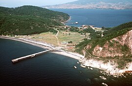
Navotas Island is an island in the city of Navotas, Philippines. Situated in the Tullahan River delta, it is surrounded on the west by Manila Bay, on the north by the Tangos River, on the east by the Navotas River, and on the south by the Tullahan River. The city center or poblacion of Navotas is located on the island. With an estimated land area of 1.95 km2 (0.75 sq mi), Navotas Island is one of the most densely populated islands in the world.