Cavite, officially the Province of Cavite, is a province in the Philippines located in the Calabarzon region in Luzon. Located on the southern shores of Manila Bay and southwest of Manila, it is one of the most industrialized and fastest-growing provinces in the Philippines. As of 2020, it has a population of 4,344,829, making it the most populated province in the country if the independent cities of Cebu are excluded from Cebu's population figure.

Rizal, officially the Province of Rizal, is a province in the Philippines located in the Calabarzon region in Luzon. Its capital is the city of Antipolo. It is about 16 kilometres (9.9 mi) east of Manila. The province is named after José Rizal, one of the main national heroes of the Philippines. It is bordered by Metro Manila to the west, Bulacan to the north, Quezon to the east and Laguna to the southeast. The province also lies on the northern shores of Laguna de Bay, the largest lake in the country. Rizal is a mountainous province perched on the western slopes of the southern portion of the Sierra Madre mountain range.

Bataan, officially the Province of Bataan, is a province in the Central Luzon region of the Philippines. Its capital is the city of Balanga while Mariveles is the largest town in the province. Occupying the entire Bataan Peninsula on Luzon, Bataan is bordered by the provinces of Zambales and Pampanga to the north. The peninsula faces the South China Sea to the west and Subic Bay to the north-west, and encloses Manila Bay to the east.
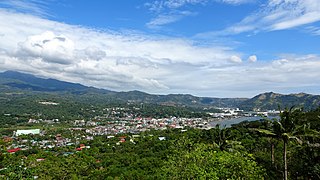
Mariveles, officially the Municipality of Mariveles, is a first class municipality in the province of Bataan, Philippines. According to the 2020 census, it has a population of 149,879 people.
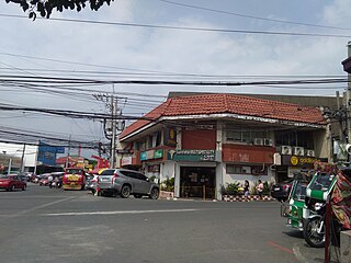
Noveleta, officially the Municipality of Noveleta, formerly known as Tierra Alta during the Spanish colonial era, is a 3rd class municipality in the province of Cavite, Philippines. According to the 2020 census, it has a population of 49,452 people.

The Diocese of Balanga is one of the 72 dioceses of the Catholic Church in the Philippines. It was established on March 17, 1975, by Pope Paul VI.

The Cavite Peninsula is a peninsula extending northeast into Manila Bay from the coastal town of Noveleta in Cavite province in the Philippines. The northern tip of the peninsula is geographically the northernmost part of the Province of Cavite.

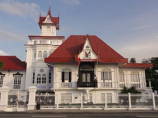
The Magdiwang was a chapter of the Katipunan, a Philippine revolutionary organization founded by Filipino rebels in Manila in 1892, with the aim to gain independence from Spain. The Magdiwang Council was acknowledged "as the supreme organ responsible for the successful campaigns against the enemy" within Cavite.
Ayala Malls is a retail subsidiary of real estate company Ayala Land, an affiliate of Ayala Corporation. Founded in 1988, Ayala Malls own a chain of large shopping malls, all located in the Philippines. Ayala Malls is the one of the largest shopping mall retailer in the Philippines, along with SM Supermalls and Robinsons Malls.
The geography of the City of Manila is characterized by its coastal position at the estuary of the Pasig River that flows to Manila Bay. The city is located on a naturally protected harbor, regarded as one of the finest harbors in Asia. The scarce availability of land is a contributing factor that makes Manila the densest populated city in the world.

Manila, also formerly known as Tondo until 1859, was a province in the Philippines, encompassing the former pre-Hispanic polities of Tondo, Maynila and Namayan. In 1898, it included the City of Manila and 23 other municipalities. Alongside the District of Morong, it was incorporated into the Province of Rizal in 1901.

The Battle of Binakayan–Dalahican was a simultaneous battle during the Philippine Revolution that was fought on November 9–11, 1896 that led to a decisive Filipino victory. The twin battle took place at the shores of Binakayan, in the town of Cavite Viejo ; Dalahican and Dagatan in Noveleta; and, to minimal extent, in Imus and Bacoor towns in Cavite, Philippines that lasted for two days before the Spanish army retreated demoralized and in disarray. The result of the battle was the first significant Filipino victory in the country's history.

Morong was an administrative division of the Philippines existing as a politico-military district created out of parts of the provinces of Tondo and Laguna on February 23, 1853 by a decree of the Superior Gobierno, composing Morong, Pililla, Tanay, Baras, Binangonan, Jalajala, Angono and Cardona from Laguna; and Antipolo, Boso-Boso, Cainta and Taytay from Tondo. The offices were housed at a building now known as Comandancia. Its first military governor was Francisco Turrentigue.
The Mounts Palay-Palay–Mataas-na-Gulod Protected Landscape is a 3,973.13-hectare (9,817.8-acre) protected area encompassing the Palay-Palay Mountain Range in southwestern Luzon island near Manila in the Philippines. It was established on 26 October 1976 as a national park and game refuge and bird sanctuary covering an initial area of 4,000 hectares. In 2007, the national park was designated as a protected landscape area under the National Integrated Protected Areas System through Proclamation No. 1315 signed by President Gloria Arroyo. The park is the last remaining lowland rainforest in the province of Cavite and is well known for Mount Pico de Loro, a popular destination for mountaineers and hikers from Metro Manila.

The following is an alphabetical list of articles related to the Philippine capital region of Metro Manila.

The Ternate–Nasugbu Road, also known as Ternate–Nasugbu Highway or Nasugbu–Ternate Highway, is a two-to-four lane, secondary road in the provinces of Cavite and Batangas, Philippines. It connects the municipality of Ternate in Cavite to the municipality of Nasugbu in Batangas.
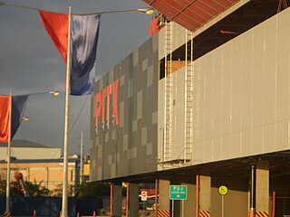
The Parañaque Integrated Terminal Exchange is a public transport terminal in Parañaque, Metro Manila, Philippines. PITX is built and operated by Megawide Construction Corporation and the Department of Transportation (DOTr) under the Philippine government's Public-Private Partnership program.

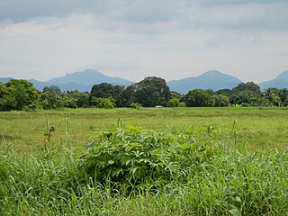
Mount Batulao is an inactive stratovolcano in the Calabarzon region of the Philippines, located in northwest Batangas province along its border with Cavite. It is a dissected andesitic stratovolcano at the northwestern rim of the Taal Caldera which began to form in the late Pliocene period, about 3.4 million years ago. The mountain is a prominent landmark of jagged peaks, rolling to rugged ridges and deep gorges situated just west of the hill station of Tagaytay at the southwestern end of the Tagaytay Ridge. It is well known for its scenery, as well as its retreat centers and resorts located just 85 kilometres (53 mi) south of Manila.


