Transportation in the Philippines covers the transportation methods within the archipelagic nation of over 7,600 islands. From a previously underdeveloped state of transportation, the government of the Philippines has been improving transportation through various direct infrastructure projects, and these include an increase in air, sea, road, and rail transportation and transport hubs.

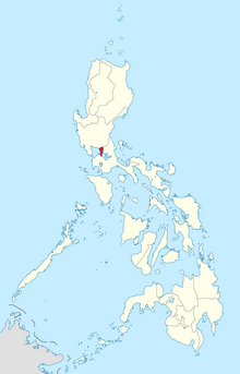
Metropolitan Manila, commonly shortened to Metro Manila and formally the National Capital Region, is the capital region and largest metropolitan area of the Philippines. Located on the eastern shore of Manila Bay, the region lies between the Central Luzon and Calabarzon regions. Encompassing an area of 636.00 km2 (245.56 sq mi) and with a population of 13,484,462 as of 2020, it consists of sixteen highly urbanized cities: Manila—the capital city—Caloocan, Las Piñas, Makati, Malabon, Mandaluyong, Marikina, Muntinlupa, Navotas, Parañaque, Pasay, Pasig, Quezon City, San Juan, Taguig, and Valenzuela, along with one independent municipality, Pateros. As the second most populous and the most densely populated region in the Philippines, it ranks as the 9th most populous metropolitan area in Asia and the 6th most populous urban area in the world.

Rizal, officially the Province of Rizal, is a province in the Philippines located in the Calabarzon region in Luzon. Its capital is the city of Antipolo. It is about 16 kilometers (9.9 mi) east of Manila. The province is named after José Rizal, one of the main national heroes of the Philippines. It is bordered by Metro Manila to the west, Bulacan to the north, Quezon to the east and Laguna to the southeast. The province also lies on the northern shores of Laguna de Bay, the largest lake in the country. Rizal is a mountainous province perched on the western slopes of the southern portion of the Sierra Madre mountain range.

The Pasig River is a water body in the Philippines that connects Laguna de Bay to Manila Bay. Stretching for 25.2 kilometers (15.7 mi), it bisects the Philippine capital of Manila and its surrounding urban area into northern and southern halves. Its major tributaries are the Marikina River and San Juan River. The total drainage basin of the Pasig River, including the basin of Laguna de Bay, covers 4,678 square kilometers (1,806 sq mi).

Pasig, officially the City of Pasig, is a highly urbanized city in the National Capital Region of the Philippines. According to the 2020 census, it has a population of 803,159 people.

Taguig, officially the City of Taguig, is the fifth-most populous city in the Philippines situated in eastern shores of Metro Manila, the national capital region. It is a center for culture, finance, technology, entertainment and media, academics, and the arts and fashion. The city hosts several embassies, making it an important center for the country's international diplomacy. As the home of Bonifacio Global City, major multinational corporations have their headquarters in the city, and it has the fourth largest skyline in the Philippines, with 289 high-rises, 80 of which exceed 100 m (328 ft).

Caloocan, officially the City of Caloocan, is a highly urbanized city in Metro Manila, Philippines. According to the 2020 census, it has a population of 1,661,584 people making it the fourth-most populous city in the Philippines.

Mega Manila is a megalopolis on the island of Luzon in the Philippines. There are varying definitions of the megalopolis, but it is generally seen as encompassing the administrative regions of Central Luzon, Calabarzon, and Metro Manila. On some occasions, the administrative region of Mimaropa is also included.

The legislative districts of Rizal are the representations of the province of Rizal in the various national and local legislatures of the Philippines. At present, the province is represented in the House of Representatives of the Philippines by its four congressional districts, with the districts' representatives being elected every three years. Additionally, each district is allotted a certain number of seats in the Rizal Provincial Board, with board members also being elected every three years.

Ayala Malls is a retail subsidiary of real estate company Ayala Land, an affiliate of Ayala Corporation. Founded in 1988, Ayala Malls owns a chain of large shopping malls, all located in the Philippines. Ayala Malls is one of the largest shopping mall retailer in the Philippines, along with SM Supermalls and Robinsons Malls.
Manila, also known as Tondo until 1859, was a province of the Philippines that encompassed the former pre-Hispanic polities of Tondo, Maynila, and Namayan. In 1898, it comprised the city of Manila and 23 other municipalities. In 1901, the province was dissolved, with the city of Manila absorbing six of its smaller neighboring municipalities. The remaining part was merged with the adjacent district of Morong to form the province of Rizal.

In Metro Manila, Philippines, tourism is a significant industry. In 2012, the city and the region welcomed 974,379 overnight visitors. Serving as the main gateway to the Philippines' numerous destinations, the city attracts mainly international tourists, with a total of 3,139,756 visitors in 2012. Global Blue ranks Manila as the eleventh 'Best Shopping Destination' in Asia. The city holds the tenth position in MasterCard's global top 20 fastest-growing cities for international visitors from 2009 to 2013.
Numerous events and festivals are held annually in Metro Manila. They include:
The following is a timeline of the history of the city and metropolitan area of Manila, the capital city of the Philippines.
Metro Manila, the capital region of the Philippines, is a large metropolitan area that has several levels of subdivisions. Administratively, the region is divided into seventeen primary local government units with their own separate elected mayors and councils who are coordinated by the Metropolitan Manila Development Authority, a national government agency headed by a chairperson directly appointed by the Philippine president. The cities and municipality that form the region's local government units are further divided into several barangays or villages which are headed by an elected barangay captain and barangay council.

The following is an alphabetical list of articles related to the Philippine capital region of Metro Manila.

Greater Manila, officially the City of Greater Manila and sometimes referred to as the Greater Manila Area (GMA), was a chartered city that existed during the Japanese occupation of the Philippines in World War II, from 1942 to 1945. Governed by the Commonwealth of the Philippines, it served as a model for the present-day Metro Manila and the administrative functions of the governor of Metro Manila—both established three decades later during the administration of President Ferdinand Marcos. It was a merger of Manila, Quezon City, and the then-Rizal towns of Caloocan, Makati, Mandaluyong, Parañaque, Pasay, and San Juan, all present parts of Metro Manila.

The COVID-19 pandemic in Metro Manila was a part of the worldwide pandemic of coronavirus disease 2019 caused by severe acute respiratory syndrome coronavirus 2. The virus reached Metro Manila on January 30, 2020, when the first case of COVID-19 in the Philippines was confirmed in Manila. Metro Manila is the worst affected region in the Philippines, where most cases in the country are recorded. A state of calamity and community quarantine was declared in the region on March 15.