This article needs additional citations for verification .(December 2020) |
This is a partial list of parks, public squares and protected areas in and around Metro Manila, Philippines.
This article needs additional citations for verification .(December 2020) |
This is a partial list of parks, public squares and protected areas in and around Metro Manila, Philippines.
| Image | Name | Location | Coordinates | Size |
|---|---|---|---|---|
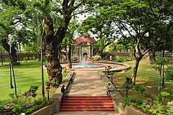
 | Arroceros Forest Park | Ermita, Manila | 14°35′39″N120°58′54″E / 14.59423°N 120.98172°E | 2 ha (4.9 acres) |
 | Balara Filters Park | Diliman, Quezon City | 14°39′25″N121°04′43″E / 14.65688°N 121.07869°E | 60 ha (150 acres) |
 | Isla Pulo | Tanza, Navotas | 14°34′14″N120°59′00″E / 14.5705475393°N 120.983432715°E | 29.5 ha (73 acres) |
 | La Mesa Ecopark | Greater Lagro, Quezon City | 14°42′43″N121°04′27.5″E / 14.71194°N 121.074306°E | 33 ha (82 acres) |
 | Manila Zoological and Botanical Garden | Malate, Manila | 14°33′53″N120°59′19″E / 14.5647412°N 120.9886014°E | 5.5 ha (14 acres) |
 | Ninoy Aquino Parks and Wildlife Center | Diliman, Quezon City | 14°39′04″N121°02′33″E / 14.65114°N 121.04247°E | 65 ha (160 acres) |
 | Pasig Rainforest Park | Maybunga, Pasig | 14°34′28″N121°05′53″E / 14.57448°N 121.09796°E | 8 ha (20 acres) |
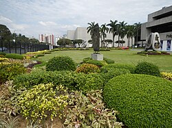
 | University of the Philippines Arboretum | U.P. Campus, Quezon City | 14°39′38″N121°03′05″E / 14.66049°N 121.05143°E | 16 ha (40 acres) |
| Image | Name | Location | Coordinates | Size |
|---|---|---|---|---|
 | La Mesa Watershed Reservation | Quezon City | 14°44′37″N121°06′03″E / 14.74361°N 121.10083°E | 2,000 ha (4,900 acres) |
 | Las Piñas–Parañaque Critical Habitat and Ecotourism Area (LPPCHEA) | Parañaque and Las Piñas | 14°29′44″N120°58′56″E / 14.49552°N 120.98219°E | 175 ha (430 acres) |
| Image | Name | Location |
|---|---|---|
| Acropolis Park | Libis, Quezon City | |
 | Agrifina Circle | Ermita, Manila |
| Aguirre Central Park | BF Homes, Parañaque | |
| Alabang River Park | Alabang, Muntinlupa | |
| Alveo Central Plaza | Bonifacio Global City, Taguig | |
 | APEC Sculpture Garden | CCP Complex, Pasay |
| ASEAN Garden | Malate, Manila [2] | |
 | Arkong Bato Park | Arkong Bato, Valenzuela [3] |
| ASEAN Gardens | Intramuros, Manila | |
| Bacood Park | Santa Mesa, Manila | |
| Baltao Park | Santo Niño, Parañaque | |
 | Barangay San Antonio Pocket Garden | San Antonio, Pasig |
| Battle of Zapote Bridge Park | Zapote, Las Piñas | |
| Bayanan Baywalk | Bayanan, Muntinlupa | |
 | Bernardo Park | Kamuning, Quezon City |
| BGC Greenway Park | Bonifacio Global City, Taguig | |
 | Bonifacio Shrine | Ermita, Manila |
| Buendia Freedom Park | San Antonio, Makati | |
 | Burgos Circle | Bonifacio Global City, Taguig |
| C.P. Garcia Community Park | Diliman, Quezon City | |
 | Capitol Commons Park | Kapitolyo, Pasig [4] |
| Campanilla Park | Dasmariñas Village, Makati | |
 | China-Philippines Friendship Park | Intramuros, Manila |
 | Central Garden | Greenhills, Greenhills, San Juan |
| Christine Village Park | Santolan, Pasig | |
 | Corinthian Gardens Park | Ugong Norte, Quezon City |
| Cuenca Park | Ayala Alabang, Muntinlupa | |
| De Jesus Oval Park | Bonifacio Global City, Taguig | |
 | Dolphin Park | Makati CBD, Makati |
| Don Bosco Football Field | Pag-asa, Mandaluyong | |
| Don Galo Park | Don Galo, Parañaque | |
| Don Jose Heights Park | Commonwealth, Quezon City | |
| DOST Plaza | Lower Bicutan, Taguig | |
 | Earnshaw Linear Park | Santa Ana, Manila |
| Eastwood Central Park | Libis, Quezon City | |
 | EDSA-Buendia Park | Makati |
| EDSA-Pinagkaisahan Park | Pinagkaisahan, Makati | |
 | Ermitaño Linear Park | Ermitaño, San Juan |
| Evolution Park Marikina | Marikina Heights, Marikina | |
| Elizalde Park | BF Homes, Parañaque | |
 | Estero de Magdalena Linear Park | Tondo, Manila |
| Eugenio Park | Marcelo Green, Parañaque | |
| Filinvest City Central Park | Alabang, Muntinlupa | |
| Filinvest Park Batasan | Batasan Hills, Quezon City | |
| Forbes Town Park and Lagoon | Bonifacio Global City, Taguig | |
| FTI Park | FTI Complex, Taguig | |
 | Glorieta Park | Tala, Caloocan |
| Glorietta 3 Park | Makati CBD, Makati | |
 | Greenbelt Park | Makati CBD, Makati |
| Guadalajara Park | Merville, Parañaque | |
 | Guadalupe Linear Park | Guadalupe Nuevo, Makati |
| Guadalupe Viejo Cloverleaf Park | Guadalupe Viejo, Makati | |
| Guava Park | Ayala Alabang, Muntinlupa | |
| Hacienda Heights Park | Concepcion Dos, Marikina | |
| Hardin ng Pag-asa | Addition Hills, Mandaluyong | |
| Ilaya Park | Santolan, Pasig | |
 | Industrial Valley Complex Park (FVR Road Park) | Industrial Valley, Marikina |
| Jackson Park | Greenhills, San Juan [5] | |
 | Johnson Park | Greenhills, San Juan |
| J.Y. Campos Park | Bonifacio Global City, Taguig | |
| Kapitolyo Park | Kapitolyo, Pasig | |
 | Kennely Ann L. Binay Park (Guadalupe Nuevo Cloverleaf Park) | Guadalupe Nuevo, Makati |
| Lagro Dulo Park | North Fairview, Quezon City | |
 | Legazpi Active Park | Makati CBD, Makati |
 | Liwasan ng mga Bayani Park | Alabang, Muntinlupa |
 | Liwasang Balagtas | Pandacan, Manila |
| Madrigal Circle Park | Ugong Norte, Quezon City | |
 | Magallanes Interchange Park | Magallanes, Makati |
| Maharlika Village Park | Maharlika Village, Taguig | |
| Mahogany Park | Dasmariñas Village, Makati | |
 | Makati Poblacion Park | Poblacion, Makati |
| Makiling Park | Ayala Alabang, Muntinlupa | |
 | Malabon People's Park | Catmon, Malabon |
| Mandaluyong Freedom Park | Addition Hills, Mandaluyong | |
| Mariana Park | New Manila, Quezon City | |
 | Maysilo Circle Park | Plainview, Mandaluyong |
 | McKinley Park | Greenhills, San Juan |
| Marikina Freedom Park | Santa Elena, Marikina | |
| Meridian Park | Bay City, Pasay | |
| Mother Ignacia Park | Grace Park, Caloocan | |
 | Muntinlupa Sunken Garden | Poblacion, Muntinlupa |
| Namayan Park | Namayan, Mandaluyong | |
| Narra Park | Ayala Alabang, Muntinlupa | |
 | Navotas Centennial Park | Bagumbayan North, Navotas |
| North Olympus Park | Novaliches, Quezon City | |
 | N.S. Amoranto Park | Santa Teresita, Quezon City |
 | Ortigas Park | San Antonio, Pasig [6] |
| Osano Park | Upper Bicutan, Taguig | |
| Palmera Homes Park | Novaliches, Quezon City | |
 | Pandacan Linear Park | Pandacan, Manila |
| Paraiso ng Batang Maynila | Malate, Manila | |
| Paterno Circle Park | Ugong Norte, Quezon City | |
| Philamlife Village Park | Pamplona Dos, Las Piñas | |
| Philippines–Thailand Friendship Circle | Santa Ana, Manila | |
| Pilar Friendship Park | Pilar Village, Las Piñas | |
| Plaza Avanceña | Quiapo, Manila | |
| Plaza Avelino | Sampaloc, Manila | |
 | Plaza Aviles | San Miguel, Manila |
 | Plaza Benavides | Sampaloc, Manila |
| Plaza Bonifacio | Kapasigan, Pasig | |
 | Plaza Bonifacio | Ligid-Tipas, Taguig |
 | Plaza Cristo Rey | Poblacion, Makati |
| Plaza de Borja | Poblacion, Pateros | |
| Plaza de la Virgen | Pandacan, Manila | |
| Plaza del Carmen | Quiapo | |
| Plaza del Conde | San Nicolas, Manila | |
 | Plaza Felipe Calderon | Santa Ana, Manila |
| Plaza Ferguson | Ermita, Manila | |
| Plaza Hernandez | Tondo, Manila | |
 | Plaza Hugo | Santa Ana, Manila |
| Plaza Hulong Duhat | Hulong Duhat, Malabon | |
| Plaza Isabelo de los Reyes | Sampaloc, Manila | |
| Plaza La Huerta | La Huerta, Parañaque | |
| Plaza Lachambre | Binondo, Manila | |
 | Plaza Quezon | Santa Ana, Taguig |
 | Plaza Morga | Tondo, Manila [7] |
| Plaza Noli | Sampaloc | |
 | Plaza Olivia Salamanca | Ermita, Manila |
| Plaza Quezon | Elias Aldana, Las Piñas | |
 | Plaza Rizal | Malinao, Pasig [8] |
| Plaza Rizal | Daniel Fajardo, Las Piñas | |
| Plaza Rodriguez | San Agustin, Malabon | |
 | Plaza Rueda | Paco, Manila |
| Plaza Santo Tomas | Intramuros, Manila | |
 | Plaza Yuchengco | Binondo, Manila [9] |
| Plazuela de Santa Isabel | Intramuros, Manila | |
| Polo Mini Park | Polo, Valenzuela [10] | |
 | Remedios Circle | Malate, Manila [11] |
| Rosalia Park | Tandang Sora, Quezon City | |
 | Salcedo Park | Bel-Air, Makati |
 | San Juan Mini Park | Pedro Cruz, San Juan |
| San Juanico Park | Ayala Alabang, Muntinlupa | |
 | Santiago and Libertad Cua Park | Carmona, Makati |
| Spectrum Linear Park | Alabang, Muntinlupa | |
| Spectrum Piazza | Alabang, Muntinlupa | |
 | Sucat People's Park | Sucat, Muntinlupa |
| Sun Valley Park | Sun Valley, Parañaque | |
| Tabuena Park | Ugong Norte, Quezon City | |
| Tamarind Park | Ayala Alabang, Muntinlupa | |
 | Terra 28th Park | Bonifacio Global City, Taguig |
 | Track 30th Park | Bonifacio Global City, Taguig |
| UP Lagoon | U.P. Campus, Diliman, Quezon City | |
| UP Science Park | U.P. Campus, Diliman, Quezon City | |
 | UP Sunken Garden | U.P. Campus, Quezon City |
 | Valenzuela Family Park | Karuhatan, Valenzuela [10] |
| Valenzuela Linear Park | Valenzuela, Makati | |
 | Valenzuela People's Park | Karuhatan, Valenzuela [10] |
| Veterans Park | Sipac Almacen, Navotas | |
| Vergara Linear Park | Vergara, Mandaluyong | |
 | Washington Sycip Park | Makati CBD, Makati |
 | Wisdom Park | New Manila, Quezon City [12] |
| West Side LRT Park | Grace Park, Caloocan | |