
Collier County is a county in the U.S. state of Florida. As of the 2020 census, its population was 375,752; an increase of 16.9% since the 2010 United States Census. Its county seat is East Naples, where the county offices were moved from Everglades City in 1962.

Everglades City is a city in Collier County, Florida, United States, of which it was once the county seat. It is part of the Naples–Marco Island Metropolitan Statistical Area, which is included in the Cape Coral-Fort Myers-Naples Combined Statistical Area. The Gulf Coast Visitor Center for Everglades National Park is located in Everglades City. As of the 2020 US census, the population was 352, down from 400 in the 2010 US census.

Immokalee is an unincorporated community and census-designated place in Collier County, Florida, United States. The population was 24,557 at the 2020 census, up from 24,154 at the 2010 census. It is part of the Naples–Marco Island metropolitan area.

Marco Island is a city and barrier island in Collier County, Florida, 20 miles (32 km) south of Naples on the Gulf Coast of the United States. It is the largest barrier island in Southwest Florida's Ten Thousand Islands area, which extends southerly to Cape Sable. Marco Island is home to an affluent beach community with resort amenities.

Naples is a city in Collier County, Florida, United States. As of the 2020 census, the population was 19,115, down from 19,539 at the 2010 census. Naples is a principal city of the Naples–Marco Island metropolitan area, which had a population of about 375,752 as of 2020. Naples' USPS City population includes most of the communities in Collier County with the notable exceptions of Immokalee, Marco Island, Ave Maria, Everglades City, and a few others, and thus Naples' USPS City population is approximately 333,083.

Flamingo is the southernmost headquarters of Everglades National Park, in Monroe County, Florida, United States. Flamingo is one of the two end points of the 99-mile (159-km) Wilderness Waterway, and the southern end of the only road through the park from Florida City. It began as a small coastal settlement on the eastern end of Cape Sable on the southern tip of the Florida peninsula, facing Florida Bay. The actual town of Flamingo was located approximately 4+1⁄2 miles west of the current Flamingo campground area. All that remains of the former town are a few remnants of building foundations, and it is considered a ghost town.
The Tamiami Trail is the southernmost 284 miles (457 km) of U.S. Highway 41 (US 41) from State Road 60 (SR 60) in Tampa to US 1 in Miami. A portion of the road also has the hidden designation of State Road 90 (SR 90).
Ave Maria, Florida, United States, is a planned community and census-designated place located in Collier County, Florida, consisting of approximately 5,000 acres. The population was 6,242 at the 2020 census. It is part of the Naples-Marco Island, Florida Metropolitan Statistical Area.

State Road 29 is a state highway that runs north–south through Southwest Florida. It begins in Carnstown and runs north to a point just south of Palmdale. A rural road, it runs mostly through uninhabited farmland in its northern half, and along wetlands in its southern half. The route previously continued south of Carnestown to Everglades City and Chokoloskee, which has since become County Road 29.
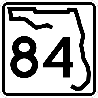
State Road 84 is a highway in the U.S. state of Florida originally extending from Tamiami Trail in Naples to U.S. Route 1 in Fort Lauderdale. The road consists of two noncontiguous pieces––in Collier County as Davis Boulevard and in Broward County as Marina Mile Boulevard and highway frontage roads.

Ochopee is an unincorporated community in Collier County, Florida, United States. It is located to the east of the intersection of US 41 and State Road 29, near Carnestown. The community is part of the Naples–Marco Island Metropolitan Statistical Area.
Harker was an unincorporated community located in Collier County, Florida, United States, about 40 kilometres (25 mi) East of the city of Bonita Springs and 8 kilometres (5.0 mi) Southeast of the town of Immokalee. Most maps indicate that Harker is located on State Road 29 between West Main Street to the North and Oil Well Road to the South. West of Harker is Summerland Swamp, and to the East is the Okaloacoochee Slough.
The Burns Lake Site is a historic site in Ochopee, Florida. It is located three miles west of Ochopee on U.S. 41. On May 27, 1986, it was added to the U.S. National Register of Historic Places.

The Naples Seaboard Air Line Railway Station is a historic Seaboard Air Line Railway depot in Naples, Florida. It is located at 1051 5th Avenue, South.
The Plaza Site is an archaeological site near Ochopee, Florida. It is located in the Big Cypress National Preserve. On May 28, 1986, it was added to the U.S. National Register of Historic Places.
The Sugar Pot Site is an archaeological site near Ochopee, Florida. It is located in the Big Cypress National Preserve. On December 15, 1978, it was added to the U.S. National Register of Historic Places.
The Monroe Station was a historic gas station, restaurant and bar in Ochopee, Florida. It was located at the junction of Tamiami Trail and Loop Road. On May 11, 2000, it was added to the U.S. National Register of Historic Places. As of July 29, 2007, it was boarded up and abandoned.
Copeland is an unincorporated community located in eastern Collier County, Florida, United States. It lies at the junction of State Road 29 and Janes Memorial Scenic Drive. Copeland lies along the western border of the Big Cypress National Preserve, and wedged beside the Fakahatchee Strand Preserve State Park to the east. The hamlet of Jerome is a few miles to the north, while Carnestown lies a few miles to the south at the intersection of State Road 29 and U.S. Route 41. Copeland is part of the Naples–Marco Island Metropolitan Statistical Area.

The 2023 Florida wildfire season was series of wildfires that burned throughout the U.S. state of Florida. As of December 3, there were a total of 2,656 wildfires, burning 101,188 acres (158.106 sq mi) across the state.


