
Alipurduar is a city and a municipality in the Indian state of West Bengal. It is the headquarters of the Alipurduar district. Situated on the east bank of Kaljani River on the foothills of the Himalayas, the city is a gateway to Bhutan and northeastern states of India.
Birpara is a census town in Alipurduar I CD block in Alipurduar subdivision of Alipurduar district, West Bengal, India
Binnaguri is a Cantonment town located in the Jalpaiguri district of West Bengal state, India. It is located at 26° 46' 0N latitude and 89° 2' 60E longitude at an altitude of 216 metres above sea level.
Banarhat is a village (gaon) in Jalpaiguri district in the state of West Bengal, India. Banarhat is 72 km. far from Siliguri and 65 km from Jalpaiguri. This is the melting pot of different cultures where the aborigines, the tea garden workers, Marwaris, Bengalis, Oriya from both side of the border and Nepalese live together in harmony. Banarhat is surrounded by tea gardens and basties (villages). People of these tea gardens in and around are dependent on this town for their essentials. The tea gardens around has ensured that people in this area have a relatively better standard of living. Major occupation of people is service. Although many are engaged in businesses as well. Banarhat is one of the most important towns in Dooars. The town is strategically located on the NH-31C providing close access to major tourist attractions around.
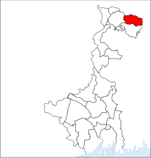
Alipurduar District is the 20th district in the state of West Bengal, India. It consists of Alipurduar municipality, Falakata municipality and six community development blocks: Madarihat–Birpara, Alipurduar–I, Alipurduar–II, Falakata, Kalchini and Kumargram. The six blocks contain 66 gram panchayats and nine census towns. The district has its headquarters at Alipurduar. It was made a district on 25 June 2014.
Madarihat is a small town located in the Alipurduar subdivision of Alipurduar district, West Bengal, India. This village is situated on the outskirts of Jaldapara National Park, which is famous for Indian rhinoceros. This is one of the main tourist spots in North Bengal, surrounded by tea gardens, forests, hills, and small rivers, and also having highly diverse population. Madarihat is also world famous for the local wooden furniture.
Madarihat-Birpara is a community development block that forms an administrative division in the Alipurduar subdivision of the Alipurduar district in the Indian state of West Bengal.

Vivekananda College, established in 1985, is general degree college in Alipurduar. It is in Alipurduar district. It offers undergraduate courses in arts. It is affiliated to University of North Bengal.
Birpara College, established in 1986, is general degree college in Birpara. It is in Alipurduar district. It offers undergraduate courses in arts and commerce. It is affiliated to University of North Bengal.

National Highway 17 is a National Highway in India running from Sevoke in West Bengal to Guwahati in Assam. This Highway runs mainly through the hilly terrain. It starts from its junction with NH-10 near Sevoke and connects Bagrakote, Chalsa, Nagarkata, Goyerkata, Birpara, Falakata, Sonarpur, Coochbehar, Tufanganj in West Bengal; Golakganj, Bilasipara, North Salmara, Goalpara, Boko and terminating at its junction with NH-27 near Guwahati in Assam.
National Highway 317 is a National Highway in India. This highway runs entirely in the state of West Bengal. It is a secondary route of National Highway 17. This route was earlier part of old national highway 31C. Birpara to Hasimara stretch of this national highway is part of Asian Highway 48.

Baniapara is a village in Kamrup rural district, in the state of Assam, India, situated in south bank of river Brahmaputra.
Bangaon is a Block(MCB) in Kamrup rural district, in the state of Assam, India, situated in north bank of river Brahmaputra.
Bamundi is a village in Kamrup rural district, in the state of Assam, India, situated in north bank of river Brahmaputra.
Bamunigaon is a village in Kamrup rural district, in the state of Assam, India, situated in south bank of river Brahmaputra.
Bihdia is a village in Kamrup rural district, in the state of Assam, India, situated in south bank of river Brahmaputra.
Bondapara is a village in Kamrup rural district, in the state of Assam, India, situated in south bank of river Brahmaputra.

Asian Highway 48 or AH48 is a transnational route in India and Bhutan, running 276 kilometres (171 mi) from Changrabandha in India to Thimphu in Bhutan.
Birpara Tea Garden is a village, a tea garden and two gram panchayats in the Madarihat-Birpara CD block in the Alipurduar subdivision of the Alipurduar district in the state of West Bengal, India.
Birpara refers to a census town in Alipurduar I CD block in Alipurduar district, West Bengal, India

