
South Dakota is a landlocked state in the North Central region of the United States. It is also part of the Great Plains. South Dakota is named after the Dakota Sioux tribe, which comprises a large portion of the population with nine reservations currently in the state and has historically dominated the territory. South Dakota is the 17th largest by area, but the 5th least populous, and the 5th least densely populated of the 50 United States. Pierre is the state capital, and Sioux Falls, with a population of about 213,900, is South Dakota's most populous city. The state is bisected by the Missouri River, dividing South Dakota into two geographically and socially distinct halves, known to residents as "East River" and "West River". South Dakota is bordered by North Dakota to the north, Minnesota to the east, Iowa to the southeast, Nebraska to the south, Wyoming to the west, and Montana to the northwest.

Montgomery County is a county located in the U.S. state of Mississippi. As of the 2020 census, the population was 9,822. Its county seat is Winona.

Bibb County is a county in the central portion of the U.S. state of Alabama. The county is included in the ARC's definition of Appalachia. As of the 24th decennial 2020 census, its population was 22,293. The county seat is Centreville. The county is named in honor of William W. Bibb (1781–1820), the Governor of Alabama Territory (1817–1819) and the first Governor of Alabama. He is also the namesake for Bibb County, Georgia, where he began his political career. It is a "prohibition" or dry county; however, a few towns have become "wet" by allowing the sale of alcoholic beverages: Woodstock, West Blocton, Centreville, and Brent. The Bibb County Courthouse is located in the county seat of Centreville.

Wilcox County is a county of the U.S. state of Alabama. As of the 2020 census, the population was 10,600. Its county seat is Camden.

Hill County is a county located in the U.S. state of Montana. As of the 2020 census, the population was 16,309. Its county seat is Havre. It lies along the United States border with Canada, abutting Alberta and Saskatchewan.
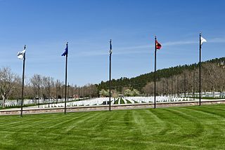
Meade County is a county in the U.S. state of South Dakota. As of the 2020 census, the population was 29,852, making it the 6th most populous county in South Dakota. Its county seat is Sturgis. The county was created in 1889 and named for Fort Meade, which was garrisoned as a United States military post in the area in 1878 and itself named for General George Meade.

Hamilton County is located in the southwestern corner of the U.S. state of Ohio. As of the 2020 census, the population was 830,639, making it the third-most populous county in Ohio. The county seat and largest city is Cincinnati. The county is named for the first Secretary of the Treasury, Alexander Hamilton. Hamilton County is part of the Cincinnati-Middletown, OH-KY-IN Metropolitan Statistical Area.

Lincoln County is a county located in the U.S. state of Colorado. As of the 2020 census, the population was 5,675. The county seat is Hugo. The county obtains its name in memory of the United States President Abraham Lincoln. County was formed from portions of Bent and Elbert counties in 1889 from a restructuring of Colorado counties.
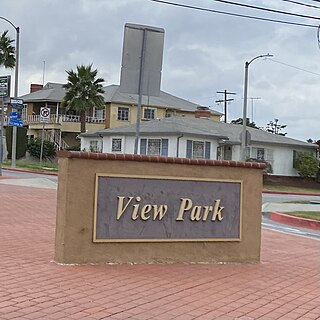
View Park−Windsor Hills is an unincorporated community in Los Angeles County, California. The View Park neighborhood is the community surrounding Angeles Vista Boulevard and the Windsor Hills neighborhood is on the southern end to the north of Slauson Avenue.

Black Hawk is a home rule municipality located in Gilpin County, Colorado, United States. The population was 127 at the 2020 United States Census, making it the least populous city in Colorado. It was a mining settlement founded in 1859 during the Pike's Peak Gold Rush and is now a part of the Denver-Aurora-Lakewood, CO Metropolitan Statistical Area and the Front Range Urban Corridor.

Rapid City is a city in South Dakota, United States, and the county seat of Pennington County. It is the second most populous city in the state, after Sioux Falls. It is located on the eastern slope of the Black Hills in western South Dakota and was named after Rapid Creek, where the settlement developed. The population was 74,703 as of the 2020 census.

The Black Rock Desert is a semi-arid region of lava beds and playa, or alkali flats, situated in the Black Rock Desert–High Rock Canyon Emigrant Trails National Conservation Area, a silt playa 100 miles (160 km) north of Reno, Nevada, that encompasses more than 300,000 acres (120,000 ha) of land and contains more than 120 miles (200 km) of historic trails. It is in the northern Nevada section of the Great Basin with a lakebed that is a dry remnant of Pleistocene Lake Lahontan.

Black Hills National Forest is located in southwestern South Dakota and northeastern Wyoming, United States. The forest has an area of over 1.25 million acres (5,066 km2) and is managed by the Forest Service. Forest headquarters are located in Custer, South Dakota. There are local ranger district offices in Custer, Rapid City, and Spearfish in South Dakota, and in Sundance, Wyoming.
The Election Massacre of 1874, or Coup of 1874, took place on election day, November 3, 1874, near Eufaula, Alabama in Barbour County. Freedmen comprised a majority of the population and had been electing Republican candidates to office. Members of an Alabama chapter of the White League, a paramilitary group supporting the Democratic Party's drive to regain political power in the county and state, used firearms to ambush black Republicans at the polls.

South Dakota is a state located in the north-central United States. It is usually considered to be in the Midwestern region of the country. The state can generally be divided into three geographic regions: eastern South Dakota, western South Dakota, and the Black Hills. Eastern South Dakota is lower in elevation and higher in precipitation than the western part of the state, and the Black Hills are a low, isolated mountain group in the southwestern corner of the state. Smaller sub-regions in the state include the Coteau des Prairies, Missouri Coteau, James River Valley, and the Dissected Till Plains. Geologic formations in South Dakota range in age from two billion-year-old Precambrian granite in the Black Hills to glacial till deposited over the last few million years. South Dakota is the 17th-largest state in the country.
Sioux National Forest was a National Forest (NF) established by Executive Order 908 on July 1, 1908. The order called for the consolidation of the following national forests and forest units into a single entity:

The Black Hills is an isolated mountain range rising from the Great Plains of North America in western South Dakota and extending into Wyoming, United States. Black Elk Peak, which rises to 7,242 feet (2,207 m), is the range's highest summit. The name of the range in Lakota is Pahá Sápa. It encompasses the Black Hills National Forest. It formed as a result of an upwarping of ancient rock, after which the removal of the higher portions of the mountain mass by stream erosion produced the present-day topography. The hills are so called because of their dark appearance from a distance, as they are covered in evergreen trees.
Black Mountain is a prominent mountain summit in the South Park Hills of the Rocky Mountains of North America. The 11,649-foot (3,551 m) peak is located in Pike National Forest, 21.7 miles (34.9 km) south by east of the community of Hartsel in Park County, Colorado, United States.

The 1984 United States presidential election in Texas took place on November 6, 1984. All fifty states and the District of Columbia, were part of the 1984 United States presidential election. Texas voters chose 29 electors to the Electoral College, which selected the president and vice president of the United States.

