Black Hills Airport Clyde Ice Field | |||||||||||||||||||
|---|---|---|---|---|---|---|---|---|---|---|---|---|---|---|---|---|---|---|---|
| Summary | |||||||||||||||||||
| Airport type | Public | ||||||||||||||||||
| Owner | Lawrence County Airport Board | ||||||||||||||||||
| Location | Spearfish, South Dakota | ||||||||||||||||||
| Elevation AMSL | 3,933 ft / 1,199 m | ||||||||||||||||||
| Coordinates | 44°28′49″N103°46′59″W / 44.48028°N 103.78306°W | ||||||||||||||||||
| Map | |||||||||||||||||||
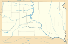 SPF Location of airport in South Dakota  SPF SPF (the United States) | |||||||||||||||||||
 | |||||||||||||||||||
| Runways | |||||||||||||||||||
| |||||||||||||||||||
| Statistics (2022) | |||||||||||||||||||
| |||||||||||||||||||
Source: Federal Aviation Administration [1] | |||||||||||||||||||
Black Hills Airport [2] ( IATA : SPF, ICAO : KSPF, FAA LID : SPF) (Clyde Ice Field) is a public airport three miles (5 km) east of Spearfish, in Lawrence County, South Dakota. [1]
Contents
Western Airlines served Spearfish from 1949-50 until 1959.