
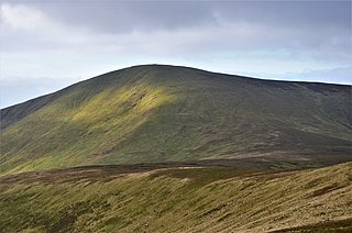
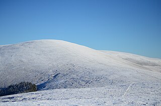
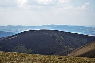
Broad Law is a hill in the Manor Hills range, part of the Southern Uplands of Scotland. The second-highest point in the Southern Uplands and the highest point in the Scottish Borders, it has an elevation of 840 metres, a prominence of 653 metres and an isolation of 81 kilometres. It is only 3 m (10 ft) lower than its parent, Merrick. Like many of its neighbours it is smooth, rounded and grassy, although the surrounding glens have very steep sides — country somewhat akin to the Cheviots or the Howgill Fells. The hill is most easily climbed from the Megget Stane to the south, beginning at an elevation of 452 m (1,483 ft), but is also frequently climbed from the villages near its base, or as part of a long, 50 km (30 mi) trek across the local area between the towns of Peebles and Moffat. On the summit is the highest VOR beacon in the UK, and also a radio tower.

Torc Mountain, at 535 metres (1,755 ft), is the 329th–highest peak in Ireland on the Arderin list. It is a popular mountain for hill walkers as it has a stone or boarded path from its base at Torc Waterfall to its summit, which has views of the Lakes of Killarney. Torc Mountain is part of the Mangerton Mountain Group range in County Kerry, Ireland.
Culter Fell is a hill in the Culter Hills range, part of the Southern Uplands of Scotland. It is the county top of the historic county of Lanarkshire, as well as the highest point in South Lanarkshire council area. It is the culmination of a network of ridges that lie south of the village of Coulter, close to the town of Biggar.

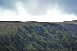
Croft Head is a hill in the Ettrick Hills range, part of the Southern Uplands of Scotland. It offers unobstructed views to the Solway Firth, the fells and mountains of Cumbria and the Pennines to the south and east. To the north, the major Moffat Hills are close by and to the west, Queensberry, the Lowthers and many of the Galloway Hills can be seen. Its summit is easily reached from Moffat by taking the Southern Upland Way path east from the Moffat water bridge near Craigbeck. A quite dramatic ridge loop is possible by climbing north on the forestry fire road shortly after Craigbeck Hope cottage via Gateshaw Rig to Croft Head's summit and descending via Cat Shoulder to the junction of the SUW and the Selcoth burn pass.

Duff Hill at 720 metres (2,360 ft), is the 78th-highest peak in Ireland on the Arderin scale, and the 97th-highest peak on the Vandeleur-Lynam scale. Duff Hill is in the middle section of the Wicklow Mountains, in County Wicklow, and is part of the large massif of Mullaghcleevaun 849 metres (2,785 ft), which lies to its south. Gravale, which is 718 metres (2,356 ft) tall, lies to its immediate north.
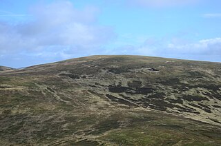
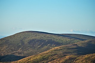
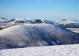
Cramalt Craig is a hill in the Manor Hills range, part of the Southern Uplands of Scotland. The second highest in the range and third highest in southern Scotland, it was previously also a Corbett until a 2013 survey by Alan Dawson found the col between it and Broad Law to be a few metres short of 500 feet. It is climbed almost solely from its southern sides at the Megget Stane or Cramalt Farm, taking in the neighbouring hills.
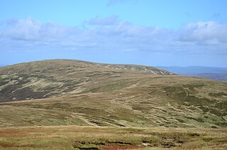
Dollar Law is a hill in the Manor Hills range, part of the Southern Uplands of Scotland. The third highest in the range and the Scottish Borders and fifth highest in southern Scotland, it is frequently climbed with its neighbours Broad Law and Cramalt Craig to the southwest from their direction or as a detour from the hills to the northwest near Drumelzier. Thief's Road, a historic heritage path, passes just south of the summit.
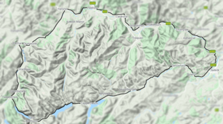
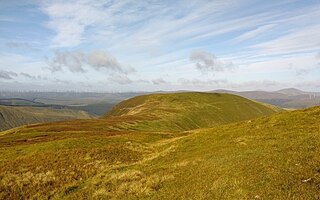
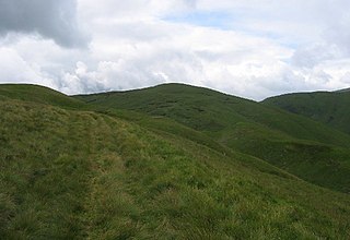
The Manor Hills, also known as the Tweedsmuir Hills, are a range of hills south of Peebles in the Scottish Borders, one of the ranges which collectively form the Southern Uplands. They are separated from the Moffat Hills by the Talla Reservoir, Megget Reservoir and St. Mary's Loch, the Moorfoot Hills by the A72 and the Culter Hills in South Lanarkshire by the A701. The western portion of the hills are designated as the 'Tweedsmuir Hills' Site of Special Scientific Interest and the 'Upper Tweeddale' National Scenic Area, with the major tributary rivers designated as Special Areas of Conservation.
Swatte Fell is a hill in the Moffat Hills range, part of the Southern Uplands of Scotland. It lies north of the town of Moffat in Dumfries and Galloway, south of its parent peak, Hart Fell. It is gently sloping on three sides of the hill, however the east ridge is steep and craggy and features a deep corrie known as Blackhope, from which a popular rock climb, the Coomb Craig ridge, originates, finishing near the summit, and was featured on the OS Explorer 330 map front cover. The normal route is from the southern ridge and can be extended to include a full loop of Blackhope, finishing on Saddle Yoke, known as the Hart Fell Horseshoe.
Middle Hill is a hill in the Manor Hills range, part of the Southern Uplands of Scotland. It is often climbed from Drumelzier to the north or Stanhope Farm to the west, but ascents from the Manor Valley to the east are also possible.
Talla Cleuch Head is a hill in the Manor Hills range, part of the Southern Uplands of Scotland. As ascents are either long or steep from all other sides, Talla Cleuch Head is normally climbed from the Megget Stane to the southeast, which allows for a deer fence to be followed to the summit.
Loch Fell is a hill in the Ettrick Hills range, part of the Southern Uplands of Scotland. Close to the Southern Upland Way, routes of ascent frequently incorporate its track and it is almost always climbed along with the neighbouring hills.

Dun Law is a hill in the Lowther Hills range, part of the Southern Uplands of Scotland. It is the next Donald after Green Lowther, the highest point of the ridge, when walking northeast and is usually ascended from this direction.
Stob Law is a hill in the Manor Hills range, part of the Southern Uplands of Scotland. It is normally climbed as an outlier of the Dun Rig horseshoe, starting from Peebles.
Drumelzier Law is a hill in the Manor Hills range, part of the Southern Uplands of Scotland. It is often ascended from Drumelzier itself or Stanhope farm to the west, but ascents from the Manor Valley to the east are also common.

Birkscairn Hill is a hill in the Manor Hills range, part of the Southern Uplands of Scotland. It is the lowest, and normally first, Donald in a round of hills known as the Dun Rig Horseshoe, south of Peebles.
Tarmangie Hill is a hill in the Ochil Hills range, part of the Central Lowlands in Scotland. It is one of two Ochil Donalds to lie on the Clackmannanshire-Perth and Kinross border - the other being Blairdenon Hill. It is often climbed as part of a round from Glen Sherup.
Comb Law is a hill in the Lowther Hills range, part of the Southern Uplands of Scotland. The second lowest Donald in the area south of the A702 road, it is surrounded on most sides by tracks or roads and there are various routes to the summit, but the easiest ascent is from the Daer Reservoir.
Greenside Law is a hill in the Manor Hills range, part of the Southern Uplands of Scotland. The lowest Donald hill in the range, it is situated at the head of the Manor Valley, with its position somewhat in-between the adjacent ridges on its west and east. The easiest ascents are from the Manor Valley itself to the north, or Craigierig Farm to the south.

Lousie Wood Law is a hill in the Lowther Hills range, part of the Southern Uplands of Scotland. The terminal northeast Donald on the main ridge in the northern portion of the Lowthers range, it is most easily climbed from its northern and eastern flanks.

