
Pedra Branca is a rock islet in the Southern Ocean, off the southern coast of Tasmania, Australia. The island is situated approximately 26 km (16 mi) south southeast of South East Cape and is contained within the Southwest National Park, part of the Tasmanian Wilderness World Heritage Site. An erosional remnant of the Tasmanian mainland, the island is approximately 270 m (890 ft) long, 100 m (330 ft) wide, with an elevation of 60 m (200 ft) above sea level. The island is estimated to have separated from the Tasmanian mainland at least 15,000 years ago.
The Albatross Island, part of the Hunter Island Group, is an 18-hectare (44-acre) island and nature reserve located in Bass Strait, that lies between north-west Tasmania and King Island, Australia. The Peerapper name for the island is Tangatema.

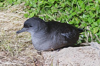
Steep Island, also known as Steep Head, is a 21.6 ha island in Bass Strait in south-eastern Australia. It is part of Tasmania’s Hunter Island Group and lies between north-west Tasmania and King Island. It was once used for grazing sheep but title has been transferred to the Tasmanian Aboriginal community; with an estimated 250,000 shearwater burrows present, it is principally used for muttonbirding.
Bird Island is an island game reserve, with an area of 43.92 ha, in Bass Strait, south-eastern Australia. It is part of Tasmania’s Hunter Island Group which lies between north-west Tasmania and King Island. It is home to about 5,000 pairs of short-tailed shearwaters, the young of which are harvested annually, and about 3,000 pairs of little penguins.
Stack Island is an island game reserve, with an area of 23.7 ha and a high point 54 m above sea-level, in Bass Strait, south-eastern Australia. It is part of Tasmania’s Hunter Island Group which lies between north-west Tasmania and King Island.
Penguin Islet is a small island nature reserve with an area of 3.46 ha in Bass Strait, south-eastern Australia. It is part of Tasmania’s Hunter Island Group which lies between north-west Tasmania and King Island. It is notable as the only pelican colony in western Bass Strait.

Curtis Island is a granite island, with an area of 150 ha, in south-eastern Australia. It is part of Tasmania’s Curtis Group, lying in northern Bass Strait between the Furneaux Group and Wilsons Promontory in Victoria. It is a nature reserve and has been identified as an Important Bird Area because it supports up to 390,000 breeding pairs of short-tailed shearwaters or Tasmanian muttonbirds.

Wright Rock is a small, steep-sided granite island, with an area of 9.36 ha, in south-eastern Australia. It is part of Tasmania’s Bass Pyramid Group, lying in northern Bass Strait between Flinders Island and the Kent Group. It has been a nature reserve since 5 April 1978.
The Bass Pyramid, part of the Furneaux Group, is a small, two sectioned oval, steep-sided 100-square-metre (1,100 sq ft) unpopulated granite island, located in Bass Strait, lying north of the Flinders Island and south of the Kent Group, in Tasmania, Australia. A rock bridge connects the two sections.

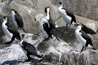
The Gull Island, part of the Passage Group within the Furneaux Group, is an 8.5-hectare (21-acre) granite island, located in Bass Strait southeast of Cape Barren Island, in Tasmania, in south-eastern Australia. The island is a conservation reserve and with the Passage and Forsyth islands, the Gull Island forms part of the Forsyth, Passage and Gull Islands Important Bird Area (IBA), identified as such by BirdLife International because it supports over 1% of the world populations of little penguins and black-faced cormorants.

The Forsyth Island, part of the Passage Group within the Furneaux Group, is a 167-hectare (410-acre) granite island, located in Bass Strait south of Cape Barren Island, in Tasmania, in south-eastern Australia. With the Passage and Gull islands, the Forsyth Island forms part of the Forsyth, Passage and Gull Islands Important Bird Area (IBA), identified as such by BirdLife International because it supports over 1% of the world populations of little penguins and black-faced cormorants.

The Low Islets, part of the Passage Group within the Furneaux Group, is a close pair of unpopulated small granite islands with a combined area of 2 hectares, located in Bass Strait, south of Cape Barren Island, and west of both Spike and Clarke islands, in Tasmania, in south-eastern Australia.

Night Island is a small granite island, with an area of 2.59 ha, is part of the Preservation Island Group, lying in eastern Bass Strait south of Cape Barren Island in the Furneaux Group, Tasmania, Australia.
Boxen Island is a flat dolerite island, with an area of 7 ha, in south-eastern Australia. It is part of Tasmania’s Long Island Group, lying in eastern Bass Strait west of Cape Barren Island in the Furneaux Group. Together with nearby Big Black Reef it is classified by BirdLife International as an Important Bird Area because it has been recorded as supporting 288 breeding pairs of black-faced cormorants.
The Little Badger Island, part of the Badger Group within the Furneaux Group, is a 2.5-hectare (6.2-acre) unpopulated low-lying granite island, located in Bass Strait, lying west of the Flinders and Cape Barren islands, Tasmania, south of Victoria, in south-eastern Australia.
The North West Mount Chappell Islet, part of the Badger Group within the Furneaux Group, is a 7,100-square-metre (76,000 sq ft) unpopulated mainly granite islet, in Bass Strait, lying west of the Flinders and Cape Barren islands, Tasmania, south of Victoria, in south-eastern Australia. The island is located within a conservation area and is part of the Chalky, Big Green and Badger Island Groups Important Bird Area.
The Little Goose Island, part of the Badger Group within the Furneaux Group, is a 3.6-hectare (8.9-acre) unpopulated flat, round granite island, located in Bass Strait, lying west of the Flinders and Cape Barren islands, Tasmania, south of Victoria, in south-eastern Australia. The island is contained within a nature reserve and is part of the Chalky, Big Green and Badger Island Groups Important Bird Area.
The Beagle Island, part of the Badger Group within the Furneaux Group, is a 1.2-hectare (3.0-acre) unpopulated low, flat granite island, located in Bass Strait, lying west of the Flinders and Cape Barren islands, Tasmania, south of Victoria, in south-eastern Australia. The island is contained within a nature reserve and is part of the Chalky, Big Green and Badger Island Groups Important Bird Area.

The Cat Island, part of the Babel Group within the Furneaux Group, is a 39-hectare (96-acre) unpopulated granite island, located in Bass Strait, lying off the east coast of Flinders Island, Tasmania, south of Victoria, in south-eastern Australia.
The Little Waterhouse Island, part of the Waterhouse Island Group, is a 2.5-hectare (6.2-acre) granite island situated in Banks Strait, part of Bass Strait, lying close to the north-eastern coast of Tasmania, Australia.
