Blackpipe, South Dakota

Last updated

Blackpipe
USA South Dakota location map.svg
Red pog.svg
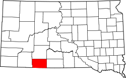
Blackpipe
Location within the state of South Dakota
Usa edcp location map.svg
Red pog.svg
Blackpipe
Blackpipe (the United States)
Coordinates: 43°20′38″N101°16′29″W / 43.34389°N 101.27472°W / 43.34389; -101.27472
Country United States
State South Dakota
County Bennett
Elevation
2,917 ft (889 m)
Time zone UTC-7 (Mountain (MST))
  Summer (DST) UTC-6 (MDT)
GNIS feature ID1261097 [1]

Blackpipe is an unincorporated community in Bennett County, South Dakota, United States. GNIS also states a post office was there in 1940.

Prior to the opening of a convenience store in 2014, residents had to travel across county lines to Parmelee or White River to get gas. The store was funded by the Rosebud Sioux Tribe and the Four Band Community Fund, Inc. in Eagle Butte. [2]

Education

The Bennett County School District serves all of Bennett County. [3]

Related Research Articles

<span class="mw-page-title-main">Aberdeen, South Dakota</span> City in South Dakota, United States

Aberdeen is a city in and the county seat of Brown County, South Dakota, United States, located approximately 125 miles (201 km) northeast of Pierre. The city population was 28,495 at the 2020 census, making it the third most populous city in the state after Sioux Falls and Rapid City. Aberdeen is the principal city of the Aberdeen Micropolitan Statistical Area, which includes all of Brown and Edmunds counties and has a population of 42,287 in 2020. Aberdeen is considered a college town, being the home of both Northern State University and Presentation College.

<span class="mw-page-title-main">Oglala Lakota County, South Dakota</span> County in South Dakota, United States

Oglala Lakota County is a county in southwestern South Dakota, United States. As of the 2020 census, the population was 13,672. Oglala Lakota County does not have a functioning county seat; Hot Springs in neighboring Fall River County serves as its administrative center. The county was created as a part of the Dakota Territory in 1875, although it remains unorganized. Its largest community is Pine Ridge.

<span class="mw-page-title-main">Bennett County, South Dakota</span> County in South Dakota, United States

Bennett County is a county in the U.S. state of South Dakota. As of the 2020 census, the population was 3,381. Its county seat is Martin. The county lies completely within the exterior boundary of the Pine Ridge Indian Reservation. To the east is the Rosebud Indian Reservation, occupied by Sicangu Oyate, also known the Upper Brulé Sioux Nation and the Rosebud Sioux Tribe (RST), a branch of the Lakota people.

<span class="mw-page-title-main">Rolette County, North Dakota</span> County in North Dakota, United States

Rolette County is a county in the U.S. state of North Dakota. As of the 2020 census, the population was 12,187. Its county seat is Rolla.

<span class="mw-page-title-main">Benson County, North Dakota</span> County in North Dakota, United States

Benson County is a county in the U.S. state of North Dakota. As of the 2020 census, the population was 5,964. Its county seat is Minnewaukan. The county was created on March 9, 1883 by the Dakota Territory legislature, and was named for Bertil W. Benson, a Dakota Territory legislator at the time. The county government was organized on June 4, 1884, and its boundary lines were altered by two legislative actions in 1885.

<span class="mw-page-title-main">Ramsey County, Minnesota</span> County in Minnesota, United States

Ramsey County is a county located in the U.S. state of Minnesota. As of the 2020 census, the population was 552,352, making it the second-most populous county in Minnesota. Its county seat and largest city is Saint Paul, the state capital and the twin city of Minneapolis. The county was founded in 1849 and is named for Alexander Ramsey, the first governor of the Minnesota Territory.

<span class="mw-page-title-main">Dakota County, Minnesota</span> County in Minnesota, United States

Dakota County is the third-most populous county in the U.S. state of Minnesota, located in the east central portion of the state. As of the 2020 census, the population was 439,882. The population of Dakota County was estimated to be 443,341 in 2022. The county seat is Hastings. Dakota County is named for the Dakota Sioux tribal bands who inhabited the area.

<span class="mw-page-title-main">Williston, North Dakota</span> City in North Dakota, United States

Williston is a city in and the county seat of Williams County, North Dakota, United States. The 2020 census gave its population as 29,160, making Williston the sixth-most populous city in North Dakota. The city's population nearly doubled between 2010 and 2020, due largely to the North Dakota oil boom.

<span class="mw-page-title-main">Allen, South Dakota</span> CDP in South Dakota, United States

Allen is a census-designated place on the Pine Ridge Indian Reservation in Bennett County, South Dakota, United States, that was named for the Allen Township, which it encompasses. As of the 2020 census, the CDP had a population of 460. It is one of two places which are closest to the North American continental pole of inaccessibility.

<span class="mw-page-title-main">Martin, South Dakota</span> City in South Dakota, United States

Martin is a city and the county seat of Bennett County, South Dakota, United States. The population was 938 at the 2020 census.

<span class="mw-page-title-main">Brandon, South Dakota</span> City in South Dakota, United States

Brandon is a city in Minnehaha County, South Dakota, United States. Brandon is located five miles east of Sioux Falls. The population was 11,048 as of the 2020 census.

<span class="mw-page-title-main">Lemmon, South Dakota</span> City in South Dakota, United States

Lemmon is a town in Perkins County, South Dakota, United States. The population was 1,160 at the 2020 census.

<span class="mw-page-title-main">Pine Ridge, South Dakota</span> CDP in South Dakota, United States

Pine Ridge is a census-designated place (CDP) and the most populous community in Oglala Lakota County, South Dakota, United States. The population was 3,138 at the 2020 census. It is the tribal headquarters of the Oglala Sioux Tribe on the Pine Ridge Indian Reservation.

<span class="mw-page-title-main">Sioux Falls, South Dakota</span> City in South Dakota, United States

Sioux Falls is the most populous city in the U.S. state of South Dakota and the 121st-most populous city in the United States. It is the county seat of Minnehaha County and also extends into Lincoln County to the south, which continues up to the Iowa state line. As of 2022, Sioux Falls had an estimated population of 202,078. The Sioux Falls metro area accounts for more than 30% of the state's population. Chartered in 1856 on the banks of the Big Sioux River, the city is situated in the rolling hills at the junction of interstates 29 and 90.

<span class="mw-page-title-main">Pine Ridge Indian Reservation</span> Indian reservation in United States, Oglala Sioux

The Pine Ridge Indian Reservation, also called Pine Ridge Agency, is an Oglala Lakota Indian reservation located almost entirely within the U.S. state of South Dakota, with a small portion in Nebraska. Originally included within the territory of the Great Sioux Reservation, Pine Ridge was created by the Act of March 2, 1889, 25 Stat. 888. in the southwest corner of South Dakota on the Nebraska border. Today it consists of 3,468.85 sq mi (8,984 km2) of land area and is one of the largest reservations in the United States.

Tuthill is an unincorporated community in Bennett County, South Dakota, United States. Tuthill has been assigned the ZIP code of 57574.

<span class="mw-page-title-main">Rosebud Indian Reservation</span> Indian reservation in South Dakota, United States

The Rosebud Indian Reservation is an Indian reservation in South Dakota, United States. It is the home of the federally recognized Rosebud Sioux Tribe, who are Sicangu, a band of Lakota people. The Lakota name Sicangu Oyate translates as the "Burnt Thigh Nation", also known by the French term, the Brulé Sioux.

Swett is an unincorporated former town of Bennett County, South Dakota, United States. It was put up for sale as a ghost town in June 2014 and as of November 2016 had not found a buyer.

Harrington is an unincorporated community in Bennett County, in the U.S. state of South Dakota.

<span class="mw-page-title-main">Vetal, South Dakota</span> Place in South Dakota, United States

Vetal is an unincorporated community in Bennett County, in the U.S. state of South Dakota.

References

  1. U.S. Geological Survey Geographic Names Information System: Blackpipe, South Dakota
  2. Waln, Vi (August 7, 2014). "Black Pipe Hosts Grand Opening of C-Store". Lakota Country Times. Retrieved August 15, 2016.
  3. "2020 CENSUS - SCHOOL DISTRICT REFERENCE MAP: Bennett County, SD" (PDF). U.S. Census Bureau . Retrieved August 11, 2021.