
Harter Fell is a fell in the western part of the English Lake District, located between the Eskdale and Duddon valleys. Its height is 649 m (2128 ft). There are several walking routes to the summit.

Whitbarrow is a hill in Cumbria, England. Designated a biological Site of Special Scientific Interest and national nature reserve, it forms part of the Morecambe Bay Pavements Special Area of Conservation due to its supporting some of the best European examples of natural limestone habitats. Also known as Whitbarrow Scar, the hill lies about 9 kilometres (5.6 mi) south-west of Kendal, just north of the A590 road, close to the village of Witherslack. Part of the site is a local nature reserve called Whitbarrow Scar.

High Street is a fell in the English Lake District. At 828 metres (2,718 ft), its summit is the highest point in the far eastern part of the national park. The fell is named after the possible Roman road which ran over the summit.

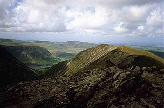
Grasmoor is a mountain in the north-western part of the Lake District, northern England. It is the highest peak in a group of hills between the villages of Lorton, Braithwaite and Buttermere, and overlooks Crummock Water.

Binsey is a hill on the northern edge of the Lake District in Cumbria, England. It is detached from the rest of the Lakeland hills, and thus provides a good spot to look out at the Northern and North Western Fells of the Lake District, as well as the coastal plain and, across the Solway Firth, Scotland. Snaefell on the Isle of Man is also visible on a clear day. It is the northernmost of the Wainwrights.

Seatallan is a mountain in the western part of the English Lake District. It is rounded, grassy and fairly unassuming, occupying a large amount of land. However, it is classed as a Marilyn because of the low elevation of the col connecting it to Haycock, its nearest higher neighbour to the north. The name Seatallan is believed to have a Cumbric origin, meaning "Aleyn's high pasture".

Castle Crag is a hill in the North Western Fells of the English Lake District. It is the smallest hill included in Alfred Wainwright's influential Pictorial Guide to the Lakeland Fells, the only Wainwright below 1,000 feet (300 m).

Blake Fell is a hill in the Western part of the English Lake District. It is the highest point of the Loweswater Fells, an area of low grassy hills with steep sides overlooking the lake of Loweswater. The fell also overlooks the village of Loweswater, from which it can be climbed. An alternative route is from the Cogra Moss reservoir on its western slopes. Because the Loweswater Fells are a separate geographical unit, Blake Fell is a Marilyn. It is located in the Parish of Lamplugh.
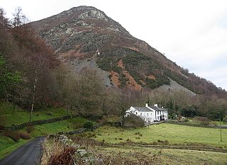
Barf is a fell in the north-western Lake District in Cumbria, UK. It stands on the south-western shore of Bassenthwaite Lake. Barf is well known for a whitewashed pillar of rock on the lower slopes, the so-called "Bishop's Rock" or "Bishop of Barf". The name is thought to be a derivative of "burgh".
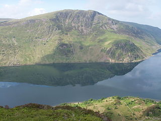
Whiteside is a fell in the north-western area of the English Lake District. It stands at the western end of the Grisedale Pike- Hopegill Head ridge overlooking Crummock Water.

Seat Sandal is a fell in the English Lake District, situated four kilometres north of the village of Grasmere from where it is very well seen. Nevertheless, it tends to be overshadowed by its more illustrious neighbours in the Eastern Fells, Helvellyn and Fairfield.
Graystones is a fell in the English Lake District. It lies in the North Western Fells region and is one of the peaks on the ridge which encircles the valley of Aiken Beck.

Grike is a hill in the west of the English Lake District, near Ennerdale Water. It is part of the Lank Rigg group, the most westerly Wainwright as the fells diminish toward the coastal plain. It can be climbed from Kinniside or Ennerdale Bridge.

Caw Fell is a fell in the English Lake District, standing between Haycock the Lank Rigg group. It occupies a wide upland area with Ennerdale to the north and Blengdale to the south. Caw Fell is distant from any point of access by Lakeland standards, but can be climbed from Blengdale or Bowness Knott car-parks.
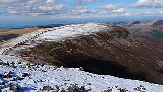
Crag Fell is a hill in the English Lake District. It is part of the Lank Rigg group, standing above Ennerdale Water in the Western Fells. The craggy northern face above the lake gives the fell its name, prominent in views from the car park at Bowness Knott. Ascents are commonly made from the foot of Ennerdale Water.

Lank Rigg is a fell in the English Lake District. It stands to the south of Ennerdale in the Western Fells. A sprawling hill with gentle grassy slopes it can be climbed from various points on the Coldfell road. It carries various remains from ancient habitation.
Iron Crag is a mountain in the English Lake District, standing between Crag Fell and Caw Fell. The name of the fell is the source of some confusion, as the summit is unnamed on Ordnance Survey maps. Iron Crag apparently refers to the rocky outcrop below the summit, while the lower slopes are referred to as Ennerdale Fell. The Western aspect of the lower slopes, facing Ennerdale Water is known as The Side.

Top o'Selside is a hill in the Lake District in Cumbria, England. At 335 metres (1,099 ft), it is the highest point of the group of hills situated between Coniston Water and Windermere. This group also includes the Wainwright of Black Fell and the summits of Black Brows and Rusland Heights. Top o'Selside lies not in the centre of this region, but in the south-western corner, just outside the forestry plantations of Grizedale Forest and only two-thirds of a mile from the eastern shore of Coniston Water. This large separation from any higher ground gives it enough relative height to make it a Marilyn.

Flat Fell is a hill located on the edge of the English Lake District, standing at 272m. It is included in Alfred Wainwright's Outlying Fells of Lakeland book, sharing a chapter with Dent. Wainwright's clockwise route to the two summits starts at Wath Brow.
Whoap is a hill located near the western edge of the English Lake District, standing at 511 m. It is part of the Lank Rigg group and is separated from this fell by an unnamed col, known locally as the Whoap Step. Whoap is not listed as a Wainwright, although it is briefly mentioned in the chapters for Lank Rigg and Crag Fell in Volume 7: The Western Fells.

