
Ouray County is one of the 64 counties of the U.S. state of Colorado. As of the 2010 census, the population was 4,436. The county seat is Ouray. Because of its rugged mountain topography, Ouray County is also known as the Switzerland of America.

Montrose County is one of the 64 counties of the U.S. state of Colorado. As of the 2010 census, the population was 41,276. The county seat is Montrose, for which the county is named.

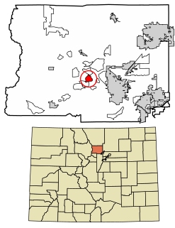
The City of Delta is the Home Rule Municipality that is the county seat and the most populous municipality of Delta County, Colorado, United States. The population was 8,915 at the 2010 census, up from 6,400 at the 2000 census. The United States Forest Service headquarters of the Grand Mesa, Gunnison, and Uncompahgre National Forests are located in Delta.

Lincoln Park is a census-designated place (CDP) in Fremont County, Colorado, United States. The population was 3,546 at the 2010 census, down from 3,904 at the 2000 census.

Crested Butte is a home rule municipality in Gunnison County, Colorado, United States. The town population was 1,487 at the 2010 United States Census. The former coal mining town is now called "the last great Colorado ski town". Crested Butte is a destination for skiing, mountain biking, and a variety of other outdoor activities.

The City of Gunnison is the county seat and the most populous municipality of Gunnison County, Colorado, United States. As of the 2010 census, the city had a population of 5,854. It was named in honor of John W. Gunnison, a United States Army officer who surveyed for the transcontinental railroad in 1853. Gunnison is a Home Rule municipality which reserves the right to choose how it is governed.

The Town of Marble is a Statutory Town in Gunnison County, Colorado, United States. The town population was 131 at the 2010 United States Census.

Crystal is a ghost town on the upper Crystal River in Gunnison County, Colorado, United States. It is located in the Elk Mountains along a four-wheel-drive road 6 miles (9.7 km) east of Marble and 20 miles (32 km) northwest of Crested Butte. Crystal was a mining camp established in 1881 and after several decades of robust existence, was all but abandoned by 1917. Many buildings still stand in Crystal, but its few residents live there only in the summer.

Almont is an unincorporated community and U.S. Post Office in Gunnison County, Colorado, United States. The ZIP Code of the Almont Post Office is 81210.

Uranium mining in Colorado, United States, goes back to 1872, when pitchblende ore was taken from gold mines near Central City, Colorado. The Colorado uranium industry has seen booms and busts, but continues to this day. Not counting byproduct uranium from phosphate, Colorado is considered to have the third largest uranium reserves of any US state, behind Wyoming and New Mexico.
The Shenandoah-Dives Mill or Mayflower Mill is an intact and functional but inactive historic ore mill two miles east of Silverton, Colorado, United States. The mill was built in 1929 to recover gold, silver, lead, zinc, and copper from ore mined at the Mayflower mine and brought to the mill by an aerial tramway.

Crested Butte is a prominent mountain summit in the Elk Mountains range of the Rocky Mountains of North America. The 12,168-foot (3,709 m) peak is located in Gunnison National Forest, 2.1 miles (3.4 km) northeast by east of the Town of Crested Butte in Gunnison County, Colorado, United States. Ski lifts and runs of the Crested Butte Mountain Resort occupy the north side of the mountain.

Bristol Wells, also known as National City, Bristol City and Tempest, is a ghost town in Lincoln County, Nevada. The mining town was located on the west side of Bristol Mountain, 14 miles (23 km) northwest of Pioche, Nevada.

The Henderson molybdenum mine is a large underground molybdenum mine west of the town of Empire in Clear Creek County, Colorado, USA. The Henderson mine, which has produced molybdenum since 1976, is owned by Freeport-McMoRan.
Crisman is a census-designated place (CDP) in Boulder County, Colorado, United States. The population as of the 2010 Census was 186.
El Dorado City, which is now a ghost town, was a mining camp in the Colorado Mining District at the mouth of January Wash at its confluence with El Dorado Canyon. It was located about a mile down the canyon from Huse Spring, at an elevation of 2382 feet. Its site was located nearby to the south southeast of the Techatticup Mine the primary source of the ore its mill processed.
Quartette or Quartette Mill or Quartette Landing, was a mining settlement, location of the stamp mill of the Quartette Mining Company, owner of the largest mine in the Searchlight Mining District and a steamboat landing on the Colorado River, in what is now Clark County, Nevada. It lay at an elevation of 646 feet.
Vulcan is a ghost town in Gunnison County, Colorado, United States, approximately 15 miles (24 km) southwest of the City of Gunnison. Vulcan was a mining camp established along Camp Creek in 1894 and was deserted within thirty years.


