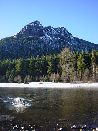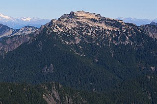
Rattlesnake Ridge, known as daʔšədabš to the Snoqualmie people, is the ridge of Rattlesnake Mountain located south of North Bend, Washington, United States. The western end is near the intersection of State Route 18 and I-90 in Snoqualmie, Washington, and runs southeast about 7 miles (11 km) or 11 miles (18 km) by trail. It is the highest and easternmost of the Issaquah Alps. A maze of abandoned logging roads and constructed trails have been strung together to provide a 10.5-mile (16.9 km) footpath from the Snoqualmie Point trailhead at Exit 27 on I-90 all the way to the Rattlesnake Lake trailhead near Exit 32.

The Alpine Lakes Wilderness is a large wilderness area spanning the Central Cascades of Washington state in the United States. The wilderness is located in parts of Wenatchee National Forest and Snoqualmie National Forest, and is approximately bounded by Interstate 90 and Snoqualmie Pass to the south and U.S. Route 2 and Stevens Pass to the north. The Alpine Lakes is the largest wilderness area near the population centers of Puget Sound, counted at 414,161 acres (167,605 ha) following the 2014 expansion.

Chikamin Peak is a 7,000+ ft mountain summit located in the cascade Range, in Kittitas County of Washington state. It is situated within the Alpine Lakes Wilderness, on land managed by the Okanogan–Wenatchee National Forest. The mountain's name "Chikamin" derives from Chinook Jargon meaning "money" or "metal", and was submitted by Edmond S. Meany, president of The Mountaineers. This name was officially adopted in 1916 by the U.S. Board on Geographic Names. Chikamin Peak is the highest point of Chikamin Ridge, 6 mi (9.7 km) northeast of Snoqualmie Pass. Other notable peaks on Chikamin Ridge include Four Brothers and Three Queens. Precipitation runoff from this mountain drains into tributaries of the Yakima River. The Pacific Crest Trail traverses the southwest slope of Chikamin Ridge, and from the trail a scramble up a gully leads to the summit and several alpine lakes including Chikamin Lake and Spectacle Lake.

Preacher Mountain is a broad summit located in King County of Washington state. It's located at the western edge of the Cascade Range and is within the Alpine Lakes Wilderness on land managed by Mount Baker-Snoqualmie National Forest. The nearest higher peak is Kaleetan Peak, 3.11 miles (5.01 km) to the southeast. The Pulpit is situated 2.19 miles to the northwest. Precipitation runoff from the mountain drains into tributaries of the Snoqualmie River.

Mount Defiance is a 5,584-foot (1,702-metre) mountain summit located in King County of Washington state. It's part of the Cascade Range and is within the Alpine Lakes Wilderness. Mount Defiance is situated 6.5 mi (10.5 km) west of Snoqualmie Pass on land managed by Mount Baker-Snoqualmie National Forest. Precipitation runoff on the mountain drains into tributaries of the Snoqualmie River. The nearest higher peak is Granite Mountain, 3.96 mi (6.37 km) to the east-southeast, and Bandera Mountain is 1.85 mi (2.98 km) to the southeast. Mount Defiance can be reached by trail, with access via the Ira Spring, Talapus Lake, or Pratt Lake trailheads.

Big Snow Mountain is a prominent 6,680-foot (2,040-metre) mountain summit located 7 mi (11 km) north of Snoqualmie Pass in the Alpine Lakes Wilderness in eastern King County of Washington state. It is part of the Cascade Range and is situated on land managed by Mount Baker-Snoqualmie National Forest. Precipitation runoff from the mountain drains into tributaries of the Snoqualmie and Skykomish Rivers. The nearest higher peak is Overcoat Peak, 3.75 mi (6.04 km) to the east-southeast.

Rampart Ridge is a 5,870 ft (1,790 m) elevation mountain ridge located in the Cascade Range, in Kittitas County of Washington state. It is situated northeast of Hyak, Washington, and the north end of Keechelus Lake, within the Alpine Lakes Wilderness, on land managed by Wenatchee National Forest. Its nearest higher peak is Alta Mountain, 1.74 mi (2.80 km) to the north-northeast, and Dungeon Peak rises 0.77 mi (1.24 km) to the south-southwest. The north-south trending ridge is characterized by vertical cliffs on its west-facing side above the Gold Creek valley, and gentle meadows with lakes on the eastern side, such as Rachel Lake, Lake Lillian, and the Rampart Lakes. The descriptive name of rampart was officially adopted 1918 by the United States Board on Geographic Names based on a suggestion by The Mountaineers. Precipitation runoff from the ridge drains into tributaries of the Yakima River.

Little Big Chief Mountain is a 7,225-foot (2,202-metre) mountain summit located immediately southwest of Dutch Miller Gap, on the common border separating King County and Kittitas County in Washington state. It is situated within the Alpine Lakes Wilderness, on land managed by Mount Baker-Snoqualmie National Forest. Little Big Chief Mountain is set ten miles northeast of Snoqualmie Pass on the crest of the Cascade Range. Precipitation runoff from the west side of the mountain drains into tributaries of the Snoqualmie River, whereas the east side drains into tributaries of the Yakima River. The nearest higher peak is Summit Chief Mountain, 0.7 miles (1.1 km) to the southwest, and Chimney Rock is set 2.2 miles (3.5 km) to the southwest. The first ascent of this peak was made in August 1939 by Fred Beckey, Wayne Swift, Joe Barto, and Campbell Brooks. This mountain was named for Lorenz A. Nelson during the 1925 Mountaineers climb of Summit Chief Mountain. Nelson was a pioneering mountaineer who led first ascents of Mount Olympus, Mount Meany, and Chiwawa Mountain.

Trico Mountain is a 6,640+ ft mountain summit located 10 mi (16 km) south of Stevens Pass on the common border of King County, Kittitas County and Chelan County in Washington state. "Trico" is a portmanteau of triple county. This peak is part of the Wenatchee Mountains, which are a subset of the Cascade Range, and is situated 20 mi (32 km) west of Leavenworth in the Alpine Lakes Wilderness. Trico is a triple divide peak with precipitation runoff from the mountain draining south into Cle Elum River, northwest into Deception Creek, and northeast into Leland Creek, which is a tributary of Icicle Creek. The scenic Tuck and Robin Lakes are set on the south slopes, between Trico and Granite Mountain, which is 1.6 mi (2.6 km) to the southeast. The Pacific Crest Trail skirts below the western aspect this peak as it crosses Deception Pass.
Joe Lake is a freshwater lake located on the eastern skirt of Alaska Mountain at the border between King County and Kittitas County, Washington. The lake is a popular area for hiking, swimming, and fishing rainbow trout and cutthroat trout. Frequently hicked Huckleberry Mountain is just north of the lake on the opposite side of the Pacific Crest Trail. Other Alpine lakes are in the vicinity, including the Rampart Lakes a short distance south, at the base of Mount Margaret. To the east is Hibox Mountain.

Spectacle Lake is an alpine freshwater lake located on the northern skirt of Chikamin Peak and Lemah Mountain in Kittitas County on its western border with King County, Washington. Because of its proximity to surrounding peaks and mountains at the heart of the Alpine Lakes Wilderness, the lake is a popular area for hiking, camping and fishing cutthroat trout. Other Alpine lakes are in the vicinity, including the Chikamin Lake, a short distance North, at the base of Chikamin Peak. To the South is Hibox Mountain.
Crawford Lake is a freshwater lake located in the Alpine Lakes Wilderness, at the western ridge of Iron Cap Mountain in King County, Washington. The lake is nestled on a set of prominent valleys and peaks and produces Crawford Creek which flows as one of many tributaries of the Middle Fork Foss River. A short distance towards the north are Chetwoot Lake, Angeline Lake and the Necklace Valley Lakes. Self-issued Alpine Lake Wilderness permit required for transit within the Necklace Valley area.
Myrtle Lake is a freshwater lake located on the northern slope of Big Snow Mountain between Snoqualmie Lake and Chetwoot Lake, in King County, Washington. Self-issued Alpine Lake Wilderness permit required for transit within the Big Snow Mountain area. Because Myrtle Lake is at the heart of the Alpine Lakes Wilderness, the lake is a popular area for hiking, swimming, and fishing rainbow trout and coastal cutthroat trout.
Snoqualmie Lake Potholes is a set of freshwater lakes located southeast Snoqualmie Lake, in King County, Washington. Self-issued Alpine Lake Wilderness permit required for transit within the Big Snow Mountain area. Because Snoqualmie Lake Potholes are at the heart of the Alpine Lakes Wilderness, the lake is a popular area for hiking, swimming, and fishing rainbow trout and cutthroat trout.
Lake Kanim is a set of small freshwater lakes located on a clif of the south skirt of Lennox Mountain, in King County, Washington. Lake Kanim is the nascent source of the North Fork of the Snoqualmie River. The lake and its accompanying waterfall were named after Jerry Kanim who was the leader of Snoqualmie people.
Coney Lake is a small alpine lake located in the Alpine Lakes Wilderness in King County, Washington. Coney Lake sits in a bowl formed by a rocky double cliff bifurcation of the south ridge of Lennox Mountain that connects to Coney's Cones-South Peak. Coney Lake is the origin of Coney Creek, which is a tributary of the west fork of Miller River. Lake Kanim is situated over the opposite side of the ridge as Lennox Mountain splits towards Canoe Peak.
Island Lakes are a set of closely related freshwater lakes located on a prominent valley at the western base of Pratt Mountain, between Mount Defiance and Bandera Mountain, in King County, Washington. They include Island Lake proper, Rainbow Lake and Blazer Lake. They are themselves surrounded by other alpine lakes, including Lake Kulla Kulla and Mason Lake on the west side of the valley. Because of its proximity to Snoqualmie Pass and other prominent peaks in the Alpine Lakes Wilderness, the lakes are a popular area for hiking, swimming, and fishing rainbow trout. Access to Island Lakes is through Mount Defiance Trail 1009, which is an offshoot of Pratt Lake Trail 1007. The trail passes between Rainbow Lake and Blazer Lake on the north edge.
Olallie Lake is a freshwater lake located on a prominent valley at the western base of Pratt Mountain, between Mount Defiance and Bandera Mountain, in King County, Washington. The name means berry in Chinook Jargon.
Talapus Lake is a freshwater lake located on a prominent valley at the eastern skirt of Bandera Mountain, in King County, Washington. Mount Defiance and Pratt Mountain are a short distance to the west of Talapus Lake. The name Talapus is a Chinook word for coyote.
Crosby Lake is an alpine freshwater lake located on a plateau at the northern skirt of Crosby Mountain, a short distance south of Red Mountain and Palmer Mountain in King County, Washington. Boner Lake is at the opposite side of the Crosby Mountain ridge. Crosby Lake is a small 1.4 acres (0.57 ha) lake and it is stocked with golden trout.


