Kinshasa, formerly Léopoldville, is the capital and the largest city of the Democratic Republic of the Congo. With a total population of 15 million as of 2021, it is the most populous city in Africa.
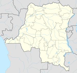
The Democratic Republic of the Congo (DRC), also known as Congo-Kinshasa, DR Congo, the DROC, the DRC, or simply either Congo or the Congo, and formerly Zaire, is a country in Central Africa. It is, by area, the largest country in sub-Saharan Africa, the second-largest in all of Africa, and the 11th-largest in the world. With a population of around 105 million, the Democratic Republic of the Congo is the most populous officially Francophone country in the world, as well as the third-most populous country in Africa and the 14th-most populous country in the world. It is a member of the United Nations, Non-Aligned Movement, African Union, and COMESA. Since 2015, the Eastern DR Congo has been the site of an ongoing military conflict in Kivu. The capital and largest city is Kinshasa.

Monrovia is the capital city of the West African country of Liberia. Located on the Atlantic Coast at Cape Mesurado, Monrovia had a population of 1,010,970 as of the 2008 census. With 29% of the total population of Liberia, Monrovia is the country's most populous city. Founded in 1822, Monrovia today serves as the economic, financial and cultural center of Liberia, its economy shaped primarily by its harbor and its role as the seat of Liberia's government.

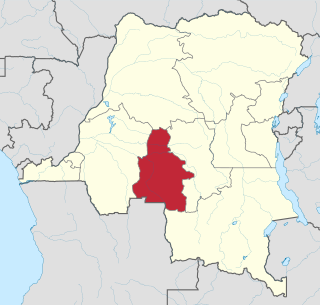
Bandundu is one of eleven former provinces of the Democratic Republic of the Congo. It bordered the provinces of Kinshasa and Bas-Congo to the west, Équateur to the north, and Kasai-Occidental to the east. The provincial capital is also called Bandundu.
Kasaï-Occidental was one of the eleven provinces of the Democratic Republic of the Congo between 1966 and 2015, when it was split into the Kasaï-Central and the Kasaï provinces.

Bukavu is a city in eastern Democratic Republic of the Congo (DRC), lying at the extreme south-western edge of Lake Kivu, west of Cyangugu in Rwanda, and separated from it by the outlet of the Ruzizi River. It is the capital of the South Kivu province and as of 2012 it had an estimated population of 806,940.

Kivu was the name for a large "region" in the Democratic Republic of the Congo under the rule of Mobutu Sese Seko that bordered Lake Kivu. It included three "Sub-Regions" : Nord-Kivu, Sud-Kivu and Maniema, corresponding to the three current provinces created in 1986. The capital of the Kivu Region was in Bukavu, and the capitals of the three Sub-Regions were in Goma, Uvira and Kindu.

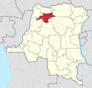
Bandundu, formerly known as Banningville or Banningstad, is the capital city of Kwilu Province of the Democratic Republic of the Congo.

Buta is a city in the northern Democratic Republic of the Congo, lying on the Rubi River, a tributary of the Itimbiri River. It is the capital of Bas-Uele province. As of 2009, it had an estimated population of 50,130.
Kayes is a small town in the Bouenza Department of the Republic of the Congo. It is located about 2 km south of Nkayi, the country’s fourth largest city. Kayes is also the name of a district, of which the town of Kayes is the capital.
Greater Monrovia is one of four districts located in Montserrado County, Liberia. It contains the country's capital Monrovia. It recorded a population of 970,824 in the 2008 census.

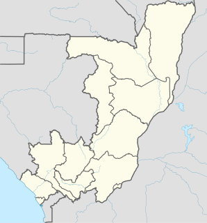
The Republic of the Congo, also known as Congo-Brazzaville, the Congo Republic or simply either Congo or the Congo, is a country located in the western coast of Central Africa. The country is bordered to the west by Gabon, to its northwest by Cameroon and its northeast by the Central African Republic, to the southeast by the DR Congo, to its south by the Angolan exclave of Cabinda and to its southwest by the Atlantic Ocean. French is the official language of the Republic of the Congo.

Aketi is a town in the Bas-Uele Province of the Democratic Republic of the Congo. It is the seat of Aketi Territory. As of 2009 it had an estimated population of 38,588.
Bolobo is a town on the Congo River in Mai-Ndombe Province in the western part of the Democratic Republic of the Congo (DRC). It is the administrative center of Bolobo Territory. As of 2009 it had an estimated population of 31,366.
Bosobolo is a small town in Nord-Ubangi Province of northern Democratic Republic of the Congo. As of 2009 it had an estimated population of 16,397. It is the administrative center of Bosobolo territory.

Gory Gopela is a rural commune and small town and in the Cercle of Kayes in western Mali. In 2009 it had a total population of 7,712, with around 3,600 people in the main town.

Noqui is a town and municipality in Zaire Province in Angola. It is on the Congo River, just across the border from the city of Matadi in the Democratic Republic of the Congo. The municipality had a population of 23,880 in 2014.

The Abir Congo Company was a company that exploited natural rubber in the Congo Free State, the private property of King Leopold II of Belgium. The company was founded with British and Belgian capital and was based in Belgium. By 1898 there were no longer any British shareholders and the Anglo-Belgian India Rubber Company changed its name to the Abir Congo Company and changed its residence for tax purposes to the Free State. The company was granted a large concession in the north of the country and the rights to tax the inhabitants. This tax was taken in the form of rubber obtained from a relatively rare rubber vine. The collection system revolved around a series of trade posts along the two main rivers in the concession. Each post was commanded by a European agent and manned with armed sentries to enforce taxation and punish any rebels.
Mongala is one of the 21 new provinces of the Democratic Republic of the Congo created in the 2015 repartitioning. Mongala, Équateur, Nord-Ubangi, Sud-Ubangi, and Tshuapa provinces are the result of the dismemberment of the former Équateur province. Mongala was formed from the Mongala District whose town of Lisala was elevated to capital city of the new province.

The Congo-Balolo Mission (CBM) was a British Baptist missionary society that was active in the Belgian Congo, the present day Democratic Republic of the Congo, from 1889 to 1915. It was the predecessor of the Regions Beyond Missionary Union (RBMU), established in 1900, which today is called World Team.