
The Mohawk River is a 149-mile-long (240 km) river in the U.S. state of New York. It is the largest tributary of the Hudson River. The Mohawk flows into the Hudson in Cohoes, New York, a few miles north of the city of Albany. The river is named for the Mohawk Nation of the Iroquois Confederacy. It is a major waterway in north-central New York. The largest tributary, the Schoharie Creek, accounts for over one quarter (26.83%) of the Mohawk River's watershed. Another main tributary is the West Canada Creek, which makes up for 16.33% of the Mohawk's watershed.

The West Branch Delaware River is one of two branches that form the Delaware River. It is approximately 90 mi (144 km) long, and flows through the U.S. states of New York and Pennsylvania. It winds through a mountainous area of New York in the western Catskill Mountains for most of its course, before joining the East Branch along the northeast border of Pennsylvania with New York. Midway or so it is empounded by the Cannonsville Dam to form the Cannonsville Reservoir, both part of the New York City water supply system for delivering drinking water to the City.

The Unadilla River is a 71-mile-long (114 km) river in the Central New York Region of New York State. The river begins northeast of the hamlet of Millers Mills and flows generally south to the village of Sidney, where it converges with the Susquehanna River, which drains into the Chesapeake Bay, a bay of the Atlantic Ocean.

Stony Clove Creek is a 10.3-mile-long (16.6 km) creek in the Catskill Mountains in New York. It is a tributary of Esopus Creek, which in turn is a tributary of the Hudson River. It joins the Esopus in the village of Phoenicia, and has two smaller tributaries up north of Phoenicia.

Otego Creek is a 32.7-mile-long (52.6 km) tributary of the Susquehanna River in Otsego County, New York. Otego Creek rises in the Town of Otsego and flows south through the Towns of Hartwick and Laurens, before joining the Susquehanna River southwest of the City of Oneonta.

Mount Isto is the highest peak in the Brooks Range, Alaska, USA. Located in the eastern Brooks Range, in what are known as the Romanzof Mountains, Mount Isto is 5 miles (8.0 km) south of Mount Hubley, the second tallest peak in the Brooks Range. Mount Isto is within the Arctic National Wildlife Refuge and was named in 1966 for Reynold E. (Pete) Isto, a civil engineer for the U.S. Geological Survey. In 2014, new measurement technology established that Mount Isto is the highest peak in the Brooks Range. Previously, Mount Chamberlin was believed to be the tallest, but it is now ranked third.
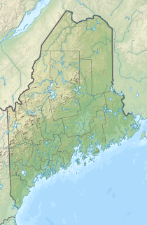
The Mill River is a tributary of the Saint George River in Thomaston, Maine. From the confluence of Branch Brook and Meadow Brook, the river runs 2.7 miles (4.3 km) south to the head of the estuary of the Saint George.

Bonny Blue is an unincorporated community and coal town in Lee County, Virginia, United States.

Macedonia Brook State Park is a public recreation area covering 2,302 acres (932 ha) in the town of Kent, Connecticut, United States. Visitors can camp in a 51-site campground, picnic, fish, and hike the blue-blazed Macedonia Ridge Trail, which crosses Cobble Mountain and other peaks. The park's first 1,552 acres (628 ha) were a gift made in 1918 by the White Memorial Foundation.

Bonny is an unincorporated community in Morgan County, Kentucky, United States. Its post office has closed.
Range Ponds State Park is a public recreation area wrapping around the eastern end of Lower Range Pond in the town of Poland in Androscoggin County, Maine. The state park offers a sandy beach with lifeguard-supervised swimming, kayaking, limited motorized boating, hiking trails, and fishing. Mountain biking trails, built with the help of local volunteers, provide intermediate level, single-track loops off a central double-track trail that winds through mature pine and hardwood forests.
Utley Brook is a tributary of Tunkhannock Creek in Susquehanna County and Wyoming County, in Pennsylvania, in the United States. It is approximately 4.5 miles (7.2 km) long and flows through Lenox Township in Susquehanna County and Nicholson Township in Wyoming County. The stream is in the United States Geological Survey quadrangles of Hop Bottom and Lenoxville. The surficial geology in its vicinity consists of Wisconsinan Till, alluvium, bedrock, wetlands, and lakes. The creek is a Coldwater Fishery and a Migratory Fishery. It has one named tributary, which is known as Willow Brook.
Trout Brook, also called Ball Brook, is a cold water tributary of the Quinapoxet River located in Holden, Massachusetts. Trout Brook is stocked with trout each spring by the Massachusetts Fisheries and Wildlife Division. As the Quinapoxet River is part of the water supply for Worcester, Massachusetts, both the Quinapoxet and all of its major tributaries including Trout Brook are monitored by the USGS for water quality.

Beech Brook is an unincorporated community in Addison Township, Shelby County, in the U.S. state of Indiana.

Beaver Brook Falls Wayside is a 7.3-acre (3.0 ha) park in Colebrook, New Hampshire, along Route 145. It features a roadside view of the scenic 80-foot (24 m) Beaver Brook Falls. Picnic tables, restroom facilities and a small picnic shelter are available.

Wildcat Brook, also known as the Wildcat River, is a 9.05-mile-long (14.56 km) stream in the White Mountains of New Hampshire, in the United States. It rises at Carter Notch in the township of Bean's Purchase in Coos County, and flows south through the town of Jackson in Carroll County to its confluence with the Ellis River near the town's southern boundary. At Jackson Falls, near the town center, the stream descends 120 feet (37 m) in 1⁄4 mile (0.4 km) over scenic granite ledges, paralleled by New Hampshire Route 16B. The surrounding area is part of the Jackson Falls Historic District.
Honnedaga Brook is a stream in the Adirondack Mountains of the U.S. state of New York. It starts at Honnedaga Lake and flows into West Canada Creek about 7 miles (11 km) upstream of Nobleboro, New York.
West Brook Downs is an unincorporated community in Richland Township, Monroe County, in the U.S. state of Indiana.

Burditt Brook is a river located in central Otsego County, New York. The creek converges with the Susquehanna River by Hyde Park, New York.

