Bono, Lawrence County, Indiana

Last updated

Bono, Indiana
Bono United Methodist Church.jpg
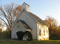
Bono United Methodist Church, built in 1880
USA Indiana location map.svg
Red pog.svg
Bono
Usa edcp location map.svg
Red pog.svg
Bono
Coordinates: 38°43′53″N86°19′16″W / 38.73139°N 86.32111°W / 38.73139; -86.32111
Country United States
State Indiana
County Lawrence
Township Bono
Elevation
[1]
659 ft (201 m)
ZIP code
47446
FIPS code 18-06418 [2]
GNIS feature ID431325 [1]

Bono is an unincorporated community in Bono Township, Lawrence County, Indiana.

History

Bono was laid out about 1816, making it the oldest settlement in Lawrence County. Bono was considered to be Indiana's state capital. [3] It was named for Pierre Bono, an early Indiana patriot. [4]

References

  1. 1 2 U.S. Geological Survey Geographic Names Information System: Bono, Lawrence County, Indiana
  2. "U.S. Census website". United States Census Bureau . Retrieved January 31, 2008.
  3. History of Lawrence and Monroe Counties, Indiana: Their People, Industries, and Institutions. B.F. Bowen. 1914. pp.  47.
  4. Grazer, Florence Elise (1957). "A study of place names in Lawrence County, Indiana". Electronic Theses and Dissertations. Indiana State University. p. 9. Retrieved August 19, 2025.