
Trimble County is a county located in the north central part of the U.S. state of Kentucky. Its county seat is Bedford. The county was founded in 1837 and is named for Robert Trimble. Trimble is no longer a prohibition or dry county. Trimble County is part of the Louisville/Jefferson County, KY–IN Metropolitan Statistical Area.
Starke County is a county in the U.S. state of Indiana. As of the 2020 United States Census, its population was 23,371. The county seat is Knox.

Parke County lies in the western part of the U.S. state of Indiana along the Wabash River. The county was formed in 1821 out of a portion of Vigo County. According to the 2020 census, the population was 16,156. The county seat is Rockville.

Marion County is located in the U.S. state of Indiana. The 2020 United States census reported a population of 977,203, making it the most populous county in the state and 51st most populated county in the country. Indianapolis is the county seat, the state capital, and most populous city. Marion County is consolidated with Indianapolis through an arrangement known as Unigov.
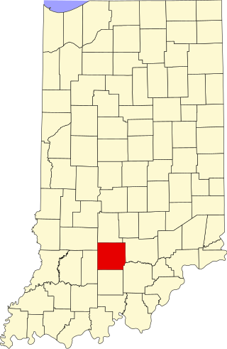
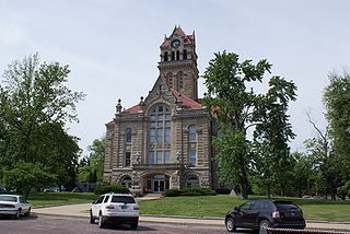
Lawrence County is a county located in the U.S. state of Indiana. As of 2020, the population was 45,011. The county seat is Bedford. Lawrence County comprises the Bedford, IN Micropolitan Statistical Area.

Jasper County is a county located in the U.S. state of Indiana. As of 2020, the population was 32,918. The county seat is Rensselaer.
Brown County is a county in Indiana which in 2020 had a population of 15,475. The county seat is Nashville.

Lawrence County is the easternmost county in the U.S. state of Illinois. At the 2020 census, the population was 15,280. Its county seat is Lawrenceville.

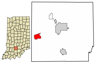
Bedford is a city in Shawswick Township and the county seat of Lawrence County, Indiana, United States. In the 2020 census, the population was 13,792. That is up from 13,413 in 2010. Bedford is the principal city of the Bedford, IN Micropolitan Statistical Area, which comprises all of Lawrence County.

Oolitic is a town in Indian Creek and Shawswick townships, Lawrence County, Indiana, United States. The population was 1,184 at the 2010 census.
Lawrence is a city in Marion County, Indiana, United States. It is one of four "excluded cities" in Marion County. The city is home to Fort Benjamin Harrison within Fort Harrison State Park. The population was 49,370 at the 2020 census. The city is on the northeast side of Indianapolis.

Mexico is an unincorporated community and census-designated place (CDP) in Jefferson Township, Miami County, in the U.S. state of Indiana. The population was 915 at the 2020 census.

Tipton is a city in and the county seat of Tipton County, Indiana, United States. The population was estimated to be 5,275 as of July 1, 2021.

Indian Creek Township is one of nine townships in Lawrence County, Indiana, United States. As of the 2020 census, its population was 2,736 and it contained 1,176 housing units.

Shawswick Township is one of nine townships in Lawrence County, Indiana, United States. As of the 2010 census, its population was 20,469 and it contained 9,653 housing units.

Owen Township is one of twelve townships in Jackson County, Indiana, United States. As of the 2010 census, its population was 1,572 and it contained 677 housing units. It was named for the local Owen family of pioneer settlers.

Jalapa is an unincorporated community and census-designated place (CDP) in Pleasant Township, Grant County, Indiana, United States. As of the 2010 census it had a population of 171. The site of the Battle of the Mississinewa, fought during the War of 1812, is nearby.
Williams is an unincorporated community and census-designated place in Spice Valley Township, Lawrence County, Indiana, United States. As of the 2010 census, the population was 286.
Miami is an unincorporated community and census-designated place (CDP) in Deer Creek Township, Miami County, in the U.S. state of Indiana.


