
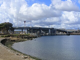
The River Derwent is a river located in Tasmania, Australia. It is also known by the palawa kani name timtumili minanya. The river rises in the state's Central Highlands at Lake St Clair, and descends more than 700 metres (2,300 ft) over a distance of more than 200 kilometres (120 mi), flowing through Hobart, the state's capital city, before emptying into Storm Bay and flowing into the Tasman Sea. The banks of the Derwent were once covered by forests and occupied by Tasmanian Aborigines. European settlers farmed the area and during the 20th century many dams were built on its tributaries for the generation of hydro-electricity.

King Island is an island in the Bass Strait, belonging to the Australian state of Tasmania. It is the largest of three islands known as the New Year Group, and the second-largest island in Bass Strait. The island's population at the 2016 census was 1,585 people, up from 1,566 in 2011. The local government area of the island is the King Island Council.

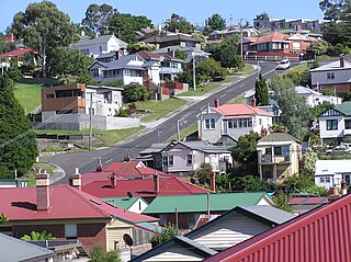
Beaconsfield is a former gold mining town near the Tamar River, in the north-east of Tasmania, Australia. It lies 40 kilometres north of Launceston on the West Tamar Highway. It is a rural and residential locality in the local government areas (LGA) of West Tamar and Latrobe in the Launceston and North-west and west LGA regions of Tasmania. The 2016 census has a population of 1298 for the state suburb of Beaconsfield.

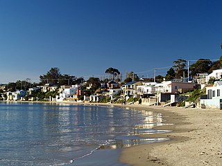
Beauty Point is a town by the Tamar River, in the north-east of Tasmania, Australia. It lies 45 km north of Launceston, on the West Tamar Highway and at the 2016 census, had a population of 1,222. It is part of the Municipality of West Tamar Council.

Zeehan is a town on the west coast of Tasmania, Australia 139 kilometres (86 mi) south-west of Burnie. It is located north of Strahan, Tasmania and Queenstown, Tasmania.
Pontville is a rural locality in the local government areas (LGA) of Brighton and Southern Midlands in the Hobart and Central LGA regions of Tasmania. The locality is about 4 kilometres (2.5 mi) north-west of the town of Brighton. The 2016 census has a population of 623 for the state suburb of Pontville. It is a small rural community 28 kilometres (17 mi) north of Hobart, in the south-east of Tasmania.

The Tarkine, officially takayna / Tarkine, is an area containing the Savage River National Park in the north west Tasmania, Australia, which environmental non-government organisations (ENGOs) claim contains significant areas of wilderness. The Tarkine is noted for its beauty and natural values, containing the largest area of Gondwanan cool-temperate rainforest in Australia, as well as for its prominence in Tasmania's early mining history. The area's high concentration of Aboriginal sites has led to it being described by the Australian Heritage Council as "one of the world's great archaeological regions".
Renison Bell is an underground tin mine and locality on the West Coast of Tasmania, Australia.
Derwent Bridge is a rural locality in the local government area (LGA) of Central Highlands in the Central LGA region of Tasmania. The locality is about 101 kilometres (63 mi) north-west of the town of Hamilton. The 2016 census has a population of 23 for the state suburb of Derwent Bridge. It is on the Lyell Highway at the southern edge of the Cradle Mountain-Lake St Clair National Park.
Birkenhead is a north-western suburb of Adelaide 14 km from the CBD, on the Lefevre Peninsula, in South Australia, and lies within the City of Port Adelaide Enfield. It is adjacent to Peterhead, Exeter and Glanville. It is bounded to the south by the Gawler Reach of the Port River, to the north by Hargrave Street and in the west and east by the Outer Harbor railway line and the Port River respectively.
South Arm is a rural residential locality in the local government area of Clarence in the Hobart region of Tasmania. The locality is about 32 kilometres (20 mi) south-east of the town of Rosny Park. The 2016 census has a population of 880 for the state suburb of South Arm.
Opossum Bay is a rural residential locality in the local government area of Clarence in the Hobart region of Tasmania. The locality is about 37 kilometres (23 mi) south-east of the town of Rosny Park. The 2016 census has a population of 329 for the state suburb of Opossum Bay.
West Hobart is an inner-city suburb of Hobart, Tasmania, Australia. It is in the hills immediately west of the city centre, and shares the postcode 7000 with that district.
Port Davey is an oceanic inlet located in the south west region of Tasmania, Australia.
Westerway is a rural locality in the local government areas (LGA) of Central Highlands and Derwent Valley in the Central and South-east LGA regions of Tasmania. The locality is about 29 kilometres (18 mi) north-west of the town of New Norfolk. The 2016 census has a population of 225 for the state suburb of Westerway.
Snug is a small coastal town on the Channel Highway located 30 kilometres (19 mi) south of Hobart in Tasmania, Australia. At the 2006 census, Snug had a population of 881. Snug is a part of the Municipality of Kingborough.

Ringarooma is a small town in north-eastern Tasmania. It is located just east of the Ringarooma River and is about 12 km (7.5 mi) south-west from Derby and 55 km (34 mi) east-northeast from Launceston. The area around Ringarooma is known for dairy farming and timber harvesting.
Moina is a town 45 km inland from Devonport on the north-west coast of Tasmania, Australia. Moina was the site of a brief gold rush in the late nineteenth century and then one of the largest wolfram and bismuth mines in Tasmania. It has been the centre of continued mineral exploration in the Middlesex district since the first discoveries of tin and tungsten ores on Dolcoath Hill in the 1890s. The name may be a derivation of a small crustacean of the same name found in Tasmanian waters.
Glen Huon is a rural residential locality in the local government area of Huon Valley in the South-east region of Tasmania. It is located about 10 kilometres (6.2 mi) west of the town of Huonville. The 2016 census has a population of 661 for the state suburb of Glen Huon.

Flinders Ranges is a locality in the Australian state of South Australia located in the mountain range of the same name, about 380 kilometres north of the state capital of Adelaide, about 86 kilometres north-east of the municipal seat of Quorn and about 131 kilometres north-east of the centre of Port Augusta in the state’s Far North region.


