Boswell's Corner, Virginia

Last updated

Boswell's Corner
CDP
Stafford County Virginia incorporated and unincorporated areas Boswell's Corner highlighted.svg
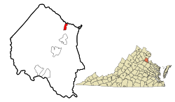
Location in Stafford County and the state of Virginia.
Coordinates: 38°30′19″N77°22′21″W / 38.50528°N 77.37250°W / 38.50528; -77.37250
CountryUnited States
State Virginia
County Stafford
Time zone UTC−5 (Eastern (EST))
  Summer (DST) UTC−4 (EDT)
ZIP codes
22554
FIPS code 51-08708
GNIS feature ID2584811

Boswell's Corner is a census-designated place situated in Stafford County, Virginia. The population as of the 2010 Census was recorded as 1,375 residents. [1] It is located along U.S. Route 1 just outside the boundary of Marine Corps Base Quantico ("Boswell's Corner" itself is the intersection with Telegraph Road).

Related Research Articles

<span class="mw-page-title-main">Spotsylvania County, Virginia</span> County in Virginia, United States

Spotsylvania County is a county in the U.S. state of Virginia. As of the July 2021 estimate, the population was 145,300. Its county seat is Spotsylvania Courthouse.

<span class="mw-page-title-main">Richmond County, Virginia</span> County in Virginia, United States

Richmond County is a county located on the Northern Neck in the U.S. state of Virginia. As of the 2020 census, the population sits at 8,923. Its county seat is Warsaw. The rural county should not be confused with the large city and state capital Richmond, Virginia. It was formed in 1692 when the first Rappahannock County was divided to form Richmond County and Essex County.

<span class="mw-page-title-main">Fairfax County, Virginia</span> County in Virginia, United States

Fairfax County, officially the County of Fairfax, is a county in the Commonwealth of Virginia. It is part of Northern Virginia and borders both the city of Alexandria and Arlington County and forms part of the suburban ring of Washington, D.C., the nation's capital. The county is predominantly suburban in character with some urban and rural pockets.

<span class="mw-page-title-main">Benton County, Indiana</span> County in Indiana, United States

Benton County is located in the northwest part of the U.S. state of Indiana, along the border with Illinois. As of 2020, the county's population was 8,719. It contains six incorporated towns as well as several small unincorporated settlements; it is divided into 11 townships which provide local services. The county seat is Fowler.

<span class="mw-page-title-main">Boswell, Oklahoma</span> Town in Oklahoma, United States

Boswell is a town in Choctaw County, Oklahoma, United States. The population was 709 at the 2010 census.

<span class="mw-page-title-main">Moncks Corner, South Carolina</span> Town in South Carolina, United States

Moncks Corner is a town in and the county seat of Berkeley County, South Carolina, United States. The population was 7,885 at the 2010 census. As defined by the U.S. Census Bureau, Moncks Corner is included within the Charleston-North Charleston, SC Metropolitan Statistical Area.

<span class="mw-page-title-main">Tysons, Virginia</span> Census-designated place in Virginia, United States

Tysons, also known as Tysons Corner, is a census-designated place (CDP) in Fairfax County, Virginia, United States, spanning from the corner of SR 123 and SR 7. It is part of the Washington metropolitan area and located in Northern Virginia between McLean and Vienna along the I-495.

<span class="mw-page-title-main">Ashburn, Virginia</span> Census-designated place in Virginia, United States

Ashburn is a rapidly growing census-designated place (CDP) in Loudoun County, Virginia, United States. At the 2010 United States census, its population was 43,511, up from 3,393 in 1990. It is 30 miles (48 km) northwest of Washington, D.C., and part of the Washington metropolitan area.

<span class="mw-page-title-main">Dranesville, Virginia</span> Census-designated place in Virginia, United States

Dranesville is a census-designated place (CDP) in Fairfax County, Virginia, United States. Dranesville is located on the Leesburg Pike at its intersection with Georgetown Pike. The U.S. Census Bureau defines Dranesville as a census-designated place (CDP) with a population of 11,921 as of 2010. At the 2020 Census the population was 11,785.

<span class="mw-page-title-main">Woodlawn, Fairfax County, Virginia</span> Census-designated place in Virginia, United States

Woodlawn is a census-designated place in Fairfax County, Virginia, United States. The population as of the 2010 census was 20,804. It was carved out of the Mount Vernon CDP beginning with the 2010 census, from the west it goes from Fort Belvoir to Little Hunting Creek stretching along U.S. Route 1 on the south and Huntley Meadows Park on the north. Historic Woodlawn Plantation occupies the southwest corner. Fairfax County Park Authority operates neighborhood parks in the area.

Sussex is a census-designated place (CDP) in and the county seat of Sussex County, Virginia, United States. The population as of the 2020 Census was 181.

<span class="mw-page-title-main">Greenbush, Virginia</span> Census-designated place in Virginia, United States

Greenbush is a census-designated place (CDP) in Accomack County, Virginia, United States. Per the 2020 census, the population was 224.

<span class="mw-page-title-main">Mappsville, Virginia</span> Census-designated place in Virginia, United States

Mappsville is a census-designated place (CDP) in Accomack County, Virginia, United States. Per the 2020 census, the population was 311.

<span class="mw-page-title-main">Quinby, Virginia</span> Census-designated place in Virginia, United States

Quinby is a census-designated place (CDP) in Accomack County, Virginia, United States. It was first listed as a CDP in 2010. Per the 2020 census, the population was 285.

<span class="mw-page-title-main">Sanford, Virginia</span> Census-designated place in Virginia, United States

Sanford is a census-designated place (CDP) in Accomack County, Virginia, United States. It was first listed as a CDP in 2010. Per the 2020 census, the population was 168.

<span class="mw-page-title-main">Bobtown, Virginia</span> Census-designated place in Virginia, United States

Bobtown is a census-designated place (CDP) in Accomack County, Virginia, United States. Per the 2020 census, the population was 267.

<span class="mw-page-title-main">McNair, Virginia</span> Census-designated place in Virginia, United States

McNair is a census-designated place located in the Oak Hill section of Fairfax County, Virginia, United States. It is directly to the east of Washington Dulles International Airport. The population as of the 2020 census was 21,598. Much of the population resides in the McNair Farms planned community. The community has a school called McNair Elementary.

<span class="mw-page-title-main">Newington Forest, Virginia</span> Census-designated place in Virginia, United States

Newington Forest is a census-designated place in Fairfax County, Virginia, United States. The population as of the 2010 census was 12,442. It is part of the Washington metropolitan area. It includes the Newington Forest subdivision and several nearby neighborhoods of southern Springfield and northern Lorton.

<span class="mw-page-title-main">South Run, Virginia</span> Census-designated place in Virginia, United States

South Run is a census-designated place in Fairfax County, Virginia, United States. The population as of the 2010 census was 6,389.

<span class="mw-page-title-main">University of Virginia (census-designated place), Virginia</span> CDP in Virginia, United States

University of Virginia is a census-designated place in Albemarle County, Virginia. The population as of the 2010 Census was 7,704.

References