Garrisonville | |
|---|---|
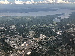 Aerial view of Garrisonville (foreground) and Aquia Harbour (center) with Aquia Creek and the Potomac River in the background | |
 Garrisonville Location within the state of Virginia  Garrisonville Garrisonville (Virginia)  Garrisonville Garrisonville (the United States) | |
| Coordinates: 38°28′57″N77°25′36″W / 38.48250°N 77.42667°W | |
| Country | United States |
| State | Virginia |
| County | Stafford |
| Elevation | 282 ft (86 m) |
| Time zone | UTC−5 (Eastern (EST)) |
| • Summer (DST) | UTC−4 (EDT) |
| ZIP code | 22463 [2] |
| GNIS feature ID | 1499463 [1] |
Garrisonville is an unincorporated community in Stafford County, Virginia, United States. [3]
